


<< Our Photo Pages >> Dobrudden South 06 - Rock Art in England in Yorkshire (West)
Submitted by Anne T on Tuesday, 01 August 2017 Page Views: 1455
Rock ArtSite Name: Dobrudden South 06 Alternative Name: Crook Farm North; ERA-2473; Boughey & Vickerman (146b); IAG146b; DS05Country: England County: Yorkshire (West) Type: Rock Art
Nearest Town: Baildon Nearest Village: Crook Farm Caravan Site
Map Ref: SE1370739620
Latitude: 53.852634N Longitude: 1.793116W
Condition:
| 5 | Perfect |
| 4 | Almost Perfect |
| 3 | Reasonable but with some damage |
| 2 | Ruined but still recognisable as an ancient site |
| 1 | Pretty much destroyed, possibly visible as crop marks |
| 0 | No data. |
| -1 | Completely destroyed |
| 5 | Superb |
| 4 | Good |
| 3 | Ordinary |
| 2 | Not Good |
| 1 | Awful |
| 0 | No data. |
| 5 | Can be driven to, probably with disabled access |
| 4 | Short walk on a footpath |
| 3 | Requiring a bit more of a walk |
| 2 | A long walk |
| 1 | In the middle of nowhere, a nightmare to find |
| 0 | No data. |
| 5 | co-ordinates taken by GPS or official recorded co-ordinates |
| 4 | co-ordinates scaled from a detailed map |
| 3 | co-ordinates scaled from a bad map |
| 2 | co-ordinates of the nearest village |
| 1 | co-ordinates of the nearest town |
| 0 | no data |
Be the first person to rate this site - see the 'Contribute!' box in the right hand menu.
Internal Links:
External Links:
I have visited· I would like to visit
SolarMegalith visited on 3rd Aug 2017 - their rating: Cond: 4 Amb: 4 Access: 5
")
This rock art panel is recorded as England's Rock Art ERA-2473 Dobrudden South 06, which includes a detailed description, photographs, a plan of the stone and its motifs, plus photogrammetry and a 3D model.
The Northern Antiquarian (TNA) also provides details for this cup and ring marked rock, describing it as "one of my favourite .... on Baildon Moor". See their entry for Crook Farm north, Baildon Moor, West Yorkshire, which has photographs, an early photograph of the carving together with an early drawing, directions on how to find the stone and a brief archaeology and history.
There appears to be no entry on Pastscape or England's Rock Art for this stone, although it is described as having upwards of 50 cup markings, two cup and rings and numerous carved lines.
TNA add: "Along this same ridge there are remains of other prehistoric sites, more cup-and-rings, remains of prehistoric walling and what may be a small cairn circle."
This rock is also recorded in Boughey & Vickerman's "Prehistoric Rock Art of the West Riding Supplement (2018)", pages 86 & 87. The rock is described as being fine gritstone with a roughly triangular exposed surface 1m x 0.55m, embedded in the turf. The Supplement has two photographs, one indicating the location of the stone, the other a close up of its exposed surface with its estimated 57, possibly more, cups.
This rock art panel is located on Open Access land.
Note: Have you visited this site? Do you have any photographs or comments you can add?
You may be viewing yesterday's version of this page. To see the most up to date information please register for a free account.
")
")
")
Do not use the above information on other web sites or publications without permission of the contributor.
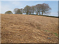
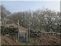
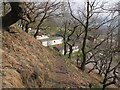
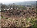
Nearby Images from Geograph Britain and Ireland:
©2017(licence)
©2017(licence)
©2017(licence)
©2017(licence)
©2017(licence)
The above images may not be of the site on this page, they are loaded from Geograph.
Please Submit an Image of this site or go out and take one for us!
Click here to see more info for this site
Nearby sites
Key: Red: member's photo, Blue: 3rd party photo, Yellow: other image, Green: no photo - please go there and take one, Grey: site destroyed
Download sites to:
KML (Google Earth)
GPX (GPS waypoints)
CSV (Garmin/Navman)
CSV (Excel)
To unlock full downloads you need to sign up as a Contributory Member. Otherwise downloads are limited to 50 sites.
Turn off the page maps and other distractions
Nearby sites listing. In the following links * = Image available
8m WNW 300° Dobrudden South 05* Rock Art (SE1370039624)
27m NNE 27° Dobrudden South 07* Rock Art (SE1371939644)
89m N 9° Dobrudden South 09* Rock Art (SE1372039708)
98m NW 325° Baildon Moor Barrow Round Barrow(s) (SE13653970)
106m N 7° Dobrudden South 08* Rock Art (SE1371939725)
142m NNW 343° Dobrudden South 04* Rock Art (SE1366639756)
150m E 98° Hope Farm 01a* Rock Art (SE1385639599)
193m NNW 341° Dobrudden South 02* Rock Art (SE1364439803)
202m NNW 331° Baildon Moor (U/R2)* Rock Art (SE1360939797)
209m NNW 329° Dobrudden South 01* Rock Art (SE1360039800)
237m NNW 346° Dobrudden South 03* Rock Art (SE1365039850)
280m NNE 12° Dobrudden South 10* Rock Art (SE1376639894)
310m NNE 16° Dobrudden South 12 Rock Art (SE1379239918)
325m NNE 14° Dobrudden South 11* Rock Art (SE1378739935)
432m N 6° Dobrudden 01 Rock Art (SE1375040050)
470m N 1° Low Plain* Rock Art (SE13714009)
472m N 1° Dobrudden Stone* Rock Art (SE1371840092)
477m N 2° Low Plain 02* Rock Art (SE1372340097)
492m E 92° Baildon Moor (186) Rock Art (SE142396)
492m E 92° Hope Farm 01. Rock Art (SE1420039600)
526m N 6° Low Plain 06* Rock Art (SE1375940144)
534m NNE 14° Low Plain 19* Rock Art (SE1383840138)
542m N 4° Low Plain 05* Rock Art (SE1374340161)
550m N 7° Low Plain 10* Rock Art (SE1377240166)
587m N 9° Dobrudden Necropolis Cairn (SE138402)
View more nearby sites and additional images


 We would like to know more about this location. Please feel free to add a brief description and any relevant information in your own language.
 Wir möchten mehr über diese Stätte erfahren. Bitte zögern Sie nicht, eine kurze Beschreibung und relevante Informationen in Deutsch hinzuzufügen.
 Nous aimerions en savoir encore un peu sur les lieux. S'il vous plaît n'hesitez pas à ajouter une courte description et tous les renseignements pertinents dans votre propre langue.
 Quisieramos informarnos un poco más de las lugares. No dude en añadir una breve descripción y otros datos relevantes en su propio idioma.