<< Our Photo Pages >> Yatesfield Hill (Otterburn) - Standing Stone (Menhir) in England in Northumberland
Submitted by Anne T on Tuesday, 11 July 2017 Page Views: 1473
Neolithic and Bronze AgeSite Name: Yatesfield Hill (Otterburn)Country: England County: Northumberland Type: Standing Stone (Menhir)
Nearest Town: Otterburn Nearest Village: Rochester
Map Ref: NY8563297177
Latitude: 55.268534N Longitude: 2.227662W
Condition:
| 5 | Perfect |
| 4 | Almost Perfect |
| 3 | Reasonable but with some damage |
| 2 | Ruined but still recognisable as an ancient site |
| 1 | Pretty much destroyed, possibly visible as crop marks |
| 0 | No data. |
| -1 | Completely destroyed |
| 5 | Superb |
| 4 | Good |
| 3 | Ordinary |
| 2 | Not Good |
| 1 | Awful |
| 0 | No data. |
| 5 | Can be driven to, probably with disabled access |
| 4 | Short walk on a footpath |
| 3 | Requiring a bit more of a walk |
| 2 | A long walk |
| 1 | In the middle of nowhere, a nightmare to find |
| 0 | No data. |
| 5 | co-ordinates taken by GPS or official recorded co-ordinates |
| 4 | co-ordinates scaled from a detailed map |
| 3 | co-ordinates scaled from a bad map |
| 2 | co-ordinates of the nearest village |
| 1 | co-ordinates of the nearest town |
| 0 | no data |
Internal Links:
External Links:
I have visited· I would like to visit
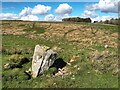
Anne T visited on 8th Jul 2017 - their rating: Cond: 3 Amb: 4 Access: 5 Yatesfield Hill Standing Stone, Otterburn Ranges: Driving up to Yatesfield Hill, I noticed this stone by the side of the road. There is no mention of it on Pastscape, English Heritage or the OS maps.
It might be a marker stone or a rubbing stone, as it is sited by the junction of Yatesfield Hill road and a trackway west, but looks as if it has been here for some time, as it is deeply embedded in the ground and has small stones and boulders packed around its base.
There was a lovely military Port-a-loo nearby!
 (PID:167714)")
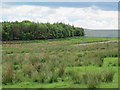
Sitting just below the top of Yatesfield Hill, this standing stone sits on the western side of the military road leading from the A68 at Benettsfield to Toft House (Yatesfield Road).
It is not mentioned on the OS map, Pastscape or English Heritage. As it is located just to the south of a trackway, I thought it had been set up either as a marker stone for the trackway, or as a rubbing post for the sheep. On closer inspection, this stone appears to have been here for some time, is deeply embedded into the ground and has some stone packing around it.
With the strange shaping of the top, I thought it might align with the shapes of the surrounding hills, but couldn't find anything that might closely match it in the landscape. Curious!
Note: Does anyone have any information about this stone, or views on if it's a standing stone, rubbing stone or marker stone?
You may be viewing yesterday's version of this page. To see the most up to date information please register for a free account.
 (PID:167716)")
 (PID:167715)")
Do not use the above information on other web sites or publications without permission of the contributor.
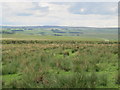
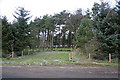
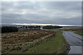
Nearby Images from Geograph Britain and Ireland:
©2024(licence)
©2013(licence)
©2008(licence)
©2008(licence)
©2013(licence)
The above images may not be of the site on this page, they are loaded from Geograph.
Please Submit an Image of this site or go out and take one for us!
Click here to see more info for this site
Nearby sites
Key: Red: member's photo, Blue: 3rd party photo, Yellow: other image, Green: no photo - please go there and take one, Grey: site destroyed
Download sites to:
KML (Google Earth)
GPX (GPS waypoints)
CSV (Garmin/Navman)
CSV (Excel)
To unlock full downloads you need to sign up as a Contributory Member. Otherwise downloads are limited to 50 sites.
Turn off the page maps and other distractions
Nearby sites listing. In the following links * = Image available
541m NNE 33° Yatesfield (Otterburn)* Ancient Village or Settlement (NY85939763)
2.0km WNW 299° Bremenium Roman tumulus* Artificial Mound (NY8384098165)
2.5km S 179° Brownrigg (Rochester)* Ancient Cross (NY8566894716)
2.9km WNW 290° Rochester (Otterburn)* Modern Stone Circle etc (NY8293998149)
4.6km WNW 288° Burdhope (Rochester)* Ancient Village or Settlement (NY8128098584)
4.6km ESE 107° Todlaw Pike Rock Art (NY900958)
5.2km NW 309° Bellshiel Law 2e Rock Art (NT8158800501)
5.3km NNE 25° Crow Stone (Otterburn)* Natural Stone / Erratic / Other Natural Feature (NT8783901967)
5.3km NW 310° Bellshiel Law 2a Rock Art (NT8154200601)
5.3km NW 310° Bellshiel Law 2b Rock Art (NT8154600609)
5.3km NW 310° Bellshiel Law 2c Rock Art (NT8153400619)
5.4km NW 310° Bellshiel Law 2d Rock Art (NT8150600619)
5.8km NW 313° Bellshiel Law 1f Rock Art (NT8138001120)
5.8km NW 313° Bellshiel Law 1e Rock Art (NT8138401127)
5.8km WNW 301° Bellshiel Law 2f Rock Art (NT8064400188)
5.8km NW 313° Bellshiel Law 1d Rock Art (NT8135801135)
5.9km NW 313° Bellshiel Law* Chambered Cairn (NT8131601173)
6.0km NW 312° Bellshiel Law 1c Rock Art (NT8116001200)
6.0km NW 312° Bellshiel Law 1b Rock Art (NT8116001204)
6.1km NW 309° Bellshiel Law 1a Rock Art (NT8094901039)
6.1km NW 312° Bellshiel Law 1g Rock Art (NT8111801331)
6.1km SW 218° Padon Hill b Rock Art (NY8183292339)
6.2km SW 216° Padon Hill N01 Rock Art (NY8199292157)
6.2km SW 216° Padon Hill a Rock Art (NY8199692154)
6.6km SSW 206° Whitley Pike 2 Rock Art (NY8275791248)
View more nearby sites and additional images


 We would like to know more about this location. Please feel free to add a brief description and any relevant information in your own language.
 Wir möchten mehr über diese Stätte erfahren. Bitte zögern Sie nicht, eine kurze Beschreibung und relevante Informationen in Deutsch hinzuzufügen.
 Nous aimerions en savoir encore un peu sur les lieux. S'il vous plaît n'hesitez pas à ajouter une courte description et tous les renseignements pertinents dans votre propre langue.
 Quisieramos informarnos un poco más de las lugares. No dude en añadir una breve descripción y otros datos relevantes en su propio idioma.