Featured: How and why the ancients enchanted Great Britain and Brittany

How and why the ancients enchanted Great Britain and Brittany

Random Image


UrrutiƱa Dolmen

Explore Cornwall with the amazing Megalithic Portal smartphone app

Explore Cornwall with the amazing Megalithic Portal smartphone app

Who's Online

There are currently, 261 guests and 1 members online.

You are a guest. To join in, please register for free by clicking here

Sponsors

<< Our Photo Pages >> Castle Dore - Hillfort in England in Cornwall

Submitted by mikeaitch on Wednesday, 12 May 2004  Page Views: 17761

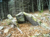
Iron Age and Later PrehistorySite Name: Castle Dore
Country: England County: Cornwall Type: Hillfort
Nearest Town: Fowey  Nearest Village: Torfrey
Map Ref: SX1034454824  Landranger Map Number: 200
Latitude: 50.362687N  Longitude: 4.667914W
Condition:
5Perfect
4Almost Perfect
3Reasonable but with some damage
2Ruined but still recognisable as an ancient site
1Pretty much destroyed, possibly visible as crop marks
0No data.
-1Completely destroyed
4 Ambience:
5Superb
4Good
3Ordinary
2Not Good
1Awful
0No data.
4 Access:
5Can be driven to, probably with disabled access
4Short walk on a footpath
3Requiring a bit more of a walk
2A long walk
1In the middle of nowhere, a nightmare to find
0No data.
5 Accuracy:
5co-ordinates taken by GPS or official recorded co-ordinates
4co-ordinates scaled from a detailed map
3co-ordinates scaled from a bad map
2co-ordinates of the nearest village
1co-ordinates of the nearest town
0no data
4

Internal Links:
External Links:

I have visited· I would like to visit

lucasn visited - their rating: Cond: 4 Amb: 4 Access: 4

mikeaitch have visited here

Castle Dore
Castle Dore submitted by mikeaitch : View NE from NW (Vote or comment on this photo)
Small iron Age hill fort re occupied in the 5th-8th centuries. Traces of a wooden hall associated with King Mark of Arthurian legend and the father or uncle of Tristam (see Tristam Stone)

Have you visited this site? Please add a comment below.
You may be viewing yesterday's version of this page. To see the most up to date information please register for a free account.


Castle Dore
Castle Dore submitted by mikeaitch : View S from NW Corner of Field (Vote or comment on this photo)

Castle Dore
Castle Dore submitted by mikeaitch : Inner Ditch N from SW (Vote or comment on this photo)

Castle Dore
Castle Dore submitted by mikeaitch : View NW from E (Vote or comment on this photo)

Castle Dore
Castle Dore submitted by mikeaitch : View SW from W (Vote or comment on this photo)

Castle Dore
Castle Dore submitted by mikeaitch : View N from SW (Vote or comment on this photo)

Castle Dore
Castle Dore submitted by Thorgrim : Iron Age fort, re-settled in the dark Ages and with a timber hall associated with King Mark. Also used defensively in the English Civil War. Can any other hillfort claim such a long period of use?

Castle Dore
Castle Dore submitted by Thorgrim : Iron Age fort re-settled in the 5th-8th centuries AD.

Castle Dore
Castle Dore submitted by Bladup : Part of the bank at the wonderful Castle Dore.

Castle Dore
Castle Dore submitted by Bladup

Castle Dore
Castle Dore submitted by mikeaitch : View NE from W

Castle Dore
Castle Dore submitted by mikeaitch : Inner ditch view S from SW

Castle Dore
Castle Dore submitted by mikeaitch : Inner Ring from West

Castle Dore
Castle Dore submitted by mikeaitch : Eastern Entrance (Tricky lighting conditions with Sun directly behind ramparts)

Castle Dore
Castle Dore submitted by mikeaitch : View S from E

Castle Dore
Castle Dore submitted by mikeaitch : View W from NW

Castle Dore
Castle Dore submitted by mikeaitch : View NNE from NW

Castle Dore
Castle Dore submitted by mikeaitch : Info Plaque on W Side reads: These earthworks, 225ft in diameter, enclosed a village dating from the 3rd to 1st centuries B.C. In the 6th century A.D. they surrounded the wooden hall of King Mark of Cornwall, who figures in the story of Tristan and Iseult and who is named on the stone found near here and now at the Four Turnings, Fowey. On 31st August 1644, the site was held by Parliamentary...

Castle Dore
Castle Dore submitted by mikeaitch : Entrance gate from the roadside on the West of the site.

Do not use the above information on other web sites or publications without permission of the contributor.
Click here to see more info for this site

Nearby sites

Click here to view sites on an interactive OS map

Key: Red: member's photo, Blue: 3rd party photo, Yellow: other image, Green: no photo - please go there and take one, Grey: site destroyed

Download sites to:
KML (Google Earth)
GPX (GPS waypoints)
CSV (Garmin/Navman)
CSV (Excel)

To unlock full downloads you need to sign up as a Contributory Member. Otherwise downloads are limited to 50 sites.


Turn off the page maps and other distractions

Nearby sites listing. In the following links * = Image available
 1.8km E 79° St Samson's Well (Golant)* Holy Well or Sacred Spring (SX121551)
 2.8km SSE 160° Tristan Stone* Early Christian Sculptured Stone (SX1123252117)
 3.1km SSW 192° Tregaminion Crosses* Ancient Cross (SX096518)
 4.5km W 278° Prideaux Camp* Hillfort (SX059556)
 4.5km NNW 339° Pelyn Cross* Ancient Cross (SX089591)
 4.7km SSE 148° Lanteglos-by-Fowey Church Crosses Ancient Cross (SX12755074)
 4.7km SSE 148° St Saviour's Holy Well (Polruan)* Holy Well or Sacred Spring (SX12755073)
 4.9km NNW 327° St Bryvyth's Well* Holy Well or Sacred Spring (SX078590)
 5.0km NW 321° Trethew Cross* Ancient Cross (SX07355881)
 5.1km SE 137° Polruan Standing Stones* Standing Stones (SX137510)
 5.6km NNE 24° St Nectan Church Cross* Ancient Cross (SX128599)
 5.9km WNW 301° St Cyors's Well* Holy Well or Sacred Spring (SX054580)
 6.1km WNW 300° Luxulyan Cross* Ancient Cross (SX05185806)
 6.8km WNW 303° Luxulyan stones* Natural Stone / Erratic / Other Natural Feature (SX0474658699)
 6.9km W 265° Menear* Standing Stone (Menhir) (SX0345154469)
 7.0km W 270° Carn Grey* Rock Outcrop (SX033551)
 7.8km WSW 248° Gwallon Longstone* Standing Stone (Menhir) (SX02965212)
 8.0km NNW 327° Helman Tor* Causewayed Enclosure (SX06166166)
 8.3km E 87° Bake rings* Ancient Village or Settlement (SX187549)
 8.6km NNW 336° Lesquite Quoit* Burial Chamber or Dolmen (SX07076276)
 8.7km NNW 333° Lesquite Cross* Ancient Cross (SX06666269)
 8.7km W 279° Caerloggas Down longstone* Modern Stone Circle etc (SX0174756485)
 8.8km W 279° Caerloggas Barrow I Timber Circle (SX017565)
 8.8km W 279° Caerloggas Barrow III Timber Circle (SX017565)
 8.8km N 8° Bofarnel down* Barrow Cemetery (SX119635)
View more nearby sites and additional images

<< The Altar

Carsington Pasture >>

Please add your thoughts on this site

Cornwall in Prehistory

Cornwall in Prehistory

Sponsors

Auto-Translation (Google)

Translate from English into:

"Castle Dore" | Login/Create an Account | 9 News and Comments
  
Go back to top of page    Comments are owned by the poster. We aren't responsible for their content.
Re: Castle Dore by Anonymous on Sunday, 14 May 2023
To correct the commentary, the site probably wasn't occupied in any meaningful way after the 1st century.
[ Reply to This ]

Re: Castle Dore by Anonymous on Monday, 05 October 2015
good
[ Reply to This ]

Re: Castle Dore by Anonymous on Saturday, 25 July 2015
I'm pretty sure Cornwall was not a constitue part of England in 5 th century, and even in the 8 th century its status can be best described as ambiguous, indeed, some constitutional experts claim it still is. So in light of the Cornish gaining minority recognition like the Welsh, Scots and Irish your otherwise informative site should reflect the contested nature of Cornish historical sites and resist the temptation to place them in a part of England.
[ Reply to This ]

Re: Castle Dore by stevemc on Sunday, 28 March 2010
(User Info | Send a Message)
hi ,I would be most grateful if u could forward me any pictures or drawings you may have ,that replicates how these hillforts may have looked in their heyday! thanks.
[ Reply to This ]

Re: Castle Dore by MikeAitch on Friday, 19 March 2010
(User Info | Send a Message)
Entrance to site from roadside.
[ Reply to This ]

Street View by coldrum on Thursday, 18 March 2010
(User Info | Send a Message)

View Larger Map
[ Reply to This ]

Re: Castle Dore by MikeAitch on Thursday, 18 March 2010
(User Info | Send a Message)
Condition:3
Ambience:4
Access:4
Accuracy:4

I was in the local area and paid an unplanned visit to this site last week, from my OS map I was expecting to see just another ploughed out Cornish Iron Age round/defensive settlement - Castle Dore proved to be anything but! Wonderful site with clearly defined banks and ditches with commanding views over the coast and countryside.
[ Reply to This ]

Re: Castle Dore by Anonymous on Monday, 04 January 2010
hi, have tried to visit and have found it too be on private land ,is there a specific way to access the monument?
[ Reply to This ]

Re: Castle Dore by Anonymous on Friday, 24 January 2003
I live in Tywardreath just a mile away and often visit it whilst walking the dog. The Tristan Stone which now stands by the roadside into Fowey (3 miles distance) was originally at the Castle Dore site and legend has it that when it was excavated that they found two sets of skeletons in an embrace. This hillfort was also the scene of a civil war battle on 31st Aug 1644. when the Kings men defeated the Parliamentarians under the Earl of Essex
[ Reply to This ]

Your Name: Anonymous [ Register Now ]
Subject:


Add your comment or contribution to this page. Spam or offensive posts are deleted immediately, don't even bother

<<< What is five plus one as a number? (Please type the answer to this question in the little box on the left)
You can also embed videos and other things. For Youtube please copy and paste the 'embed code'.
For Google Street View please include Street View in the text.
Create a web link like this: <a href="https://www.megalithic.co.uk">This is a link</a>  

Allowed HTML is:
<p> <b> <i> <a> <img> <em> <br> <strong> <blockquote> <tt> <li> <ol> <ul> <object> <param> <embed> <iframe>

We would like to know more about this location. Please feel free to add a brief description and any relevant information in your own language.
Wir möchten mehr über diese Stätte erfahren. Bitte zögern Sie nicht, eine kurze Beschreibung und relevante Informationen in Deutsch hinzuzufügen.
Nous aimerions en savoir encore un peu sur les lieux. S'il vous plaît n'hesitez pas à ajouter une courte description et tous les renseignements pertinents dans votre propre langue.
Quisieramos informarnos un poco más de las lugares. No dude en añadir una breve descripción y otros datos relevantes en su propio idioma.