<< Text Pages >> Lower Treginnis - Cairn in Wales in Pembrokeshire
Submitted by vicky on Saturday, 21 September 2002 Page Views: 9395
Neolithic and Bronze AgeSite Name: Lower TreginnisCountry: Wales County: Pembrokeshire Type: Cairn
Nearest Town: St Davids
Map Ref: SM718236 Landranger Map Number: 160
Latitude: 51.864187N Longitude: 5.315808W
Condition:
| 5 | Perfect |
| 4 | Almost Perfect |
| 3 | Reasonable but with some damage |
| 2 | Ruined but still recognisable as an ancient site |
| 1 | Pretty much destroyed, possibly visible as crop marks |
| 0 | No data. |
| -1 | Completely destroyed |
| 5 | Superb |
| 4 | Good |
| 3 | Ordinary |
| 2 | Not Good |
| 1 | Awful |
| 0 | No data. |
| 5 | Can be driven to, probably with disabled access |
| 4 | Short walk on a footpath |
| 3 | Requiring a bit more of a walk |
| 2 | A long walk |
| 1 | In the middle of nowhere, a nightmare to find |
| 0 | No data. |
| 5 | co-ordinates taken by GPS or official recorded co-ordinates |
| 4 | co-ordinates scaled from a detailed map |
| 3 | co-ordinates scaled from a bad map |
| 2 | co-ordinates of the nearest village |
| 1 | co-ordinates of the nearest town |
| 0 | no data |
Internal Links:
External Links:
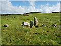
Cairn in Pembrokeshire
Only four stone survive on site. Have you visited this site? Please add a comment below.
You may be viewing yesterday's version of this page. To see the most up to date information please register for a free account.
Do not use the above information on other web sites or publications without permission of the contributor.
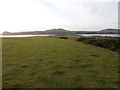
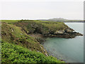
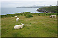
Nearby Images from Geograph Britain and Ireland:
©2020(licence)
©2018(licence)
©2014(licence)
©2015(licence)
©2019(licence)
The above images may not be of the site on this page, they are loaded from Geograph.
Please Submit an Image of this site or go out and take one for us!
Click here to see more info for this site
Nearby sites
Key: Red: member's photo, Blue: 3rd party photo, Yellow: other image, Green: no photo - please go there and take one, Grey: site destroyed
Download sites to:
KML (Google Earth)
GPX (GPS waypoints)
CSV (Garmin/Navman)
CSV (Excel)
To unlock full downloads you need to sign up as a Contributory Member. Otherwise downloads are limited to 50 sites.
Turn off the page maps and other distractions
Nearby sites listing. In the following links * = Image available
1.2km NNE 25° Castell Henif* Promontory Fort / Cliff Castle (SM72362469)
1.6km WNW 292° Ramsay Monolith* Modern Stone Circle etc (SM70302428)
1.7km NNE 18° St Justinian's Well* Holy Well or Sacred Spring (SM72402522)
1.8km NNE 21° St Justinians East* Standing Stone (Menhir) (SM7252725278)
1.9km NNE 15° St Justinians North* Standing Stone (Menhir) (SM7237625371)
2.0km NNE 32° Rhosson Well Holy Well or Sacred Spring (SM72932526)
2.1km WNW 296° Carn Ysgubor Cairn (SM69992460)
2.2km W 260° Carn Llundain (South)* Cairn (SM69652331)
2.2km ENE 71° Porth Clais well* Holy Well or Sacred Spring (SM739242)
2.3km NE 49° Ffynnon Llygaid (Great Orme) Holy Well or Sacred Spring (SM736250)
2.4km NE 50° Clegyr Boia* Hillfort (SM73732509)
2.6km NNE 27° Trelyddan Well Holy Well or Sacred Spring (SM731259)
3.3km ENE 75° St Non's Chapel* Early Christian Sculptured Stone (SM7507524345)
3.4km ENE 74° St Non's Well (Pembrokeshire)* Holy Well or Sacred Spring (SM75102437)
3.8km NNE 19° Whitesands Bay Submerged Forest Not Known (by us) (SM7320227125)
3.8km ENE 60° St David's Cathedral* Ancient Cross (SM75202536)
4.0km ENE 59° Ffynnon-Y-Cwcwll Holy Well or Sacred Spring (SM7533725498)
4.1km ENE 64° Pembrokeshire National Park Visitors Centre* Museum (SM756252)
4.1km ENE 64° Cocyn Round* Misc. Earthwork (SM7559325258)
4.1km NNE 27° Ffynnon Faiddog Holy Well or Sacred Spring (SM73842720)
4.3km N 4° St David's Head* Hillfort (SM723279)
4.4km E 81° Penpleidiau fort* Hillfort (SM762241)
4.5km NE 49° Trefarchan* Standing Stone (Menhir) (SM7531126407)
4.5km N 7° Coetan Arthur Dolmen* Chambered Tomb (SM72532806)
4.6km NNE 19° Carn Llidi* Chambered Tomb (SM73512790)
View more nearby sites and additional images


 We would like to know more about this location. Please feel free to add a brief description and any relevant information in your own language.
 Wir möchten mehr über diese Stätte erfahren. Bitte zögern Sie nicht, eine kurze Beschreibung und relevante Informationen in Deutsch hinzuzufügen.
 Nous aimerions en savoir encore un peu sur les lieux. S'il vous plaît n'hesitez pas à ajouter une courte description et tous les renseignements pertinents dans votre propre langue.
 Quisieramos informarnos un poco más de las lugares. No dude en añadir una breve descripción y otros datos relevantes en su propio idioma.