

<< Our Photo Pages >> Gwal y Filiast - Chambered Tomb in Wales in Carmarthenshire
Submitted by vicky on Thursday, 12 November 2020 Page Views: 35003
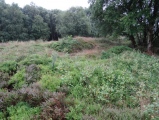
Neolithic and Bronze AgeSite Name: Gwal y Filiast Alternative Name: Bwrdd ArthurCountry: Wales County: Carmarthenshire Type: Chambered Tomb
Nearest Town: St Clears Nearest Village: Llanboidy
Map Ref: SN17052564 Landranger Map Number: 145
Latitude: 51.899190N Longitude: 4.660533W
Condition:
| 5 | Perfect |
| 4 | Almost Perfect |
| 3 | Reasonable but with some damage |
| 2 | Ruined but still recognisable as an ancient site |
| 1 | Pretty much destroyed, possibly visible as crop marks |
| 0 | No data. |
| -1 | Completely destroyed |
| 5 | Superb |
| 4 | Good |
| 3 | Ordinary |
| 2 | Not Good |
| 1 | Awful |
| 0 | No data. |
| 5 | Can be driven to, probably with disabled access |
| 4 | Short walk on a footpath |
| 3 | Requiring a bit more of a walk |
| 2 | A long walk |
| 1 | In the middle of nowhere, a nightmare to find |
| 0 | No data. |
| 5 | co-ordinates taken by GPS or official recorded co-ordinates |
| 4 | co-ordinates scaled from a detailed map |
| 3 | co-ordinates scaled from a bad map |
| 2 | co-ordinates of the nearest village |
| 1 | co-ordinates of the nearest town |
| 0 | no data |
Internal Links:
External Links:
I have visited· I would like to visit
jess TheDuke SolarMegalith KieKa emh504 Gryffincoch would like to visit
Couplands visited on 16th Oct 2023 - their rating: Cond: 2 Amb: 5 Access: 3
Seb4253 visited on 10th Oct 2022 - their rating: Cond: 3 Amb: 5 Access: 3 Lots has already been said about this fascinating site, a few brief observations of my own however:
-If this was intended to a "tomb" of some kind - why is it barley long enough to accommodate me ( and i'm pretty short ) laying down. As is the case for many cromlechs I've encountered ?
-ive noticed the obviously colossal weight of the cap stone is balanced on the tinniest of points on almost all supporting uprights- a feature I've noticed in a few other cromlechs. In some cases a cap stone has been placed entirely on fine points.
-the interior face of the furthest upright from the "entrance" is worn smooth with an indentation at the uppermost part ( discovered by accident when laying inside to test the feasibility of this being a tomb)....I could easily- and nearly did- drift off in to there as it was actually amazingly comfortable, obviously very many others had, hence the ergonomicly worn indentation mentioned above.
- as an unrelated aside, there are some amazing fungi on neighbouring trees, for any amateur mycologists out there!!
woodini254 visited on 14th Jun 2012 - their rating: Cond: 4 Amb: 5 Access: 3 Directions
From Crymych travel south on the A478 to the hamlet of Glandy Cross, turn left towards Llanglydwen for approximately 4Km. Drive through the village past the Bont pub. Turn right towards Login and pull into the lay by on the right. Around 100 yards is the start of the footpath marked ‘Penpontbren’ walk down this path following the wood which is on the right for between 10 and 15 minutes until you come to a steel farm gate, climb over the gate and take the left hand path for approximately 100 yards to the monument.
This impressive monument consists of a large single capstone supported by four uprights which appear to delineate a polygonal chamber. A fifth upright was recorded by Barnwell in 1872 suggesting that this formed an entrance. Surrounding the monument is a series of kerb stones which are possibly the remnants of an earthen mound.
Penbron PERKYPUFFIN Bladup paulcall PAB have visited here
Average ratings for this site from all visit loggers: Condition: 3 Ambience: 5 Access: 3
")
Note: Gwal y Filiast trees update - CADW say the owner is not felling the trees, but in conjunction with the footpath people, looking at making any diseased ones safe.
You may be viewing yesterday's version of this page. To see the most up to date information please register for a free account.
")
")
")
")
")
")
")
")
")
")
")
")
")
")
")
")
")
")
")
")
")
")
")
")
")
These are just the first 25 photos of Gwal y Filiast. If you log in with a free user account you will be able to see our entire collection.
Do not use the above information on other web sites or publications without permission of the contributor.
Click here to see more info for this site
Nearby sites
Key: Red: member's photo, Blue: 3rd party photo, Yellow: other image, Green: no photo - please go there and take one, Grey: site destroyed
Download sites to:
KML (Google Earth)
GPX (GPS waypoints)
CSV (Garmin/Navman)
CSV (Excel)
To unlock full downloads you need to sign up as a Contributory Member. Otherwise downloads are limited to 50 sites.
Turn off the page maps and other distractions
Nearby sites listing. In the following links * = Image available
638m W 278° Bach-sylw* Standing Stones (SN16422575)
1.0km NNE 20° St Clydwen's Church Cross Stone* Early Christian Sculptured Stone (SN17452660)
1.6km W 263° Maen Hir Farm 1* Standing Stone (Menhir) (SN155255)
1.6km W 263° Efailwen-Isaf Barrow* Round Barrow(s) (SN15482550)
1.6km W 277° Maen Hir Farm 4* Standing Stone (Menhir) (SN15452589)
1.7km W 263° Rhos Coynant Round Barrow(s) (SN154255)
1.7km W 260° Coynant Maenhir Standing Stone (Menhir) (SN15412540)
2.0km WNW 299° Carreg Fyrddin Standing Stone (Menhir) (SN153267)
2.1km W 264° Maen Hir Farm 2 and 3* Standing Stones (SN149255)
2.3km WNW 284° Pantymenyn Ancient Village or Settlement (SN148263)
2.5km NW 323° Carn Besi* Chambered Tomb (SN15632768)
2.7km WNW 296° Castell Garw* Ancient Village or Settlement (SN147269)
2.8km WNW 297° Glandymawr* Cairn (SN14562702)
3.0km WNW 286° Meini Gwyr* Henge (SN14172658)
3.1km W 280° Glandy Cross Tumulus* Barrow Cemetery (SN140263)
3.2km W 264° Capel Nebo Stone* Standing Stone (Menhir) (SN13852541)
3.2km WNW 285° Yr Allor* Standing Stones (SN13952661)
3.3km WNW 284° Eisteddfa Brynber Round Barrow(s) (SN13842659)
3.6km NNE 33° Efessangus stone* Early Christian Sculptured Stone (SN191286)
3.7km SE 135° Cefn Brafle* Chambered Tomb (SN196229)
3.7km SE 135° Crosshands* Standing Stones (SN196229)
3.9km W 262° Maen Pica Stone* Standing Stone (Menhir) (SN13172524)
4.4km ENE 75° Crug Hywel Cairn Cairn (SN214266)
4.5km E 81° Tumulus at Pantglas* Cairn (SN215262)
4.5km NNW 343° Foel Dyrch, Pentre Galar Cairn (SN159300)
View more nearby sites and additional images


 We would like to know more about this location. Please feel free to add a brief description and any relevant information in your own language.
 Wir möchten mehr über diese Stätte erfahren. Bitte zögern Sie nicht, eine kurze Beschreibung und relevante Informationen in Deutsch hinzuzufügen.
 Nous aimerions en savoir encore un peu sur les lieux. S'il vous plaît n'hesitez pas à ajouter une courte description et tous les renseignements pertinents dans votre propre langue.
 Quisieramos informarnos un poco más de las lugares. No dude en añadir una breve descripción y otros datos relevantes en su propio idioma.