


<< Our Photo Pages >> Taro La Cerca (2) - Ancient Village or Settlement in Spain in Canary Isles
Submitted by Klingon on Sunday, 14 September 2014 Page Views: 1472
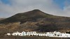
Multi-periodSite Name: Taro La Cerca (2)Country: Spain Region: Canary Isles Type: Ancient Village or Settlement
Latitude: 29.176752N Longitude: 13.493982W
Condition:
| 5 | Perfect |
| 4 | Almost Perfect |
| 3 | Reasonable but with some damage |
| 2 | Ruined but still recognisable as an ancient site |
| 1 | Pretty much destroyed, possibly visible as crop marks |
| 0 | No data. |
| -1 | Completely destroyed |
| 5 | Superb |
| 4 | Good |
| 3 | Ordinary |
| 2 | Not Good |
| 1 | Awful |
| 0 | No data. |
| 5 | Can be driven to, probably with disabled access |
| 4 | Short walk on a footpath |
| 3 | Requiring a bit more of a walk |
| 2 | A long walk |
| 1 | In the middle of nowhere, a nightmare to find |
| 0 | No data. |
| 5 | co-ordinates taken by GPS or official recorded co-ordinates |
| 4 | co-ordinates scaled from a detailed map |
| 3 | co-ordinates scaled from a bad map |
| 2 | co-ordinates of the nearest village |
| 1 | co-ordinates of the nearest town |
| 0 | no data |
Internal Links:
External Links:
I have visited· I would like to visit
Klingon visited on 19th Aug 2014 - their rating: Cond: 3 Amb: 5 Access: 3
 (PID:123904)")
You may be viewing yesterday's version of this page. To see the most up to date information please register for a free account.
 (PID:123905)")
Do not use the above information on other web sites or publications without permission of the contributor.
Nearby Images from Flickr


The above images may not be of the site on this page, but were taken nearby. They are loaded from Flickr so please click on them for image credits.
Click here to see more info for this site
Nearby sites
Click here to view sites on an interactive map of the areaKey: Red: member's photo, Blue: 3rd party photo, Yellow: other image, Green: no photo - please go there and take one, Grey: site destroyed
Download sites to:
KML (Google Earth)
GPX (GPS waypoints)
CSV (Garmin/Navman)
CSV (Excel)
To unlock full downloads you need to sign up as a Contributory Member. Otherwise downloads are limited to 50 sites.
Turn off the page maps and other distractions
Nearby sites listing. In the following links * = Image available
63m SSE 168° Taro La Cerca (1)* Cave or Rock Shelter
490m NE 52° Taro del Volcan de La Corona* Ancient Village or Settlement
2.2km NE 34° Taro Ye* Broch or Nuraghe
6.1km ESE 110° Quesera de Bravo* Carving
11.7km S 185° Las Veguetas de Guinea* Carving
12.0km S 182° Montaña de Guinea Settlement* Ancient Village or Settlement
12.1km S 183° Montaña de Guinea Outcrop* Rock Outcrop
12.8km S 181° Vega Vieja* Carving
12.8km S 181° Litófono Pena Luis* Natural Stone / Erratic / Other Natural Feature
14.3km SSW 202° Castillo de Santa Barbara* Museum
19.7km SSW 202° Llano de Zonzamas* Ancient Palace
19.8km SSW 202° Museo de Zonzamas* Museum
20.9km SSW 200° Quesera de Zonzamas* Carving
22.7km SSW 210° Museo Tanit* Museum
23.2km SW 228° Taro Caldera Quemada* Ancient Village or Settlement
25.0km SSW 192° Castillo de San Gabriel* Museum
27.4km SW 220° Taro de Testeyna* Ancient Village or Settlement
31.3km SW 221° Quesera Guardilama* Carving
40.2km SW 223° Cueva de las Palomas* Carving
40.8km SW 223° Tomb Pico de la Aceituna* Cave or Rock Shelter
40.8km SW 223° Tagoror Pico de la Aceituna* Ancient Temple
46.5km SW 218° Los Pozos de San Marcial del Rubicón* Holy Well or Sacred Spring
70.5km SW 214° Cueva del Llanos* Cave or Rock Shelter
79.8km SW 216° Montaña Tindaya* Carving
88.7km SSW 204° Conchero de El Matorral* Ancient Village or Settlement
View more nearby sites and additional images


 We would like to know more about this location. Please feel free to add a brief description and any relevant information in your own language.
 Wir möchten mehr über diese Stätte erfahren. Bitte zögern Sie nicht, eine kurze Beschreibung und relevante Informationen in Deutsch hinzuzufügen.
 Nous aimerions en savoir encore un peu sur les lieux. S'il vous plaît n'hesitez pas à ajouter une courte description et tous les renseignements pertinents dans votre propre langue.
 Quisieramos informarnos un poco más de las lugares. No dude en añadir una breve descripción y otros datos relevantes en su propio idioma.