

<< Our Photo Pages >> Hurston Ridge Settlement - Ancient Village or Settlement in England in Devon
Submitted by Bladup on Tuesday, 29 October 2013 Page Views: 2332
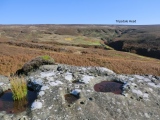
Multi-periodSite Name: Hurston Ridge SettlementCountry: England County: Devon Type: Ancient Village or Settlement
Nearest Town: Moretonhampstead Nearest Village: Lettaford / Postbridge
Map Ref: SX67338253
Latitude: 50.627333N Longitude: 3.877091W
Condition:
| 5 | Perfect |
| 4 | Almost Perfect |
| 3 | Reasonable but with some damage |
| 2 | Ruined but still recognisable as an ancient site |
| 1 | Pretty much destroyed, possibly visible as crop marks |
| 0 | No data. |
| -1 | Completely destroyed |
| 5 | Superb |
| 4 | Good |
| 3 | Ordinary |
| 2 | Not Good |
| 1 | Awful |
| 0 | No data. |
| 5 | Can be driven to, probably with disabled access |
| 4 | Short walk on a footpath |
| 3 | Requiring a bit more of a walk |
| 2 | A long walk |
| 1 | In the middle of nowhere, a nightmare to find |
| 0 | No data. |
| 5 | co-ordinates taken by GPS or official recorded co-ordinates |
| 4 | co-ordinates scaled from a detailed map |
| 3 | co-ordinates scaled from a bad map |
| 2 | co-ordinates of the nearest village |
| 1 | co-ordinates of the nearest town |
| 0 | no data |
Internal Links:
External Links:
I have visited· I would like to visit
graemefield visited on 18th May 2017 - their rating: Cond: 2 Amb: 4 Access: 2
")
Update November 2019: This settlement is featured on the Prehistoric Dartmoor Walks (PDW) website - see their entry for the Hurston Ridge Settlement.
This enclosed stone hut circle settlement is also recorded as Pastscape Monument No. 443787, as MDV6668 (Hurston Ridge Prehistoric Enclosure, Chagford) on the Devon and Dartmoor HER, and scheduled as part of Historic England List Entry No. 1019577 (Stone alignment, cairns, enclosed prehistoric settlement and a length of reave on Hurston Ridge).
You may be viewing yesterday's version of this page. To see the most up to date information please register for a free account.
Do not use the above information on other web sites or publications without permission of the contributor.
Nearby sites
Download sites to:
KML (Google Earth)
GPX (GPS waypoints)
CSV (Garmin/Navman)
CSV (Excel)
To unlock full downloads you need to sign up as a Contributory Member. Otherwise downloads are limited to 50 sites.
Nearby sites listing. In the following links * = Image available
36m SW 235° Hurston Ridge* Multiple Stone Rows / Avenue (SX67308251)
361m NE 40° Chagford Common Cairn* Cairn (SX6757182800)
1.1km SE 142° Bennet's Cross* Ancient Cross (SX68008162)
1.2km ESE 106° Bush Down Settlement* Ancient Village or Settlement (SX6849282173)
1.2km W 274° Assycombe Hill* Cairn (SX66108264)
1.2km N 349° The Heath Stone* Standing Stone (Menhir) (SX6712083750)
1.3km S 187° Water hill cairn* Cairn (SX67158128)
1.3km W 272° Assycombe* Multiple Stone Rows / Avenue (SX66058260)
1.3km NW 309° Lowton Brook West Settlement* Ancient Village or Settlement (SX663834)
1.4km NW 324° East Lowton settlement* Ancient Village or Settlement (SX6653783668)
1.6km NNW 340° Metherall Settlement* Ancient Village or Settlement (SX66838401)
1.6km ESE 121° Birch Tor Cairn* Cairn (SX6868681654)
1.9km N 7° Yardworthy* Stone Row / Alignment (SX6760184393)
1.9km NNW 341° Thornworthy Cairn* Cairn (SX6674284335)
2.1km ESE 101° Shapley Common Ancient Village or Settlement (SX69428206)
2.2km WSW 242° White Ridge stone row* Stone Row / Alignment (SX65408156)
2.3km W 260° White Ridge cairn* Round Cairn (SX65028218)
2.3km NW 310° Fernworthy Cairn E* Cairn (SX65568407)
2.4km SE 135° Challacombe Down Cairn Circle* Cairn (SX68968083)
2.4km NW 308° Fernworthy Cairn 4* Cairn (SX65518403)
2.4km SE 135° Challacombe rows* Multiple Stone Rows / Avenue (SX68988082)
2.4km SW 230° Stannon Newtake cist* Cist (SX65468105)
2.4km NW 309° Fernworthy stone row SE* Stone Row / Alignment (SX65498407)
2.4km NW 309° Fernworthy Cairn SE* Cairn (SX65498409)
2.4km NW 309° Fernworthy* Multiple Stone Rows / Avenue (SX65488410)


 We would like to know more about this location. Please feel free to add a brief description and any relevant information in your own language.
 Wir möchten mehr über diese Stätte erfahren. Bitte zögern Sie nicht, eine kurze Beschreibung und relevante Informationen in Deutsch hinzuzufügen.
 Nous aimerions en savoir encore un peu sur les lieux. S'il vous plaît n'hesitez pas à ajouter une courte description et tous les renseignements pertinents dans votre propre langue.
 Quisieramos informarnos un poco más de las lugares. No dude en añadir una breve descripción y otros datos relevantes en su propio idioma.