


<< Text Pages >> Storab Burn - Stone Circle in Scotland in Isle of Raasay
Submitted by Tom_Bullock on Sunday, 14 July 2002 Page Views: 9079
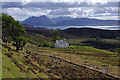
Neolithic and Bronze AgeSite Name: Storab BurnCountry: Scotland County: Isle of Raasay Type: Stone Circle
Map Ref: NG557410 Landranger Map Number: 24
Latitude: 57.393593N Longitude: 6.067506W
Condition:
| 5 | Perfect |
| 4 | Almost Perfect |
| 3 | Reasonable but with some damage |
| 2 | Ruined but still recognisable as an ancient site |
| 1 | Pretty much destroyed, possibly visible as crop marks |
| 0 | No data. |
| -1 | Completely destroyed |
| 5 | Superb |
| 4 | Good |
| 3 | Ordinary |
| 2 | Not Good |
| 1 | Awful |
| 0 | No data. |
| 5 | Can be driven to, probably with disabled access |
| 4 | Short walk on a footpath |
| 3 | Requiring a bit more of a walk |
| 2 | A long walk |
| 1 | In the middle of nowhere, a nightmare to find |
| 0 | No data. |
| 5 | co-ordinates taken by GPS or official recorded co-ordinates |
| 4 | co-ordinates scaled from a detailed map |
| 3 | co-ordinates scaled from a bad map |
| 2 | co-ordinates of the nearest village |
| 1 | co-ordinates of the nearest town |
| 0 | no data |
Internal Links:
External Links:
Ancient site in Raasay
Have you visited this site? Please add a comment below.
You may be viewing yesterday's version of this page. To see the most up to date information please register for a free account.
Do not use the above information on other web sites or publications without permission of the contributor.
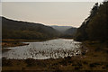
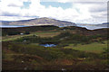
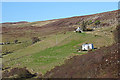
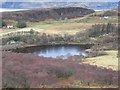
Nearby Images from Geograph Britain and Ireland:
©2019(licence)
©2015(licence)
©2018(licence)
©2006(licence)
©2015(licence)
The above images may not be of the site on this page, they are loaded from Geograph.
Please Submit an Image of this site or go out and take one for us!
Click here to see more info for this site
Nearby sites
Key: Red: member's photo, Blue: 3rd party photo, Yellow: other image, Green: no photo - please go there and take one, Grey: site destroyed
Download sites to:
KML (Google Earth)
GPX (GPS waypoints)
CSV (Garmin/Navman)
CSV (Excel)
To unlock full downloads you need to sign up as a Contributory Member. Otherwise downloads are limited to 50 sites.
Turn off the page maps and other distractions
Nearby sites listing. In the following links * = Image available
4.3km S 174° Inverarish Stone Row / Alignment (NG55903668)
4.3km S 190° Raasay* Class II Pictish Symbol Stone (NG54673677)
4.7km S 179° Dun Borodale* Stone Fort or Dun (NG55473633)
4.7km SE 131° Hallaig* Stone Row / Alignment (NG591377)
5.8km SSW 202° Dunan An Aisilidh* Stone Fort or Dun (NG53203571)
6.4km SSE 160° Eyre Stone Rows* Stone Row / Alignment (NG57493488)
7.0km SSE 160° Eyre Standing Stone Standing Stone (Menhir) (NG57753432)
7.1km WNW 294° Dun Torvaig* Stone Fort or Dun (NG49374422)
7.1km SSE 157° Eyre Point* Burial Chamber or Dolmen (NG581343)
8.0km WNW 298° Dun Gerashader* Hillfort (NG489452)
11.1km WNW 296° Drumuie Standing Stone* Standing Stone (Menhir) (NG4606746524)
11.8km WNW 301° Dun Borve (Skye)* Broch or Nuraghe (NG45914772)
12.6km WNW 300° Borve Stone Row* Stone Row / Alignment (NG452480)
14.1km NNW 333° Old Man of Storr* Rock Outcrop (NG5003853990)
15.2km ENE 78° Torr Mor (Applecross) Ancient Village or Settlement (NG70764313)
15.3km W 263° Tungadal* Souterrain (Fogou, Earth House) (NG404401)
15.5km ENE 75° Applecross* Stone Circle (NG7144)
15.6km SSW 200° River Sligachan Stone Circle (NG49582662)
15.6km E 96° Toscaig (Applecross) Standing Stones (NG712385)
15.7km WNW 295° St Columba's Chapel (Skeabost) Early Christian Sculptured Stone (NG41824850)
15.8km WNW 297° Tote, Skye* Class I Pictish Symbol Stone (NG421491)
16.0km WNW 293° Dun Sgalair* Stone Fort or Dun (NG41354826)
16.2km WNW 303° Kensaleyre S Cairn* Cairn (NG42605059)
16.2km WNW 303° Kensalyre Stone* Standing Stone (Menhir) (NG426507)
16.3km WNW 303° Kensaleyre N Cairn* Cairn (NG42555064)
View more nearby sites and additional images


 We would like to know more about this location. Please feel free to add a brief description and any relevant information in your own language.
 Wir möchten mehr über diese Stätte erfahren. Bitte zögern Sie nicht, eine kurze Beschreibung und relevante Informationen in Deutsch hinzuzufügen.
 Nous aimerions en savoir encore un peu sur les lieux. S'il vous plaît n'hesitez pas à ajouter une courte description et tous les renseignements pertinents dans votre propre langue.
 Quisieramos informarnos un poco más de las lugares. No dude en añadir una breve descripción y otros datos relevantes en su propio idioma.