<< Our Photo Pages >> Swordale Hill - Rock Art in Scotland in Highlands
Submitted by dougie on Saturday, 09 February 2013 Page Views: 6744
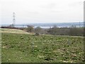
Rock ArtSite Name: Swordale HillCountry: Scotland County: Highlands Type: Rock Art
Nearest Town: Dingwall Nearest Village: Evanton
Map Ref: NH5772066156
Latitude: 57.662736N Longitude: 4.386577W
Condition:
| 5 | Perfect |
| 4 | Almost Perfect |
| 3 | Reasonable but with some damage |
| 2 | Ruined but still recognisable as an ancient site |
| 1 | Pretty much destroyed, possibly visible as crop marks |
| 0 | No data. |
| -1 | Completely destroyed |
| 5 | Superb |
| 4 | Good |
| 3 | Ordinary |
| 2 | Not Good |
| 1 | Awful |
| 0 | No data. |
| 5 | Can be driven to, probably with disabled access |
| 4 | Short walk on a footpath |
| 3 | Requiring a bit more of a walk |
| 2 | A long walk |
| 1 | In the middle of nowhere, a nightmare to find |
| 0 | No data. |
| 5 | co-ordinates taken by GPS or official recorded co-ordinates |
| 4 | co-ordinates scaled from a detailed map |
| 3 | co-ordinates scaled from a bad map |
| 2 | co-ordinates of the nearest village |
| 1 | co-ordinates of the nearest town |
| 0 | no data |
Internal Links:
External Links:
I have visited· I would like to visit
DrewParsons SumDoood would like to visit
")
The majority of the cup-marked stones, as well as the henge, have been identified and recorded by Tain man Douglas Scott who says all the evidence suggests the hill was once a "ritual centre of some significance".
He has lodged his findings with the Highland Historic Environment Record, the Royal Commission of Ancient Monuments and has produced a photographic guide, Druim Mor Cupmarks, which he has sent to ARCH Highland in Dingwall.
The area at Druim Mor ridge is scheduled which means it is protected by law and can’t be excavated without the proper permission.
Douglas now wants to encourage people to get a copy of his guid to find out more about the ancient rock art there. "This is information for everybody, it belongs to us all," he said.
Free Download: Dougie Scott's guide to the cup and ring marks. (PDF, 20MB)
Read more in the: Ross-shire Journal
Note: 28 rock art panels found near Dingwall, Ross-shire, guide available for download
You may be viewing yesterday's version of this page. To see the most up to date information please register for a free account.
Do not use the above information on other web sites or publications without permission of the contributor.
Nearby Images from Geograph Britain and Ireland:
©2008(licence)
©2019(licence)
©2019(licence)
©2019(licence)
©2022(licence)
The above images may not be of the site on this page, they are loaded from Geograph.
Please Submit an Image of this site or go out and take one for us!
Click here to see more info for this site
Nearby sites
Key: Red: member's photo, Blue: 3rd party photo, Yellow: other image, Green: no photo - please go there and take one, Grey: site destroyed
Download sites to:
KML (Google Earth)
GPX (GPS waypoints)
CSV (Garmin/Navman)
CSV (Excel)
To unlock full downloads you need to sign up as a Contributory Member. Otherwise downloads are limited to 50 sites.
Turn off the page maps and other distractions
Nearby sites listing. In the following links * = Image available
160m E 94° Swordale Chambered Cairn Chambered Cairn (NH57886614)
1.2km ENE 72° Carn Liath (Upper Park) Chambered Cairn (NH589665)
4.7km WSW 249° Balnacrae* Chambered Cairn (NH533646)
4.7km SSW 197° Clachan Biorach Chambered Cairn (NH562617)
5.3km SSW 200° Cnoc Ravoch Chambered Cairn (NH557612)
7.3km N 1° Balnagrotchen Chambered Cairn (NH581735)
7.6km N 1° Boath Long Cairn Chambered Cairn (NH581738)
7.7km ESE 116° St Martin's Well (Fortrose)* Holy Well or Sacred Spring (NH645625)
7.7km SSW 199° Dingwall* Class I Pictish Symbol Stone (NH54935893)
7.8km SW 231° Heights of Brae* Chambered Cairn (NH51446152)
7.8km N 2° Boath Short Chambered Cairn (NH58337395)
8.9km ESE 123° Woodhead Round Chambered Cairn* Chambered Cairn (NH650610)
9.0km ESE 110° Mid Brae Chambered Cairn (NH661628)
9.2km ESE 119° Wester Brae* Chambered Cairn (NH65646139)
9.3km SE 124° Woodhead Long* Chambered Cairn (NH653607)
9.3km NNE 22° Carn Na Feinne Chambered Cairn (NH615747)
9.4km S 178° Mulchaich* Cairn (NH57665679)
9.4km ENE 57° Mill craig Chambered Tomb (NH658710)
9.5km ENE 67° Carn Liath, Alness* Cairn (NH66626952)
9.9km ENE 57° Nonakiln Class I Pictish Symbol Stone (NH66217124)
9.9km NE 50° Cnoc Navie Chambered Cairn (NH656722)
10.1km NNE 33° Carn Nam Fiann Chambered Cairn (NH63517441)
10.3km SW 227° Blairninich* Standing Stones (NH49935934)
10.5km SW 221° Knock Farril* Vitrified Fort (NH505585)
10.6km NE 39° Dalnavie Class I Pictish Symbol Stone (NH64737414)
View more nearby sites and additional images


 We would like to know more about this location. Please feel free to add a brief description and any relevant information in your own language.
 Wir möchten mehr über diese Stätte erfahren. Bitte zögern Sie nicht, eine kurze Beschreibung und relevante Informationen in Deutsch hinzuzufügen.
 Nous aimerions en savoir encore un peu sur les lieux. S'il vous plaît n'hesitez pas à ajouter une courte description et tous les renseignements pertinents dans votre propre langue.
 Quisieramos informarnos un poco más de las lugares. No dude en añadir una breve descripción y otros datos relevantes en su propio idioma.