<< Image Pages >> Dirrans burial - Cist in Scotland in North Ayrshire
Submitted by durhamnature on Sunday, 07 October 2012 Page Views: 3057
Neolithic and Bronze AgeSite Name: Dirrans burialCountry: Scotland County: North Ayrshire Type: Cist
Map Ref: NS30684230
Latitude: 55.644659N Longitude: 4.692072W
Condition:
| 5 | Perfect |
| 4 | Almost Perfect |
| 3 | Reasonable but with some damage |
| 2 | Ruined but still recognisable as an ancient site |
| 1 | Pretty much destroyed, possibly visible as crop marks |
| 0 | No data. |
| -1 | Completely destroyed |
| 5 | Superb |
| 4 | Good |
| 3 | Ordinary |
| 2 | Not Good |
| 1 | Awful |
| 0 | No data. |
| 5 | Can be driven to, probably with disabled access |
| 4 | Short walk on a footpath |
| 3 | Requiring a bit more of a walk |
| 2 | A long walk |
| 1 | In the middle of nowhere, a nightmare to find |
| 0 | No data. |
| 5 | co-ordinates taken by GPS or official recorded co-ordinates |
| 4 | co-ordinates scaled from a detailed map |
| 3 | co-ordinates scaled from a bad map |
| 2 | co-ordinates of the nearest village |
| 1 | co-ordinates of the nearest town |
| 0 | no data |
Be the first person to rate this site - see the 'Contribute!' box in the right hand menu.
Internal Links:
External Links:
")
Canmore Site 42096
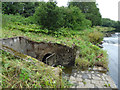
An ancient structure, 45cms in diameter and 120cm deep, was revealed in 1882 when sand was removed from the side of the Garnock Water at Dirrans. It was built of smooth, water-worn whinstones which were very much decomposed. There was no lid or covering and a small tree grew on top. In the bottom were a few centimetres of fine greyish powdery material which was sifted, but no remains were found.
"There was nothing to indicate the use of the structure, but in all likelihood it was a place of interment." It could not have been a well as no water is reached before a depth of about 3m.
J Smith 1894
A disused railway track now covers the site.
Text updated and summarised from Canmore.
You may be viewing yesterday's version of this page. To see the most up to date information please register for a free account.
")
")
Do not use the above information on other web sites or publications without permission of the contributor.
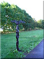
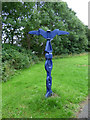
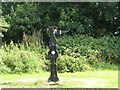
Nearby Images from Geograph Britain and Ireland:
©2005(licence)
©2019(licence)
©2009(licence)
©2019(licence)
©2019(licence)
The above images may not be of the site on this page, they are loaded from Geograph.
Please Submit an Image of this site or go out and take one for us!
Click here to see more info for this site
Nearby sites
Key: Red: member's photo, Blue: 3rd party photo, Yellow: other image, Green: no photo - please go there and take one, Grey: site destroyed
Download sites to:
KML (Google Earth)
GPX (GPS waypoints)
CSV (Garmin/Navman)
CSV (Excel)
To unlock full downloads you need to sign up as a Contributory Member. Otherwise downloads are limited to 50 sites.
Turn off the page maps and other distractions
Nearby sites listing. In the following links * = Image available
1.4km W 260° Todhill Crannog Crannog (NS2930042101)
1.6km E 91° Eglinton Park Ancient Village or Settlement (NS3229642217)
2.8km SW 226° Ardeer Sands Ancient Village or Settlement (NS2857740455)
2.8km W 263° Dubbs Cist Cist (NS27884208)
3.4km ESE 102° Sourlie Hill Modern Stone Circle etc (NS3398041490)
3.6km W 262° Stevenston Souterrain Souterrain (Fogou, Earth House) (NS27114193)
3.7km WNW 301° Ashgrove Loch Crannog* Crannog (NS27594431)
3.8km SSE 158° Grannie Stane* Natural Stone / Erratic / Other Natural Feature (NS3196038711)
4.2km ESE 109° Lawthorn Mount Barrow Cemetery (NS34654078)
4.8km WNW 293° Diddup Hillfort Hillfort (NS2636344331)
5.2km N 10° Cleaves Cove* Cave or Rock Shelter (NS31774744)
5.5km SSE 164° Shewalton Moor Ancient Village or Settlement (NS320370)
6.0km SE 129° Dreghorn Neolithic Village Ancient Village or Settlement (NS35183830)
6.0km WNW 295° Knockrivoch Mount Barrow Cemetery (NS25344510)
7.4km NW 307° Blackshaw Moor Stone Circle (NS250470)
7.4km NNW 347° Courthill Cairn* Round Barrow(s) (NS29244958)
7.5km SE 134° Drybridge Neolithic Village Ancient Village or Settlement (NS3582336852)
7.5km SE 134° Dundonald Cursus Cursus (NS35893690)
7.5km W 267° Ardrossan Shell Mound* Artificial Mound (NS23134218)
7.8km SE 136° Drybridge* Standing Stone (Menhir) (NS35923644)
9.6km SE 142° Dun Donald Hillfort (NS36363451)
9.7km NW 306° Blackshaw Rock Art* Rock Art (NS23104834)
9.9km SSE 148° Kemp Law* Stone Fort or Dun (NS35583364)
10.7km NNW 347° Carwinning Hill Hillfort (NS28715286)
10.9km SSE 149° Wardlaw Hill Fort Hillfort (NS35923276)
View more nearby sites and additional images


 We would like to know more about this location. Please feel free to add a brief description and any relevant information in your own language.
 Wir möchten mehr über diese Stätte erfahren. Bitte zögern Sie nicht, eine kurze Beschreibung und relevante Informationen in Deutsch hinzuzufügen.
 Nous aimerions en savoir encore un peu sur les lieux. S'il vous plaît n'hesitez pas à ajouter une courte description et tous les renseignements pertinents dans votre propre langue.
 Quisieramos informarnos un poco más de las lugares. No dude en añadir una breve descripción y otros datos relevantes en su propio idioma.