<< Our Photo Pages >> Lochbrow Prehistoric Landscape - Ancient Village or Settlement in Scotland in Dumfries and Galloway
Submitted by Andy B on Sunday, 09 September 2012 Page Views: 5500
Multi-periodSite Name: Lochbrow Prehistoric LandscapeCountry: Scotland County: Dumfries and Galloway Type: Ancient Village or Settlement
Nearest Town: Dumfries Nearest Village: Johnstonebridge
Map Ref: NY0942389153
Latitude: 55.188327N Longitude: 3.424183W
Condition:
| 5 | Perfect |
| 4 | Almost Perfect |
| 3 | Reasonable but with some damage |
| 2 | Ruined but still recognisable as an ancient site |
| 1 | Pretty much destroyed, possibly visible as crop marks |
| 0 | No data. |
| -1 | Completely destroyed |
| 5 | Superb |
| 4 | Good |
| 3 | Ordinary |
| 2 | Not Good |
| 1 | Awful |
| 0 | No data. |
| 5 | Can be driven to, probably with disabled access |
| 4 | Short walk on a footpath |
| 3 | Requiring a bit more of a walk |
| 2 | A long walk |
| 1 | In the middle of nowhere, a nightmare to find |
| 0 | No data. |
| 5 | co-ordinates taken by GPS or official recorded co-ordinates |
| 4 | co-ordinates scaled from a detailed map |
| 3 | co-ordinates scaled from a bad map |
| 2 | co-ordinates of the nearest village |
| 1 | co-ordinates of the nearest town |
| 0 | no data |
Internal Links:
External Links:
I have visited· I would like to visit
Andy B has visited here
")
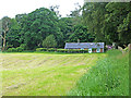
Kirsty Millican writes: It is the kind of place most people would pass by without a second glance, an apparently empty field usually occupied only by cows, but the site of Lochbrow in Dumfries and Galloway is one of my favourite archaeological sites in Scotland. My name is Kirsty Millican and I am a Historic Land-Use Assessment (HLA) Officer at RCAHMS.
So why do I find such an apparently unremarkable location interesting? Because of the cropmarks of course! Cropmarks are formed by the differential growth of crops over buried archaeology, and are best recorded from the air. A scattering of such marks were first recorded at Lochbrow by an RCAHMS aerial survey in 1992, indicating the buried presence of pits and ditches. These features can be interpreted as a timber cursus monument (a long enclosure defined by timber posts usually dating to the Earlier Neolithic), at least one, if not two, timber circles (a monument form dating from the Later Neolithic into the Bronze Age) and several round barrows (later prehistoric monuments). This tells us that this apparently empty field was an important location for a long period of time, and was probably a hive of activity during the construction and use of these monuments.
Read more at RCAHMS Day of Archaeology and see our page for Lochbrow Cursus in the nearby sites list below for more photos.
For this specific location, Canmore records: Air photography has recorded the cropmarks of a pit-defined enclosure on a gravel terrace 250m NW of Lochbrow steading (NY08NE 42). It is slightly oval on plan, measuring about 60m in maximum diameter from ENE to WSW, and the pits are set between 2m and 3m apart.
It is thought to be a large large Neolithic ritual enclosure
Read more at Canmore.
Also in the area, as Kirsty described, there are thought to be various ring ditches / barrows, a cursus (see nearby sites list) and a two possible palisaded enclosure. For the full schedule of sites in this area try this search.
Note: Volunteers needed for survey at Lochbrow near Dumfries - the hidden archaeology of a prehistoric landscape - from Mon 24th Sept
You may be viewing yesterday's version of this page. To see the most up to date information please register for a free account.
Do not use the above information on other web sites or publications without permission of the contributor.
Nearby Images from Geograph Britain and Ireland:
©2015(licence)
©2021(licence)
©2015(licence)
©2008(licence)
©2014(licence)
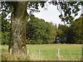
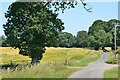
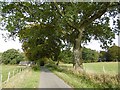
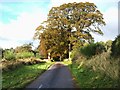
The above images may not be of the site on this page, they are loaded from Geograph.
Please Submit an Image of this site or go out and take one for us!
Click here to see more info for this site
Nearby sites
Key: Red: member's photo, Blue: 3rd party photo, Yellow: other image, Green: no photo - please go there and take one, Grey: site destroyed
Download sites to:
KML (Google Earth)
GPX (GPS waypoints)
CSV (Garmin/Navman)
CSV (Excel)
To unlock full downloads you need to sign up as a Contributory Member. Otherwise downloads are limited to 50 sites.
Turn off the page maps and other distractions
Nearby sites listing. In the following links * = Image available
217m NNE 24° Lochbrow Cursus* Cursus (NY0951489350)
832m SSW 201° Archwood Hill* Hillfort (NY0911488380)
5.6km NNE 17° Skip Knowe* Standing Stone (Menhir) (NY1118094430)
5.6km NW 324° Crunzierton Wood Scooped Settlement* Ancient Village or Settlement (NY0625093750)
7.6km SSE 151° Chapel Well (Beckton) Holy Well or Sacred Spring (NY12948243)
7.7km NNE 17° Pumplaburn* Cairn (NY11869644)
8.1km NNE 24° Wamphray Place* Misc. Earthwork (NY12829648)
8.2km NNE 33° Kirkhill* Stone Circle (NY1397895929)
8.2km NNE 25° St Cuthbert's Church (Wamphray)* Ancient Cross (NY1307096462)
9.9km N 7° Chapman's Stone* Standing Stone (Menhir) (NY1078398986)
10.9km N 4° Poldean menhir* Standing Stone (Menhir) (NT1037900011)
11.0km NNW 330° Stiddrig* Cairn (NY04139877)
12.5km NW 325° Lonnachie Rig Cairn (NY024995)
12.9km E 92° Kirkslight Rig Stone Circle (NY223885)
13.0km SSE 158° Our Lady's Well (St Mungo's Old Church) Holy Well or Sacred Spring (NY1477)
13.0km E 94° Whitcastles* Stone Circle (NY22408806)
13.7km WSW 257° Clonfeckle Cairn (NX960863)
13.7km WNW 286° Gulfhill Rig Cairn (NX963933)
13.8km SE 137° Burnswark Hill Cairn* Cairn (NY18697883)
13.8km ESE 117° Whiteholme Rig* Stone Circle (NY21718269)
13.9km SE 138° Burnswark Hillfort* Hillfort (NY18607870)
14.3km WSW 243° Kirkmahoe Cursus Cursus (NX96508286)
14.7km N 355° Dyke Row* Stone Row / Alignment (NT0837503820)
15.2km ENE 75° Castle O'er Fort* Hillfort (NY2419092850)
15.3km ESE 110° Newhall Hill (Paddockhole)* Ancient Village or Settlement (NY23808372)
View more nearby sites and additional images


 We would like to know more about this location. Please feel free to add a brief description and any relevant information in your own language.
 Wir möchten mehr über diese Stätte erfahren. Bitte zögern Sie nicht, eine kurze Beschreibung und relevante Informationen in Deutsch hinzuzufügen.
 Nous aimerions en savoir encore un peu sur les lieux. S'il vous plaît n'hesitez pas à ajouter une courte description et tous les renseignements pertinents dans votre propre langue.
 Quisieramos informarnos un poco más de las lugares. No dude en añadir una breve descripción y otros datos relevantes en su propio idioma.