<< Our Photo Pages >> Warden Law - Round Barrow(s) in England in Tyne and Wear
Submitted by durhamnature on Friday, 17 August 2012 Page Views: 9305
Neolithic and Bronze AgeSite Name: Warden LawCountry: England County: Tyne and Wear Type: Round Barrow(s)
Nearest Town: Sunderland Nearest Village: Warden law
Map Ref: NZ376502
Latitude: 54.845205N Longitude: 1.416003W
Condition:
| 5 | Perfect |
| 4 | Almost Perfect |
| 3 | Reasonable but with some damage |
| 2 | Ruined but still recognisable as an ancient site |
| 1 | Pretty much destroyed, possibly visible as crop marks |
| 0 | No data. |
| -1 | Completely destroyed |
| 5 | Superb |
| 4 | Good |
| 3 | Ordinary |
| 2 | Not Good |
| 1 | Awful |
| 0 | No data. |
| 5 | Can be driven to, probably with disabled access |
| 4 | Short walk on a footpath |
| 3 | Requiring a bit more of a walk |
| 2 | A long walk |
| 1 | In the middle of nowhere, a nightmare to find |
| 0 | No data. |
| 5 | co-ordinates taken by GPS or official recorded co-ordinates |
| 4 | co-ordinates scaled from a detailed map |
| 3 | co-ordinates scaled from a bad map |
| 2 | co-ordinates of the nearest village |
| 1 | co-ordinates of the nearest town |
| 0 | no data |
Internal Links:
External Links:
I have visited· I would like to visit
Darrenci would like to visit
PathsSeldomTrod visited on 23rd Nov 2023 - their rating: Cond: 4 Amb: 4 Access: 4
")
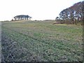
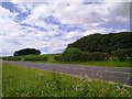
Warden Law is a hill 3 kilometres east of Houghton-le-Spring. It has deep deposits of glacial sand and clay, forming a drumlin- and –esker landscape. The top of the hill has been extensively quarried.
It is the site of several prehistoric burials and other remains, but it has a very confused history of discovery and excavation. This account is compiled from several sources, and tries to untangle the threads. Grid references and measurements of remaining features have been re-checked. There has been:-
1. One well-documented excavation of a barrow, but with uncertain location.
2. Two other possible barrows on the tops of drumlins.
3. One other possible barrow of uncertain location, but possibly one of Number 2.
4. A cist excavated in 1975.
5. A crop-mark.
6. A number of finds of flints.
1
NZ35 SE Number 3 in Roger Miket
Tyne and Wear HER 255 and 442
National Monuments Record 26345
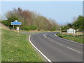
The main recorded barrow was a Neolithic round barrow excavated by Trechmann in 1911. It was on a drumlin below the 150m contour north of and near the B1404 road, 10 m across and 0.9 metres high. Forty years later, in 1952, a farm labourer indicated what he said was the site to the Ordnance Survey, at NZ37635024. It was then recorded to be 14 metres across and 0.6 metres high.
In 1974, Young described it as a grass mound in an arable field, 20.6 metres across and 0.56 metres high. In 1978, the whole site had been ploughed, only a slight rise remaining. In 2012, the whole site is a grass field and the mound is only discernable from the grid reference. There is a small crop mark at the grid reference. Discrepancies in the dimensions may be due to the gradual smoothing of the site and blurring of the barrow/drumlin boundary as the site was increasingly ploughed.
Two or three large boulders on the north-west side, one apparently dressed, were suggested to represent the remnants of a kerb or cover stone. Trechmann's account of the burials is rather brief. The first bones were slightly south east of the centre of the mound. A second set of bones was found immediately south of the centre. All were unburnt and in a very friable condition. They had been disturbed and the stones had been roughly thrown in upon them again. Those found to the south-east were apparently partly within a shallow hole dug in the original surface level. The bones were identified as the remains of a young 18-25 adult and a child under 6. Two flint cores were found close to the bones. Beneath the mound on its south eastern side were some worked flints plus a fragment of a polished greenstone axe. Within the mound, and about 90 cms from its southern edge, was a cache of flints including 2 leaf-shaped arrowheads, a leaf point knife or spearhead and a fragment of undecorated pottery.
2
“West Knoll” or “Knoll A”, tree-crowned drumlin at NZ37275022. Both number 2 and number 3 here are NZ35 SE Number 4 in Roger Miket and either or neither could be Tyne and Wear HER 254.
Number 2 is about 80 m across and 5 m high, with mature trees. It is a strong feature of the landscape. No obvious signs of burials or excavation.
3
“East Knoll” or “Knoll B”, tree-crowned drumlin at NZ37535026
This is about 90 m across and 6 m high with mature trees. It is a strong feature of the landscape. No obvious signs of burials, but some signs of excavation.
2 and 3
This is the area of most confusion. In 1877 the antiquarian Greenwell noted that "three barrows remained unopened”. In 1911 the largest was excavated by Trechmann, who noted two smaller conical mounds of natural glacial deposit covered with trees. This is puzzling, since the Trechmann excavation (Number 1) was a smaller mound than the two tree covered drumlins that remain now (2 and 3). Was he referring to features that no longer exist, or was smaller a misprint?
Greenwell excavated a cist in the middle of the 19th century, with no recorded details, sometimes said to be Number 3, but if it was, then this would contradict his statement in 1877, that three mounds remained unexcavated.
I think the best explanation is that there probably other mounds, which have been ploughed away without being properly recorded.
4
NZ35 SE Number 5 in Roger Miket
Tyne and Wear HER 256 and 447
In 1979 an urned cremation was discovered at NZ372505 in the quarry at Warden Law. It had originally been buried in a short cist covered by a barrow with a longitudinal axis approximately north-south and measuring a minimum of 11 metres long and 1.10 metres high. The cist was formed by six split-sandstone slabs, placed at right angles to each other, making a small, stone box, 300 mm square. The base of the box rested directly on the glacial till. It was completely sealed by a mound of earth to a height of 600 mm, indicating that the cist was not introduced into a pre-existing mound. It is possible that other burials may have been present before quarrying damaged the burial mound. The urn is of an unusual form in a red-brown gritted fabric, fractured but complete, and is 215 mm high, with a rim diameter of 231 mm. The internal rim bevel is decorated with oblique incisions, and the external also with short oblique slashes, below which longer incisions descend almost to the base. The cremated remains of child aged 3-6 were present. The finds are in Sunderland Museum. The urn is illustrated in Roger Miket.
5
Tyne and Wear HER 485
A possible enclosure south of the two tree-covered mounds of Warden Law, visible as a crop mark on aerial photographs. NZ376500 . Still visible in 2012.
6
NZ35 SE Number 6 in Roger Miket
Tyne and Wear HER 257
National Monuments Record 26362
Flint chips, flakes etc found in gravel under turf and in circle on the E top of Warden Law Hill at 194 m, NZ370505. "Dr Woolacott many years ago collected microliths from Warden Law..."
There are various reports of flints being found on Warden Law, but no good descriptions of the material. Some may be in the Craven Museum at Skipton. The site is a go-kart track in 2012.
You may be viewing yesterday's version of this page. To see the most up to date information please register for a free account.
")
")
Do not use the above information on other web sites or publications without permission of the contributor.
Nearby Images from Geograph Britain and Ireland:
©2007(licence)
©2012(licence)
©2019(licence)
©2019(licence)
©2015(licence)
The above images may not be of the site on this page, they are loaded from Geograph.
Please Submit an Image of this site or go out and take one for us!
Click here to see more info for this site
Nearby sites
Key: Red: member's photo, Blue: 3rd party photo, Yellow: other image, Green: no photo - please go there and take one, Grey: site destroyed
Download sites to:
KML (Google Earth)
GPX (GPS waypoints)
CSV (Garmin/Navman)
CSV (Excel)
To unlock full downloads you need to sign up as a Contributory Member. Otherwise downloads are limited to 50 sites.
Turn off the page maps and other distractions
Nearby sites listing. In the following links * = Image available
2.5km WSW 247° Copt Hill* Cairn (NZ353492)
3.3km SW 222° Fairies Cradle* Round Barrow(s) (NZ35374771)
3.4km W 264° St Michael and All Angels (Houghton-le-Spring)* Burial Chamber or Dolmen (NZ342498)
4.0km NNW 329° Offerton Cursus Cursus (NZ355536)
4.2km NE 35° Ryhope Caves* Cave or Rock Shelter (NZ39985366)
4.2km S 172° Croup Hill Barrows, Murton Round Barrow(s) (NZ382460)
4.3km NNW 333° Offerton Cursus Cursus (NZ356540)
4.5km NNE 20° Tunstall Hills* Cist (NZ39145448)
4.8km NNW 332° Hasting Hill* Round Barrow(s) (NZ353544)
5.2km SE 145° Batter Law Round Barrow(s) (NZ406460)
5.2km SE 145° Batter Law Tumulus* Round Barrow(s) (NZ40604599)
6.7km ESE 122° Hawthorn Barrow* Round Barrow(s) (NZ433467)
7.0km NNE 19° Sunderland Museum and Winter Gardens* Museum (NZ398568)
7.7km WNW 298° Fatfield Barrow* Round Barrow(s) (NZ30735374)
8.0km NNE 19° St Peter's Church (Monkwearmouth)* Early Christian Sculptured Stone (NZ4016857783)
9.0km WSW 237° Woodwell House Ancient Village or Settlement (NZ30074531)
9.4km SSE 157° .Lows Hill Round Barrow(s) (NZ413415)
10.1km WNW 288° North Lodge Cursus Cursus (NZ280533)
10.1km W 277° The Anker's House* Ancient Cross (NZ27575131)
12.0km NW 308° Sheddons Hill and Spring* Holy Well or Sacred Spring (NZ28125755)
12.6km SW 228° Maiden Castle (Durham)* Promontory Fort / Cliff Castle (NZ283417)
12.6km S 178° Old Wingate Round Barrow* Round Barrow(s) (NZ3815937568)
12.8km S 178° Old Wingate Long Barrow* Long Barrow (NZ38143745)
13.0km SW 233° St Cuthbert's Well (County Durham)* Holy Well or Sacred Spring (NZ2727642218)
13.0km SW 231° St. Oswald's Well* Holy Well or Sacred Spring (NZ27524190)
View more nearby sites and additional images


 We would like to know more about this location. Please feel free to add a brief description and any relevant information in your own language.
 Wir möchten mehr über diese Stätte erfahren. Bitte zögern Sie nicht, eine kurze Beschreibung und relevante Informationen in Deutsch hinzuzufügen.
 Nous aimerions en savoir encore un peu sur les lieux. S'il vous plaît n'hesitez pas à ajouter une courte description et tous les renseignements pertinents dans votre propre langue.
 Quisieramos informarnos un poco más de las lugares. No dude en añadir una breve descripción y otros datos relevantes en su propio idioma.