<< Our Photo Pages >> King's Weston Hill stockpound - Misc. Earthwork in England in Gloucestershire
Submitted by theCaptain on Friday, 13 April 2012 Page Views: 2901
Multi-periodSite Name: King's Weston Hill stockpoundCountry: England County: Gloucestershire Type: Misc. Earthwork
Nearest Town: Bristol Nearest Village: Coombe Dingle
Map Ref: ST55417807
Latitude: 51.499798N Longitude: 2.643763W
Condition:
| 5 | Perfect |
| 4 | Almost Perfect |
| 3 | Reasonable but with some damage |
| 2 | Ruined but still recognisable as an ancient site |
| 1 | Pretty much destroyed, possibly visible as crop marks |
| 0 | No data. |
| -1 | Completely destroyed |
| 5 | Superb |
| 4 | Good |
| 3 | Ordinary |
| 2 | Not Good |
| 1 | Awful |
| 0 | No data. |
| 5 | Can be driven to, probably with disabled access |
| 4 | Short walk on a footpath |
| 3 | Requiring a bit more of a walk |
| 2 | A long walk |
| 1 | In the middle of nowhere, a nightmare to find |
| 0 | No data. |
| 5 | co-ordinates taken by GPS or official recorded co-ordinates |
| 4 | co-ordinates scaled from a detailed map |
| 3 | co-ordinates scaled from a bad map |
| 2 | co-ordinates of the nearest village |
| 1 | co-ordinates of the nearest town |
| 0 | no data |
Internal Links:
External Links:
I have visited· I would like to visit
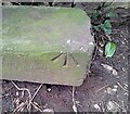
TheCaptain visited on 29th Aug 2011 - their rating: Cond: 2 Amb: 3 Access: 4 A few hundred metres west along the hilltop ridge from the Kings Weston Hillfort can be seen the remains of a large circular earthwork, of unsure date. People have been living and working on this hilltop ridge since neolithic times, and it is thought that this earthwork is some sort of stockpound dating from perhaps bronze or iron age times. It is a very pleasant spot up on this hilltop, surrounded by the northwestern suburbs of Bristol, but you would hardly know it, and can easily get taken back in time while up here.
lboutside visited - their rating: Cond: 3 Amb: 3 Access: 3
Average ratings for this site from all visit loggers: Condition: 2.5 Ambience: 3 Access: 3.5
")
People have been living and working on this hilltop ridge since neolithic times, and it is thought that this earthwork is some sort of stockpound dating from perhaps bronze or iron age times.
It is a very pleasant spot up on this hilltop, surrounded by the northwestern suburbs of Bristol, but you would hardly know it, and can easily get taken back in time while up here.
You may be viewing yesterday's version of this page. To see the most up to date information please register for a free account.
")
")
Do not use the above information on other web sites or publications without permission of the contributor.
Nearby Images from Geograph Britain and Ireland:
©2020(licence)
©2008(licence)
©2010(licence)
©2020(licence)
©2024(licence)
The above images may not be of the site on this page, they are loaded from Geograph.
Please Submit an Image of this site or go out and take one for us!
Click here to see more info for this site
Nearby sites
Key: Red: member's photo, Blue: 3rd party photo, Yellow: other image, Green: no photo - please go there and take one, Grey: site destroyed
Download sites to:
KML (Google Earth)
GPX (GPS waypoints)
CSV (Garmin/Navman)
CSV (Excel)
To unlock full downloads you need to sign up as a Contributory Member. Otherwise downloads are limited to 50 sites.
Turn off the page maps and other distractions
Nearby sites listing. In the following links * = Image available
189m ENE 71° King's Weston Hillfort* Hillfort (ST55597813)
321m WSW 244° King's Weston Hill barrow cemetary* Barrow Cemetery (ST55127793)
532m NE 55° Blaise Castle* Hillfort (ST55857837)
2.0km SSE 159° Druid Stoke* Chambered Tomb (ST56107620)
2.5km E 93° Southmead Barrow* Round Barrow(s) (ST5794477902)
4.0km SE 141° Redland Park* Standing Stone (Menhir) (ST57947492)
4.2km SSW 193° Abbots Leigh Churchyard Cross* Ancient Cross (ST5445274007)
4.8km NE 53° Highwood Road Modern Menhir* Modern Stone Circle etc (ST5928080878)
4.8km S 172° Stokeleigh Camp* Promontory Fort / Cliff Castle (ST560733)
4.9km SSE 166° Clifton Down Camp* Hillfort (ST56587329)
5.1km S 171° Burwalls Camp* Promontory Fort / Cliff Castle (ST562730)
5.4km SSW 203° Snake's Well and Spring* Holy Well or Sacred Spring (ST53287308)
5.5km SSE 151° Bristol City Museum* Museum (ST58057321)
5.8km WSW 242° Portbury* Standing Stone (Menhir) (ST50277538)
5.9km E 97° Stoke Park Long Barrow* Long Barrow (ST6132077294)
6.3km WSW 241° Conygar Hillfort Hillfort (ST49897509)
6.4km SE 130° Armoury Square Standing Stone (Menhir) (ST60287386)
6.7km NE 38° Knole Park Camp* Hillfort (ST59638334)
7.0km SSW 208° Wraxall Camp* Ancient Village or Settlement (ST52057193)
7.2km S 180° Long Ashton Cross* Ancient Cross (ST5539070910)
8.0km E 98° Oldbury Court Camp Ancient Village or Settlement (ST633769)
8.3km W 265° Eastwood Fort, Portishead* Hillfort (ST47157745)
8.5km W 264° West Hill Fort, Portishead* Hillfort (ST46967726)
8.7km SE 129° St Ann's Well (Brislington)* Holy Well or Sacred Spring (ST6217472515)
8.8km SW 226° Wraxhall Churchyard Cross* Ancient Cross (ST4902371945)
View more nearby sites and additional images


 We would like to know more about this location. Please feel free to add a brief description and any relevant information in your own language.
 Wir möchten mehr über diese Stätte erfahren. Bitte zögern Sie nicht, eine kurze Beschreibung und relevante Informationen in Deutsch hinzuzufügen.
 Nous aimerions en savoir encore un peu sur les lieux. S'il vous plaît n'hesitez pas à ajouter une courte description et tous les renseignements pertinents dans votre propre langue.
 Quisieramos informarnos un poco más de las lugares. No dude en añadir una breve descripción y otros datos relevantes en su propio idioma.