

<< Our Photo Pages >> Mapledurwell Bowl Barrow - Round Barrow(s) in England in Hampshire
Submitted by SolarMegalith on Sunday, 13 February 2011 Page Views: 5785
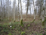
Neolithic and Bronze AgeSite Name: Mapledurwell Bowl BarrowCountry: England County: Hampshire Type: Round Barrow(s)
Nearest Town: Basingstoke
Map Ref: SU691521
Latitude: 51.263878N Longitude: 1.011017W
Condition:
| 5 | Perfect |
| 4 | Almost Perfect |
| 3 | Reasonable but with some damage |
| 2 | Ruined but still recognisable as an ancient site |
| 1 | Pretty much destroyed, possibly visible as crop marks |
| 0 | No data. |
| -1 | Completely destroyed |
| 5 | Superb |
| 4 | Good |
| 3 | Ordinary |
| 2 | Not Good |
| 1 | Awful |
| 0 | No data. |
| 5 | Can be driven to, probably with disabled access |
| 4 | Short walk on a footpath |
| 3 | Requiring a bit more of a walk |
| 2 | A long walk |
| 1 | In the middle of nowhere, a nightmare to find |
| 0 | No data. |
| 5 | co-ordinates taken by GPS or official recorded co-ordinates |
| 4 | co-ordinates scaled from a detailed map |
| 3 | co-ordinates scaled from a bad map |
| 2 | co-ordinates of the nearest village |
| 1 | co-ordinates of the nearest town |
| 0 | no data |
Internal Links:
External Links:
I have visited· I would like to visit
SolarMegalith visited on 13th Feb 2011 - their rating: Cond: 4 Amb: 3 Access: 4
")
The site has produced some artefacts, mainly flint flakes - the finds can be seen in Basingstoke.
The landowner is a very kind person and let me visit the site without hesitation, so don't dash into his property without letting him know, just ask for permission.
You may be viewing yesterday's version of this page. To see the most up to date information please register for a free account.
")
")
")
Do not use the above information on other web sites or publications without permission of the contributor.
Nearby sites
Download sites to:
KML (Google Earth)
GPX (GPS waypoints)
CSV (Garmin/Navman)
CSV (Excel)
To unlock full downloads you need to sign up as a Contributory Member. Otherwise downloads are limited to 50 sites.
Nearby sites listing. In the following links * = Image available
4.0km WSW 246° Hackwood Park Barrows* Round Barrow(s) (SU6543050410)
6.6km NNW 343° Bullsdown Camp* Hillfort (SU67085838)
7.8km W 276° Winklebury Camp (Hampshire)* Hillfort (SU613528)
8.1km W 259° Basingstoke Cursus Cursus (SU611505)
8.9km SE 139° Sheephouse Copse* Round Barrow(s) (SU751455)
11.1km NE 41° Cudbury Clump Barrow* Round Barrow(s) (SU76216058)
11.5km NNW 333° Calleva Atrebatum* Ancient Village or Settlement (SU638623)
11.5km WNW 299° Ramsdell Modern Stone Circle* Modern Stone Circle etc (SU5891457590)
11.6km SSE 160° Holybourne* Holy Well or Sacred Spring (SU732412)
12.2km SSE 149° Binsted Holy Well* Holy Well or Sacred Spring (SU755417)
12.4km NE 46° Eversley Church Sarsen Stone* Natural Stone / Erratic / Other Natural Feature (SU7791060924)
12.7km NNW 331° The Frith (Hampshire)* Hillfort (SU62686308)
12.9km NNW 327° Aldermaston Enclosure* Misc. Earthwork (SU6197062917)
13.3km ESE 103° Heath Brow Barrows* Barrow Cemetery (SU82184937)
13.4km SE 139° Binsted Cursus Cursus (SU7842)
13.8km NNW 341° Holden's Firs* Barrow Cemetery (SU64366506)
14.5km E 99° Caesar's Camp (Hampshire)* Hillfort (SU835501)
14.8km WSW 252° St Nicholas (Steventon) Ancient Cross (SU55104722)
15.1km ENE 64° Ancient field boundaries near Blackwater Misc. Earthwork (SU8257058911)
15.3km ENE 65° Hornley Common* Round Barrow(s) (SU8291758669)
15.4km NNW 337° Raven Hill* Promontory Fort / Cliff Castle (SU62876615)
15.5km NW 314° Borson Barrows* Barrow Cemetery (SU57756265)
15.5km ENE 65° Round Barrow near Blackwater Round Barrow(s) (SU8310158871)
15.5km NNW 340° Ufton Nervet Bell Barrow* Round Barrow(s) (SU6356266625)
15.5km E 93° Bat's Hogsty* Misc. Earthwork (SU84685152)


 We would like to know more about this location. Please feel free to add a brief description and any relevant information in your own language.
 Wir möchten mehr über diese Stätte erfahren. Bitte zögern Sie nicht, eine kurze Beschreibung und relevante Informationen in Deutsch hinzuzufügen.
 Nous aimerions en savoir encore un peu sur les lieux. S'il vous plaît n'hesitez pas à ajouter une courte description et tous les renseignements pertinents dans votre propre langue.
 Quisieramos informarnos un poco más de las lugares. No dude en añadir una breve descripción y otros datos relevantes en su propio idioma.