<< Text Pages >> Warren Hill Bowl Barrow - Round Barrow(s) in England in Dorset
Submitted by coldrum on Monday, 30 August 2010 Page Views: 2701
Neolithic and Bronze AgeSite Name: Warren Hill Bowl BarrowCountry: England County: Dorset Type: Round Barrow(s)
Map Ref: SZ17199069
Latitude: 50.715589N Longitude: 1.757879W
Condition:
| 5 | Perfect |
| 4 | Almost Perfect |
| 3 | Reasonable but with some damage |
| 2 | Ruined but still recognisable as an ancient site |
| 1 | Pretty much destroyed, possibly visible as crop marks |
| 0 | No data. |
| -1 | Completely destroyed |
| 5 | Superb |
| 4 | Good |
| 3 | Ordinary |
| 2 | Not Good |
| 1 | Awful |
| 0 | No data. |
| 5 | Can be driven to, probably with disabled access |
| 4 | Short walk on a footpath |
| 3 | Requiring a bit more of a walk |
| 2 | A long walk |
| 1 | In the middle of nowhere, a nightmare to find |
| 0 | No data. |
| 5 | co-ordinates taken by GPS or official recorded co-ordinates |
| 4 | co-ordinates scaled from a detailed map |
| 3 | co-ordinates scaled from a bad map |
| 2 | co-ordinates of the nearest village |
| 1 | co-ordinates of the nearest town |
| 0 | no data |
Be the first person to rate this site - see the 'Contribute!' box in the right hand menu.
Internal Links:
External Links:
Round Barrow(s) in Dorset
From Pastscape:
"Site of a Bronze Age bowl barrow. It was excavated in 1911-12 by Bushe-Fox, who found potsherds, including some of collared urns, and a quantity of worked flints, some of them Mesolithic in date. No certain burial deposit was located, although it was suggested that some charcoal deposits might represent secondary burials. Ordnance Survey field investigation in 1954 described the barrow as an earthwork mound 10 metres in diameter and 1 metre high."
Pastscape
You may be viewing yesterday's version of this page. To see the most up to date information please register for a free account.
Do not use the above information on other web sites or publications without permission of the contributor.
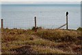
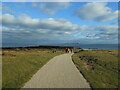
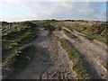
Nearby Images from Geograph Britain and Ireland:
©2008(licence)

©2007(licence)
©2021(licence)
©2007(licence)
©2007(licence)
The above images may not be of the site on this page, they are loaded from Geograph.
Please Submit an Image of this site or go out and take one for us!
Click here to see more info for this site
Nearby sites
Key: Red: member's photo, Blue: 3rd party photo, Yellow: other image, Green: no photo - please go there and take one, Grey: site destroyed
Download sites to:
KML (Google Earth)
GPX (GPS waypoints)
CSV (Garmin/Navman)
CSV (Excel)
To unlock full downloads you need to sign up as a Contributory Member. Otherwise downloads are limited to 50 sites.
Turn off the page maps and other distractions
Nearby sites listing. In the following links * = Image available
70m E 90° Warren Hill Round Barrow 1 Round Barrow(s) (SZ17269069)
150m W 269° Warren Hill Round Barrow 2* Round Barrow(s) (SZ1704090688)
419m ESE 103° Hengistbury Head* Promontory Fort / Cliff Castle (SZ176906)
675m WNW 299° Double Dykes Bowl Barrow* Round Barrow(s) (SZ16609102)
2.3km NW 326° The Red House Museum* Museum (SZ1588292577)
2.9km NE 43° Friars Cliff Tumulus* Round Barrow(s) (SZ1917492825)
5.6km NNW 329° St Catherine's Hill (Christchurch)* Barrow Cemetery (SZ143955)
6.3km NNW 347° St Michael's Well (Sopley)* Holy Well or Sacred Spring (SZ1573596865)
6.8km NW 305° Holdenhurst Long Barrow* Long Barrow (SZ116946)
7.4km NNW 328° Ramsdown Plantation / Sopley Common* Round Barrow(s) (SZ132969)
7.6km NNW 329° Sopley Common Tumulus* Round Barrow(s) (SZ132972)
9.4km NNE 16° All Saints Well* Holy Well or Sacred Spring (SZ197997)
9.4km WNW 282° Robin Hood's Barrow (Bournemouth) Round Barrow(s) (SZ07939256)
9.9km NNW 331° Hurn Forest Barrow* Round Barrow(s) (SZ123993)
10.4km N 10° Lugden Barrow* Round Barrow(s) (SU18920091)
10.4km WNW 283° Talbot Heath Misc. Earthwork (SZ070930)
10.4km W 281° Fern Barrow* Round Barrow(s) (SZ069926)
11.8km WNW 297° Two Barrow Heath Barrow Cemetery (SZ0663495924)
11.8km NW 314° Ralph's Barrow* Round Barrow(s) (SZ086988)
11.9km NW 307° Dudsbury Camp* Hillfort (SZ077979)
12.0km WNW 288° Poole Timber Circle Timber Circle (SZ057944)
12.2km NNW 339° Barnsfield Heath (North)* Round Barrow(s) (SU127020)
12.2km NW 311° Parley Barrow* Round Barrow(s) (SZ07909865)
12.3km W 277° Parkstone Standing Stone (Menhir) (SZ050922)
12.6km NW 323° Trickett's Cross Barrow* Round Barrow(s) (SU095007)
View more nearby sites and additional images


 We would like to know more about this location. Please feel free to add a brief description and any relevant information in your own language.
 Wir möchten mehr über diese Stätte erfahren. Bitte zögern Sie nicht, eine kurze Beschreibung und relevante Informationen in Deutsch hinzuzufügen.
 Nous aimerions en savoir encore un peu sur les lieux. S'il vous plaît n'hesitez pas à ajouter une courte description et tous les renseignements pertinents dans votre propre langue.
 Quisieramos informarnos un poco más de las lugares. No dude en añadir una breve descripción y otros datos relevantes en su propio idioma.