


<< Our Photo Pages >> Caerau Gaer - Hillfort in Wales in Pembrokeshire
Submitted by pab on Sunday, 25 April 2010 Page Views: 5466
Iron Age and Later PrehistorySite Name: Caerau GaerCountry: Wales County: Pembrokeshire Type: Hillfort
Nearest Town: Narberth Nearest Village: Llanddewi Velfrey
Map Ref: SN14001609
Latitude: 51.812413N Longitude: 4.69967W
Condition:
| 5 | Perfect |
| 4 | Almost Perfect |
| 3 | Reasonable but with some damage |
| 2 | Ruined but still recognisable as an ancient site |
| 1 | Pretty much destroyed, possibly visible as crop marks |
| 0 | No data. |
| -1 | Completely destroyed |
| 5 | Superb |
| 4 | Good |
| 3 | Ordinary |
| 2 | Not Good |
| 1 | Awful |
| 0 | No data. |
| 5 | Can be driven to, probably with disabled access |
| 4 | Short walk on a footpath |
| 3 | Requiring a bit more of a walk |
| 2 | A long walk |
| 1 | In the middle of nowhere, a nightmare to find |
| 0 | No data. |
| 5 | co-ordinates taken by GPS or official recorded co-ordinates |
| 4 | co-ordinates scaled from a detailed map |
| 3 | co-ordinates scaled from a bad map |
| 2 | co-ordinates of the nearest village |
| 1 | co-ordinates of the nearest town |
| 0 | no data |
Internal Links:
External Links:
I have visited· I would like to visit
PAB has visited here
")
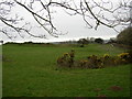
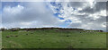
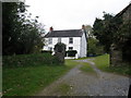
Caerau Gaer, a hillfort commanding wonderful overview north towards the Precelli Mountains, as well as south over the Afon (River) Marlais valley.
The site is only 200 metres from Llanddewi Gaer (for which there is a separate Portal entry) and the aerial photo on the RCAHMW site for the adjacent Llanddewi Gaer shows them both to greatest advantage.
The COFLEIN entry is rather disparaging and less convinced of the iron age venerability of this part of the site - shame really for this wonderful place to be 'dammed with faint praise' when it deserves more respect!
You may be viewing yesterday's version of this page. To see the most up to date information please register for a free account.
")
")
Do not use the above information on other web sites or publications without permission of the contributor.
Nearby Images from Geograph Britain and Ireland:
©2005(licence)
©2021(licence)
©2021(licence)
©2013(licence)
©2008(licence)
The above images may not be of the site on this page, they are loaded from Geograph.
Please Submit an Image of this site or go out and take one for us!
Click here to see more info for this site
Nearby sites
Key: Red: member's photo, Blue: 3rd party photo, Yellow: other image, Green: no photo - please go there and take one, Grey: site destroyed
Download sites to:
KML (Google Earth)
GPX (GPS waypoints)
CSV (Garmin/Navman)
CSV (Excel)
To unlock full downloads you need to sign up as a Contributory Member. Otherwise downloads are limited to 50 sites.
Turn off the page maps and other distractions
Nearby sites listing. In the following links * = Image available
409m E 101° Llanddewigaer* Hillfort (SN144160)
695m SW 229° Ffynnon Dewi (Llanddewi Velfrey) Holy Well or Sacred Spring (SN13461565)
2.2km SSE 159° Llan Chambered Tomb* Chambered Tomb (SN147140)
2.5km NNE 16° Triangle of stones near Llanddewi Velfrey* Modern Stone Circle etc (SN1477418468)
4.5km NE 52° St Canna's Stone (Llangan)* Natural Stone / Erratic / Other Natural Feature (SN17701874)
4.8km SSE 163° Belle Vue* Standing Stone (Menhir) (SN15211146)
5.0km SSE 158° Newhouse Barrows* Barrow Cemetery (SN15711141)
5.1km SSW 212° St Margaret's Well (Pembrokeshire)* Holy Well or Sacred Spring (SN11101186)
5.3km SE 133° Crug Swllt* Round Barrow(s) (SN17711231)
5.3km SSW 208° Templeton Cross* Early Christian Sculptured Stone (SN1131011528)
5.3km NNW 342° Llandissilio Cursus Cursus (SN12552120)
5.3km NE 43° Henllan Amgoed Inscribed Stone* Standing Stone (Menhir) (SN1776719862)
5.8km NNW 336° Llandissilio Cursus Cursus (SN11852146)
6.2km SSE 169° Longstone Camp* Hillfort (SN14990996)
6.7km S 173° The Longstone (Pembrokeshire)* Standing Stone (Menhir) (SN146094)
7.1km NW 320° Brechfa South Ancient Village or Settlement (SN0962821643)
7.4km WSW 251° Foel Eryr Hut Circle* Ancient Village or Settlement (SN069139)
7.7km SE 134° Parc-y-Twmp* Round Barrow(s) (SN19341051)
7.8km NW 322° Brechfa Ancient Village or Settlement (SN0943322461)
8.2km NW 325° Rhiwiau Round Barrow Round Barrow(s) (SN09562300)
8.8km WSW 242° Cott Lane* Modern Stone Circle etc (SN0610312254)
8.8km NE 37° Cefn Brafle* Chambered Tomb (SN196229)
8.8km NE 37° Crosshands* Standing Stones (SN196229)
9.2km N 353° Maen Pica Stone* Standing Stone (Menhir) (SN13172524)
9.3km N 357° Capel Nebo Stone* Standing Stone (Menhir) (SN13852541)
View more nearby sites and additional images

")
 We would like to know more about this location. Please feel free to add a brief description and any relevant information in your own language.
 Wir möchten mehr über diese Stätte erfahren. Bitte zögern Sie nicht, eine kurze Beschreibung und relevante Informationen in Deutsch hinzuzufügen.
 Nous aimerions en savoir encore un peu sur les lieux. S'il vous plaît n'hesitez pas à ajouter une courte description et tous les renseignements pertinents dans votre propre langue.
 Quisieramos informarnos un poco más de las lugares. No dude en añadir una breve descripción y otros datos relevantes en su propio idioma.