


<< Our Photo Pages >> Bolarein - Carving in Norway in Nord-Trøndelag
Submitted by DrewParsons on Monday, 20 October 2008 Page Views: 7847
Multi-periodSite Name: Bolarein Alternative Name: Bøla Rock Art SiteCountry: Norway Fylke: Nord-Trøndelag Type: Carving
Nearest Town: Steinkjer Nearest Village: Bolabua
Latitude: 64.140000N Longitude: 11.910000E
Condition:
| 5 | Perfect |
| 4 | Almost Perfect |
| 3 | Reasonable but with some damage |
| 2 | Ruined but still recognisable as an ancient site |
| 1 | Pretty much destroyed, possibly visible as crop marks |
| 0 | No data. |
| -1 | Completely destroyed |
| 5 | Superb |
| 4 | Good |
| 3 | Ordinary |
| 2 | Not Good |
| 1 | Awful |
| 0 | No data. |
| 5 | Can be driven to, probably with disabled access |
| 4 | Short walk on a footpath |
| 3 | Requiring a bit more of a walk |
| 2 | A long walk |
| 1 | In the middle of nowhere, a nightmare to find |
| 0 | No data. |
| 5 | co-ordinates taken by GPS or official recorded co-ordinates |
| 4 | co-ordinates scaled from a detailed map |
| 3 | co-ordinates scaled from a bad map |
| 2 | co-ordinates of the nearest village |
| 1 | co-ordinates of the nearest town |
| 0 | no data |
Internal Links:
External Links:
I have visited· I would like to visit
DrewParsons has visited here
")
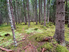
The Bolarein is a magnificent rock carving of a reindeer dated between 5000 and 6000 years ago. Located a signposted short walk from Road Rv763 on the south eastern side of Lake Snasavatnet at Bolabua half way down the lake. The carving is a magnificent work of art 1.75 metres long and 1.3 metres high. Photographed in September 2003
You may be viewing yesterday's version of this page. To see the most up to date information please register for a free account.
")
Do not use the above information on other web sites or publications without permission of the contributor.
Nearby Images from Flickr

The above images may not be of the site on this page, but were taken nearby. They are loaded from Flickr so please click on them for image credits.
Click here to see more info for this site
Nearby sites
Click here to view sites on an interactive map of the areaKey: Red: member's photo, Blue: 3rd party photo, Yellow: other image, Green: no photo - please go there and take one, Grey: site destroyed
Download sites to:
KML (Google Earth)
GPX (GPS waypoints)
CSV (Garmin/Navman)
CSV (Excel)
To unlock full downloads you need to sign up as a Contributory Member. Otherwise downloads are limited to 50 sites.
Turn off the page maps and other distractions
Nearby sites listing. In the following links * = Image available
5.6km N 9° Kjerkol Hillfort* Hillfort
9.9km W 266° Haugan-Søndre* Round Barrow(s)
10.3km W 271° Gudin-Østre* Standing Stone (Menhir)
13.3km SW 236° For Standing Stone* Standing Stone (Menhir)
14.6km WSW 237° Fornes standing stone* Standing Stone (Menhir)
16.1km ENE 66° Åneshaugen-Jørstad* Barrow Cemetery
17.5km ENE 66° Jørstad* Round Barrow(s)
17.7km SW 233° Øyster-Råde* Round Barrow(s)
18.1km SW 219° Brandsegg Nordre* Cairn
18.6km SW 226° Øysterskei Nordre* Cairn
19.6km SW 225° Risberg* Round Barrow(s)
20.4km ENE 67° Mediås* Round Barrow(s)
21.2km SW 236° Helge Gravfelt* Standing Stones
21.7km SW 232° Vive barrow cemetery* Barrow Cemetery
21.9km SW 225° Søndre Bruem* Round Barrow(s)
22.3km SW 235° Midjo* Round Barrow(s)
22.4km SW 217° Bjerkem* Round Barrow(s)
22.6km SW 222° Røliveien-Strugstad* Round Barrow(s)
22.9km SW 219° Sør-Rølivegen* Cairn
23.9km WSW 245° Gjevranmarka Gravfelt* Barrow Cemetery
24.1km WSW 238° Tingvoll Stone Setting* Stone Circle
24.2km WSW 239° Egge East Olvisheim Stone Row / Alignment
24.3km WSW 239° Olvisheim Stone Rings* Stone Row / Alignment
24.3km WSW 247° Gjevranslottet* Hillfort
24.3km SW 231° Tranaskogvegen* Barrow Cemetery
View more nearby sites and additional images


 We would like to know more about this location. Please feel free to add a brief description and any relevant information in your own language.
 Wir möchten mehr über diese Stätte erfahren. Bitte zögern Sie nicht, eine kurze Beschreibung und relevante Informationen in Deutsch hinzuzufügen.
 Nous aimerions en savoir encore un peu sur les lieux. S'il vous plaît n'hesitez pas à ajouter une courte description et tous les renseignements pertinents dans votre propre langue.
 Quisieramos informarnos un poco más de las lugares. No dude en añadir una breve descripción y otros datos relevantes en su propio idioma.