

<< Text Pages >> Karakoleta Dolmen - Burial Chamber or Dolmen in Spain in Navarra
Submitted by AlexHunger on Monday, 22 September 2008 Page Views: 898
Neolithic and Bronze AgeSite Name: Karakoleta DolmenCountry: Spain Region: Navarra Type: Burial Chamber or Dolmen
Nearest Town: Baztan Nearest Village: Berastegi
Latitude: 43.097974N Longitude: 1.934084W
Condition:
| 5 | Perfect |
| 4 | Almost Perfect |
| 3 | Reasonable but with some damage |
| 2 | Ruined but still recognisable as an ancient site |
| 1 | Pretty much destroyed, possibly visible as crop marks |
| 0 | No data. |
| -1 | Completely destroyed |
| 5 | Superb |
| 4 | Good |
| 3 | Ordinary |
| 2 | Not Good |
| 1 | Awful |
| 0 | No data. |
| 5 | Can be driven to, probably with disabled access |
| 4 | Short walk on a footpath |
| 3 | Requiring a bit more of a walk |
| 2 | A long walk |
| 1 | In the middle of nowhere, a nightmare to find |
| 0 | No data. |
| 5 | co-ordinates taken by GPS or official recorded co-ordinates |
| 4 | co-ordinates scaled from a detailed map |
| 3 | co-ordinates scaled from a bad map |
| 2 | co-ordinates of the nearest village |
| 1 | co-ordinates of the nearest town |
| 0 | no data |
Be the first person to rate this site - see the 'Contribute!' box in the right hand menu.
Internal Links:
External Links:
Burial Chamber (Dolmen) in Community of Urepel - Baztarl
Have you visited this site? Please add a comment below.
You may be viewing yesterday's version of this page. To see the most up to date information please register for a free account.
Do not use the above information on other web sites or publications without permission of the contributor.
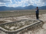
Nearby Images from Flickr
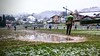

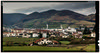
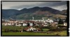

The above images may not be of the site on this page, but were taken nearby. They are loaded from Flickr so please click on them for image credits.
Click here to see more info for this site
Nearby sites
Click here to view sites on an interactive map of the areaKey: Red: member's photo, Blue: 3rd party photo, Yellow: other image, Green: no photo - please go there and take one, Grey: site destroyed
Download sites to:
KML (Google Earth)
GPX (GPS waypoints)
CSV (Garmin/Navman)
CSV (Excel)
To unlock full downloads you need to sign up as a Contributory Member. Otherwise downloads are limited to 50 sites.
Turn off the page maps and other distractions
Nearby sites listing. In the following links * = Image available
150m W 265° Txara Túmulo Round Barrow(s)
169m NNE 20° Iruso Menhir Standing Stone (Menhir)
230m ENE 61° Iruso Dolmen 2 Burial Chamber or Dolmen
279m WSW 255° Txara Dolmen Burial Chamber or Dolmen
280m NE 42° Iruso Dolmen 1 Burial Chamber or Dolmen
320m E 95° Iruso Dolmen 4 Burial Chamber or Dolmen
331m W 268° Txara Menhir Standing Stone (Menhir)
430m NE 55° Iruso Dolmen 3 Burial Chamber or Dolmen
437m NNE 21° Miztortegieta Túmulo Round Barrow(s)
1.0km E 90° Jentillen Arrobie Dolmen Burial Chamber or Dolmen
1.4km ENE 71° Arramiako Lepoa Dolmen Burial Chamber or Dolmen
1.6km ENE 68° Losarrobieta Dolmen Burial Chamber or Dolmen
2.0km ENE 68° Biuztain Túmulo Round Barrow(s)
2.0km ENE 68° Biuztain Dolmen Burial Chamber or Dolmen
2.2km E 82° Baztarrola Túmulo Round Barrow(s)
4.0km NE 53° Sarasain Bizkar Cromlech* Stone Circle
4.2km ENE 64° Urdola Ipar Chromlech 2 Stone Circle
4.2km ENE 63° Urdola Ipar Chromlech 1* Stone Circle
4.4km NE 36° Bidegorrieta Cromlech Stone Circle
4.6km SSW 213° Mugarri Haundi Dolmen Burial Chamber or Dolmen
4.6km NE 38° Urdola Cromlech 3 Stone Circle
4.6km NE 38° Urdola Cromlech 2 Stone Circle
4.6km NE 38° Urdola Cromlech 1 Stone Circle
4.7km SE 139° Larrezabaleta Menhir Standing Stone (Menhir)
4.7km NW 323° Gorosmendi Trikuharria Burial Chamber or Dolmen
View more nearby sites and additional images


 We would like to know more about this location. Please feel free to add a brief description and any relevant information in your own language.
 Wir möchten mehr über diese Stätte erfahren. Bitte zögern Sie nicht, eine kurze Beschreibung und relevante Informationen in Deutsch hinzuzufügen.
 Nous aimerions en savoir encore un peu sur les lieux. S'il vous plaît n'hesitez pas à ajouter une courte description et tous les renseignements pertinents dans votre propre langue.
 Quisieramos informarnos un poco más de las lugares. No dude en añadir una breve descripción y otros datos relevantes en su propio idioma.