Featured: Current Archaeology Book of the Year 2019!

Current Archaeology Book of the Year 2019!

Avebury Archaeology Map

Avebury Archaeology Map

Who's Online

There are currently, 220 guests and 1 members online.

You are a guest. To join in, please register for free by clicking here

Sponsors

<< Our Photo Pages >> Cnoc Freiceadain - Chambered Cairn in Scotland in Caithness

Submitted by Steveco on Monday, 23 April 2012  Page Views: 10843

Neolithic and Bronze AgeSite Name: Cnoc Freiceadain
Country: Scotland County: Caithness Type: Chambered Cairn
Nearest Town: Thurso  Nearest Village: Shebster
Map Ref: ND0132065415  Landranger Map Number: 11
Latitude: 58.565534N  Longitude: 3.698054W
Condition:
5Perfect
4Almost Perfect
3Reasonable but with some damage
2Ruined but still recognisable as an ancient site
1Pretty much destroyed, possibly visible as crop marks
0No data.
-1Completely destroyed
4 Ambience:
5Superb
4Good
3Ordinary
2Not Good
1Awful
0No data.
3 Access:
5Can be driven to, probably with disabled access
4Short walk on a footpath
3Requiring a bit more of a walk
2A long walk
1In the middle of nowhere, a nightmare to find
0No data.
3 Accuracy:
5co-ordinates taken by GPS or official recorded co-ordinates
4co-ordinates scaled from a detailed map
3co-ordinates scaled from a bad map
2co-ordinates of the nearest village
1co-ordinates of the nearest town
0no data
5

Internal Links:
External Links:

I have visited· I would like to visit

DrewParsons would like to visit

SandyG visited on 1st Jun 2015 - their rating: Cond: 4 Amb: 4 Access: 4

h_fenton have visited here

Cnoc Freiceadain
Cnoc Freiceadain submitted by h_fenton : Cnoc Freiceadain - chambered long horned cairn, dating from the Neolithic. Kite Aerial Photograph taken roughly north. just in cloud shadow a short distance beyond the far end of this cairn is Na Tri Sithean cairn which is slightly larger and better preserved. 10 May 2011 (Vote or comment on this photo)
Chambered long horned cairn and near neighbour Na Tri Sithean both dating from the Neolithic. With a view of 5000 years as well as the Dounray Nulclear Power Station in the background.

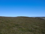
Cnoc Freiceadain is a chambered long horned cairn, dating from the Neolithic. It measures 67m long NE-SW. This cairn forms the site of Cnoc Freiceadain Long Cairns, the other cairn is just under 100 metres away, it is slightly larger and set at right angles to this cairn NW-SE. Between them they occupy the top of the hillside. Both are grassed over with stones sticking out.

This site is cared for by Historic Scotland, there are signposts to the site from the minor road to the east and limited parking on the roadside, from there it is an uphill walk.

Additional text by H Fenton and Cosmic

Note: Neolithic horned cairns and surrounding landscape scanned as part of wind farm development
You may be viewing yesterday's version of this page. To see the most up to date information please register for a free account.


Cnoc Freiceadain
Cnoc Freiceadain submitted by steveco : Cnoc Freiceadain Long Cairns ND012653. A view of 5000 years. Dounray Nulclear Power Station is in the background. (2 comments - Vote or comment on this photo)

Cnoc Freiceadain N
Cnoc Freiceadain N submitted by markj99 : Possible Capstone of Cnoc Freiceadain N Cairn Cist (Vote or comment on this photo)

Cnoc Freiceadain N
Cnoc Freiceadain N submitted by markj99 : Centre of Cnoc Freiceadain N Cairn viewed from W. (Vote or comment on this photo)

Cnoc Freiceadain N
Cnoc Freiceadain N submitted by markj99 : Cnoc Freiceadain N Cairn viewed from W. (Vote or comment on this photo)

Cnoc Freiceadain N
Cnoc Freiceadain N submitted by markj99 : Cnoc Freiceadain N Cairn viewed from S.

Cnoc Freiceadain N
Cnoc Freiceadain N submitted by markj99 : Cnoc Freiceadain N Cairn viewed from E.

Cnoc Freiceadain N
Cnoc Freiceadain N submitted by markj99 : Cnoc Freiceadain N Cairn viewed from N.

Cnoc Freiceadain
Cnoc Freiceadain submitted by SandyG : View from above and south.

Cnoc Freiceadain
Cnoc Freiceadain submitted by SandyG : View from the south east with the cairn on the skyline.

Cnoc Freiceadain
Cnoc Freiceadain submitted by SandyG : The view of the long cairn from the nearby Na Tri Sithean. Orkney provides a dramatic backdrop.

Cnoc Freiceadain
Cnoc Freiceadain submitted by SandyG : The southern end of the long cairn. View from south west. The visual character of the landscape around here has changed dramatically in recent years.

Cnoc Freiceadain
Cnoc Freiceadain submitted by SandyG : Looking north along the mound.

Cnoc Freiceadain
Cnoc Freiceadain submitted by durhamnature : Photo of the cairn from "Report on inventory of Scottish Monuments...Caithness" via archive.org

Cnoc Freiceadain
Cnoc Freiceadain submitted by cosmic : South end of Cairn

Cnoc Freiceadain
Cnoc Freiceadain submitted by cosmic : Looking SW up it

Cnoc Freiceadain
Cnoc Freiceadain submitted by cosmic : Looking NE along top

Cnoc Freiceadain
Cnoc Freiceadain submitted by cosmic : Idea of Length - Janet at far end

Do not use the above information on other web sites or publications without permission of the contributor.
Click here to see more info for this site

Nearby sites

Click here to view sites on an interactive OS map

Key: Red: member's photo, Blue: 3rd party photo, Yellow: other image, Green: no photo - please go there and take one, Grey: site destroyed

Download sites to:
KML (Google Earth)
GPX (GPS waypoints)
CSV (Garmin/Navman)
CSV (Excel)

To unlock full downloads you need to sign up as a Contributory Member. Otherwise downloads are limited to 50 sites.

Stone Pages Tour by Arosio and Meozzi


Turn off the page maps and other distractions

Nearby sites listing. In the following links * = Image available
 124m SW 219° Na Tri Sithean* Chambered Cairn (ND01246532)
 438m N 6° Cnoc Freiceadain N* Cairn (ND01386585)
 564m NNW 343° Upper Dounreay I* Multiple Stone Rows / Avenue (ND01176596)
 818m NW 318° Upper Dounreay Cairn* Chambered Cairn (ND00796604)
 850m NW 312° Upper Dounreay II Multiple Stone Rows / Avenue (ND007660)
 956m NW 312° Upper Dounreay* Standing Stone (Menhir) (ND00626607)
 1.3km WNW 300° Druim Na Ceud Stone Row / Alignment (ND00206610)
 2.0km WSW 246° Achunabust* Broch or Nuraghe (NC99436463)
 2.4km W 275° Achbuiligan Tulloch Broch or Nuraghe (NC98946570)
 2.7km E 87° Tulloch of Stemster* Broch or Nuraghe (ND03996548)
 2.8km NW 323° Cnoc Na H-uiseig Chambered Cairn (NC99696772)
 3.1km WSW 255° Achvarasdal Broch Broch or Nuraghe (NC98346469)
 3.1km WNW 285° Cnoc Urray Broch or Nuraghe (NC98386630)
 3.1km SW 222° Achvarasdal Burn* Standing Stone (Menhir) (NC99156316)
 3.9km ENE 65° Brimside Tulloch* Broch or Nuraghe (ND04956696)
 4.1km WSW 239° Borlum Stone Row / Alignment (NC97706340)
 4.2km N 358° Green Tullochs Broch or Nuraghe (ND01316964)
 4.3km NNE 17° Tulloch of Lybster Broch or Nuraghe (ND02686947)
 4.4km NNE 13° St Mary's Well (Crosskirk)* Holy Well or Sacred Spring (ND024697)
 4.4km W 261° Reay Cross Slab* Class III Pictish Cross Slab (NC96916483)
 4.8km NNE 13° Thurso Castle* Class I Pictish Symbol Stone (ND025701)
 5.1km SE 141° Torr A' Chaise Cairn (ND04446139)
 5.8km N 10° Crosskirk Class I Pictish Symbol Stone (ND02487112)
 6.1km W 266° Sandside House 1 Class I Pictish Symbol Stone (NC95226518)
 6.1km W 266° Sandside House 2 Early Christian Sculptured Stone (NC95196517)
View more nearby sites and additional images

<< Wanborough 2 Bowl Barrow

Loudon Wood >>

Please add your thoughts on this site

Caithness Archaeology: Aspects of Prehistory

Caithness Archaeology: Aspects of Prehistory

Web Links for Cnoc Freiceadain

Stone Pages Tour by Arosio and Meozzi

Sponsors

Auto-Translation (Google)

Translate from English into:

"Cnoc Freiceadain" | Login/Create an Account | 7 News and Comments
  
Go back to top of page    Comments are owned by the poster. We aren't responsible for their content.
Preserving a multi-period landscape: LiDAR survey in Caithness by Andy B on Monday, 23 April 2012
(User Info | Send a Message)
AOC Archaeology Group has recently undertaken a major landscape survey in Caithness using state of the art LiDAR surveying equipment. They were working on behalf of Baillie Windfarm Ltd to produce the LiDAR survey, which was designed to record the setting of the Baillie Hill windfarm prior to its construction.

LiDAR works by laser scanning the ground from an aeroplane, using high-accuracy GPS to position the resulting measurements. This data can be processed to create very high-resolution elevation models, detailed enough to record walls, cairns and earthworks, giving an unparalleled view of the archaeology in the area. Unlike an aerial photograph, LiDAR elevation models can be shaded and lit from multiple directions, highlighting archaeological features that are otherwise impossible to see from the air.

More details and a couple of the scans on view here
http://www.aocarchaeology.com/news/BaillieLiDAR
[ Reply to This ]

Neolithic horned cairns near Caithness wind farm scanned by Andy B on Monday, 23 April 2012
(User Info | Send a Message)
A wind farm developer has paid for archaeologists to scan a cluster of seven Neolithic horned cairns near to where 21 turbines will be erected. [Presumably not out of the goodness of their heart but because they were told to as part of the planning conditions for the site - MegP Ed]

The 5,000 year old structures at Hill of Shebster, near Thurso, in Caithness, were used for burials and rituals.

Light Detection and Ranging (LiDAR) equipment was used to map the cairns.

Edinburgh-based AOC Archaeology also recorded 300 new Bronze and Iron Age sites in the £100,000 project funded by Baillie Wind Farm.

A car park and path are to be built near the cairns to allow the public to visit them.

Consultant Dr Graeme Cavers, of AOC Archaeology, said: "The Shebster area is an unusually good example of a well-preserved cluster of sites.

"They are essentially burial and ritual monuments, much like the chapels and shrines of more recent times, and each of them is likely to have been used exclusively by individual local groups or communities."

He added: "The survey makes an invaluable contribution to the archaeological record of Caithness, and is really the first large-scale survey of its kind undertaken in Scotland."

More at

http://www.bbc.co.uk/news/uk-scotland-highlands-islands-17463275
[ Reply to This ]
    Challenges & Opportunities for Wind Farm Developers by Andy B on Monday, 23 April 2012
    (User Info | Send a Message)
    Am I the only one who is deeply uncomfortable about this?

    http://www.aocarchaeology.com/news/the-renewables-revolution-2012
    [ Reply to This ]
      Re: Challenges & Opportunities for Wind Farm Developers by frogcottage42 on Monday, 23 April 2012
      (User Info | Send a Message)
      I see your point; having an 'award winning QC' advising wind farm developers on how to circumvent planning restrictions and not upset the locals reminds me a little of Basil Fawlty 'not' upsetting the Germans!

      It seems that AOC are creating a severe conflict of interests and basically touting for work by offering to help the developers avoid fully embracing their responsibility to the communities they impact on and the wider issue of heritage.
      [ Reply to This ]
    Re: Challenges & Opportunities for Wind Farm Developers by Andy B on Monday, 23 April 2012
    (User Info | Send a Message)
    More here

    http://www.aocarchaeology.com/services/seminars

    Mitigating visual impact: challenges and solutions

    Visual impacts on the settings of Scheduled Ancient Monuments, Listed Buildings, Conservation Areas, Gardens and Designed Landscapes and World Heritage Sites are increasingly becoming significant obstacles to many developments, particularly windfarms, and the scale of this obstacle is gradually increasing. The problem is compounded by the requirement to consider not only visual impacts on the designated object itself but on its setting and in the case of World Heritage designations, we have seen recently the issue of visual impacts on the amenity zone of the designated area, i.e. an impact on the setting of a setting of a designated object. In this hour long seminar the Chairman of AOC, and Head Consultant, John Barber will offer a definition of setting that has been tested at public inquiry and suggest strategies for the mitigation of landscape scale visual impacts.

    [ Reply to This ]

Re: Cnoc Freiceadain by h_fenton on Thursday, 18 August 2011
(User Info | Send a Message)
Cnoc Freiceadain - chambered long horned cairn, dating from the Neolithic, It measures 67m long.

This cairn forms the site of Cnoc Freiceadain Long Cairns, the other cairn is just under 100 metres away, it is slightly larger and set at right angles to this cairn.

This site is cared for by Historic Scotland, there are signposts to the site and limited parking on the roadside, from there it is an uphill walk.
[ Reply to This ]

Re: Cnoc Freiceadain by cosmic on Wednesday, 03 October 2007
(User Info | Send a Message)
There are two cairns here - Cnoc Freiceadain which is orientated NE-SW and the other one, Na Tri Shean which goes NW-SE so they lie at 90 degrees to each other. Between them they occupy the top of the hillside. Both are grassed over with stones sticking out.

They are in the care of Historic Scotland and signposted off the minor road to the East.
[ Reply to This ]

Your Name: Anonymous [ Register Now ]
Subject:


Add your comment or contribution to this page. Spam or offensive posts are deleted immediately, don't even bother

<<< What is five plus one as a number? (Please type the answer to this question in the little box on the left)
You can also embed videos and other things. For Youtube please copy and paste the 'embed code'.
For Google Street View please include Street View in the text.
Create a web link like this: <a href="https://www.megalithic.co.uk">This is a link</a>  

Allowed HTML is:
<p> <b> <i> <a> <img> <em> <br> <strong> <blockquote> <tt> <li> <ol> <ul> <object> <param> <embed> <iframe>

We would like to know more about this location. Please feel free to add a brief description and any relevant information in your own language.
Wir möchten mehr über diese Stätte erfahren. Bitte zögern Sie nicht, eine kurze Beschreibung und relevante Informationen in Deutsch hinzuzufügen.
Nous aimerions en savoir encore un peu sur les lieux. S'il vous plaît n'hesitez pas à ajouter une courte description et tous les renseignements pertinents dans votre propre langue.
Quisieramos informarnos un poco más de las lugares. No dude en añadir una breve descripción y otros datos relevantes en su propio idioma.