 with our Megalithic Portal iPhone app")


<< Text Pages >> Moseling's Hole Denehole - Ancient Mine, Quarry or other Industry in England in Kent
Submitted by coldrum on Sunday, 04 May 2008 Page Views: 6899
Multi-periodSite Name: Moseling's Hole DeneholeCountry: England County: Kent Type: Ancient Mine, Quarry or other Industry
Nearest Village: Alkham
Map Ref: TR26324199
Latitude: 51.132440N Longitude: 1.233435E
Condition:
| 5 | Perfect |
| 4 | Almost Perfect |
| 3 | Reasonable but with some damage |
| 2 | Ruined but still recognisable as an ancient site |
| 1 | Pretty much destroyed, possibly visible as crop marks |
| 0 | No data. |
| -1 | Completely destroyed |
| 5 | Superb |
| 4 | Good |
| 3 | Ordinary |
| 2 | Not Good |
| 1 | Awful |
| 0 | No data. |
| 5 | Can be driven to, probably with disabled access |
| 4 | Short walk on a footpath |
| 3 | Requiring a bit more of a walk |
| 2 | A long walk |
| 1 | In the middle of nowhere, a nightmare to find |
| 0 | No data. |
| 5 | co-ordinates taken by GPS or official recorded co-ordinates |
| 4 | co-ordinates scaled from a detailed map |
| 3 | co-ordinates scaled from a bad map |
| 2 | co-ordinates of the nearest village |
| 1 | co-ordinates of the nearest town |
| 0 | no data |
Be the first person to rate this site - see the 'Contribute!' box in the right hand menu.
Internal Links:
External Links:
Ancient Mine, Quarry or other Industry in Kent
From Exploring Kent's Past:
"Moseling's Hole is a well-preserved denehole some 300m N. of Mount Ararat Farm at TR 26324199. It is driven through clay with flints and consists of a shaft about 2.0m in diameter with a present depth of 11.5m at the bottom of which three chambers are visible. 11.0m to the NW. at TR26314201 a depression about 10.0m in diameter and 1.5m in depth probably marks the site of a collapsed denehole."
Exploring Kent's Past.
You may be viewing yesterday's version of this page. To see the most up to date information please register for a free account.
Do not use the above information on other web sites or publications without permission of the contributor.
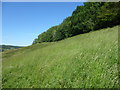
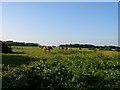
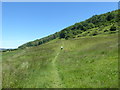
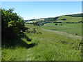
Nearby Images from Geograph Britain and Ireland:
©2019(licence)

©2007(licence)
©2007(licence)
©2019(licence)
©2019(licence)
The above images may not be of the site on this page, they are loaded from Geograph.
Please Submit an Image of this site or go out and take one for us!
Click here to see more info for this site
Nearby sites
Key: Red: member's photo, Blue: 3rd party photo, Yellow: other image, Green: no photo - please go there and take one, Grey: site destroyed
Download sites to:
KML (Google Earth)
GPX (GPS waypoints)
CSV (Garmin/Navman)
CSV (Excel)
To unlock full downloads you need to sign up as a Contributory Member. Otherwise downloads are limited to 50 sites.
Turn off the page maps and other distractions
Nearby sites listing. In the following links * = Image available
1.8km NNE 19° Minnis Barrows Round Barrow(s) (TR26834375)
3.0km NNE 24° Little Watersend Barrow Round Barrow(s) (TR27394477)
3.2km E 98° Whinless Down Barrows Round Barrow(s) (TR29514167)
3.4km S 186° Capel-le-Ferne Bowl Barrow* Round Barrow(s) (TR26113860)
3.6km NE 53° Lousyberry Wood Tumuli* Barrow Cemetery (TR29114432)
3.7km NW 306° St John's Well (Swingfield) Holy Well or Sacred Spring (TR23224401)
4.1km NNE 13° Stonehall Deneholes Ancient Mine, Quarry or other Industry (TR27104603)
5.0km W 277° Little Foxholt Barrows Round Barrow(s) (TR21284239)
5.4km E 96° Lady Well (Dover) Holy Well or Sacred Spring (TR317417)
5.5km E 100° Dover Museum* Museum (TR318413)
5.6km SW 230° Sugerloaf Hill Holy Well Holy Well or Sacred Spring (TR222382)
6.1km SW 231° Castle Hill Barrows Round Barrow(s) (TR21723798)
6.2km E 93° Harold's Well Holy Well or Sacred Spring (TR325419)
6.3km E 94° Dover Castle* Hillfort (TR3262941822)
6.4km SW 233° Caesar's Camp (Folkstone)* Hillfort (TR214379)
6.8km WSW 237° Cherry Garden Hill Barrow* Round Barrow(s) (TR20833801)
6.8km NE 36° White Caps Barrow Round Barrow(s) (TR30034766)
7.0km SSW 211° Folkestone moot stones* Marker Stone (TR22963589)
7.8km N 351° Rubury Butts* Barrow Cemetery (TR24724962)
8.7km WSW 249° Elm Gardens Mound Artificial Mound (TR183385)
9.0km NW 324° Breach Downs Barrows* Round Barrow(s) (TR20674900)
9.5km NNW 336° Barham Downs Barrows Round Barrow(s) (TR21995047)
9.8km NNE 13° Nonington Barrow Cemetary Barrow Cemetery (TR28185160)
9.8km W 271° Lyminge Barrow Round Barrow(s) (TR16504181)
9.9km E 79° St. Margaret's at Cliffe Barrows Round Barrow(s) (TR360443)
View more nearby sites and additional images


 We would like to know more about this location. Please feel free to add a brief description and any relevant information in your own language.
 Wir möchten mehr über diese Stätte erfahren. Bitte zögern Sie nicht, eine kurze Beschreibung und relevante Informationen in Deutsch hinzuzufügen.
 Nous aimerions en savoir encore un peu sur les lieux. S'il vous plaît n'hesitez pas à ajouter une courte description et tous les renseignements pertinents dans votre propre langue.
 Quisieramos informarnos un poco más de las lugares. No dude en añadir una breve descripción y otros datos relevantes en su propio idioma.