 with our Megalithic Portal iPhone app")

<< Our Photo Pages >> Åse settlement - Ancient Village or Settlement in Norway
Submitted by kenntha88 on Sunday, 18 November 2007 Page Views: 2594
Multi-periodSite Name: Åse settlement Alternative Name: Åse tunanleggCountry: Norway Type: Ancient Village or Settlement
Nearest Town: Harstad Nearest Village: Andenes
Latitude: 69.008119N Longitude: 15.755939E
Condition:
| 5 | Perfect |
| 4 | Almost Perfect |
| 3 | Reasonable but with some damage |
| 2 | Ruined but still recognisable as an ancient site |
| 1 | Pretty much destroyed, possibly visible as crop marks |
| 0 | No data. |
| -1 | Completely destroyed |
| 5 | Superb |
| 4 | Good |
| 3 | Ordinary |
| 2 | Not Good |
| 1 | Awful |
| 0 | No data. |
| 5 | Can be driven to, probably with disabled access |
| 4 | Short walk on a footpath |
| 3 | Requiring a bit more of a walk |
| 2 | A long walk |
| 1 | In the middle of nowhere, a nightmare to find |
| 0 | No data. |
| 5 | co-ordinates taken by GPS or official recorded co-ordinates |
| 4 | co-ordinates scaled from a detailed map |
| 3 | co-ordinates scaled from a bad map |
| 2 | co-ordinates of the nearest village |
| 1 | co-ordinates of the nearest town |
| 0 | no data |
Internal Links:
External Links:
")
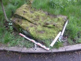
It is dated back to early iron age, possible the wandering age, and same as the one on Vollmoen, it is belived to be a defensive structure, probably many families living together for protection. But it has also been speculated that is was some sort of military "barracks".
It has a wide wiew over the sea to the south-east, and also a clear wiew to the mountains in the north. It is also very hard to spot from the sea.
Higher up in the hills above the settlement lies the remains of two other "farms", I will write about these in other site links. but maybe their purpose have been to provide the settlement with food? We can only speculate.
You may be viewing yesterday's version of this page. To see the most up to date information please register for a free account.
")
")
")
")
Do not use the above information on other web sites or publications without permission of the contributor.
Nearby Images from Flickr


The above images may not be of the site on this page, but were taken nearby. They are loaded from Flickr so please click on them for image credits.
Click here to see more info for this site
Nearby sites
Click here to view sites on an interactive map of the areaKey: Red: member's photo, Blue: 3rd party photo, Yellow: other image, Green: no photo - please go there and take one, Grey: site destroyed
Download sites to:
KML (Google Earth)
GPX (GPS waypoints)
CSV (Garmin/Navman)
CSV (Excel)
To unlock full downloads you need to sign up as a Contributory Member. Otherwise downloads are limited to 50 sites.
Turn off the page maps and other distractions
Nearby sites listing. In the following links * = Image available
1.5km N 1° Dungan/Bønna iron age settlements* Ancient Village or Settlement
5.8km S 183° Skavsteinan* Ancient Village or Settlement
9.5km WNW 295° Bø ancient farms* Ancient Village or Settlement
14.9km N 356° Buskalen* Ancient Village or Settlement
19.6km SSW 200° Pilteigen* Standing Stone (Menhir)
20.1km SSW 195° Trollosen* Ancient Village or Settlement
20.9km ESE 106° Grøtavær, Grytøya* Barrow Cemetery
20.9km ESE 104° Grøtavær* Barrow Cemetery
21.1km WSW 251° Husvågen* Ancient Village or Settlement
21.9km S 189° Finnsteinan* Natural Stone / Erratic / Other Natural Feature
22.7km ESE 117° Ytre Elgneset* Cairn
23.3km ESE 117° Indre Elgneset* Barrow Cemetery
26.8km SSE 148° Utstrand Bautasten* Standing Stone (Menhir)
28.4km SSE 154° Piklisteinen* Standing Stone (Menhir)
28.6km E 95° Øyra* Barrow Cemetery
28.7km SSE 154° Leitet* Barrow Cemetery
30.4km E 94° Bjarkøya barrow cemetary* Barrow Cemetery
30.6km SSE 147° Borkenes Cemetary* Standing Stone (Menhir)
30.7km E 93° Bjarkøya Centre, the chieftain's farm* Ancient Village or Settlement
33.2km SSE 159° Hemmestad* Standing Stone (Menhir)
35.6km ESE 114° Bessebostad, Grytøya* Barrow Cemetery
37.3km ESE 121° Trondenes* Ancient Village or Settlement
37.4km ESE 109° Alvestad, Grytøya* Barrow Cemetery
39.9km SE 128° Harstad hill fort* Hillfort
44.4km SSE 147° Storjorda sacrificial site* Natural Stone / Erratic / Other Natural Feature
View more nearby sites and additional images


 We would like to know more about this location. Please feel free to add a brief description and any relevant information in your own language.
 Wir möchten mehr über diese Stätte erfahren. Bitte zögern Sie nicht, eine kurze Beschreibung und relevante Informationen in Deutsch hinzuzufügen.
 Nous aimerions en savoir encore un peu sur les lieux. S'il vous plaît n'hesitez pas à ajouter une courte description et tous les renseignements pertinents dans votre propre langue.
 Quisieramos informarnos un poco más de las lugares. No dude en añadir una breve descripción y otros datos relevantes en su propio idioma.