 with our Megalithic Portal iPhone app")


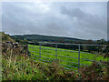
<< Our Photo Pages >> Cabragh North row - Stone Row / Alignment in Ireland (Republic of) in Co. Cork
Submitted by Anthony_Weir on Tuesday, 01 October 2002 Page Views: 5650
Neolithic and Bronze AgeSite Name: Cabragh North rowCountry: Ireland (Republic of) County: Co. Cork Type: Stone Row / Alignment
Discovery Map Number: D79
Latitude: 51.966570N Longitude: 9.05044W
Condition:
| 5 | Perfect |
| 4 | Almost Perfect |
| 3 | Reasonable but with some damage |
| 2 | Ruined but still recognisable as an ancient site |
| 1 | Pretty much destroyed, possibly visible as crop marks |
| 0 | No data. |
| -1 | Completely destroyed |
| 5 | Superb |
| 4 | Good |
| 3 | Ordinary |
| 2 | Not Good |
| 1 | Awful |
| 0 | No data. |
| 5 | Can be driven to, probably with disabled access |
| 4 | Short walk on a footpath |
| 3 | Requiring a bit more of a walk |
| 2 | A long walk |
| 1 | In the middle of nowhere, a nightmare to find |
| 0 | No data. |
| 5 | co-ordinates taken by GPS or official recorded co-ordinates |
| 4 | co-ordinates scaled from a detailed map |
| 3 | co-ordinates scaled from a bad map |
| 2 | co-ordinates of the nearest village |
| 1 | co-ordinates of the nearest town |
| 0 | no data |
Internal Links:
External Links:
I have visited· I would like to visit
GaelicLaird visited on 21st Mar 2021 - their rating: Cond: 3 Amb: 4 Access: 2
")
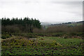
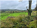
~ A few hundred metres up the track, but not visible from it, is another alignment, connected perhaps with a possible tumulus about 100m E of the track, of four stones, grooved on top, l00cm apart, and respectively 330, 275, 240 and 210cm high. About 90m away, along the same axis in a westerly direction (i.e. towards the track) is a 5th stone just over 150cm high. Close to the E end of the alignment is a 5-stone axial-stone circle, whose 2 portal stones are still visible; 2 other stones are incorporated in a field fence, and one stone is missing. S of the tumulus is an isolated standing stone 1.5m high.
~ North of the second alignment, farther up the hill, is a third.
~ 800 metres (½ mile) N, just S of the summit of Carriganirtane hill, in Carriganirtane is a fine low wedge-tomb nearly 4 metres long with 3 roof stones and some double-walling on both sides.
~ On the W side of the track leading up to Cabragh and Carriganirtane, in the townland of Clashmaguire can be seen a pair of standing stones which seem to fit into the category of 'male-and-female'.
See out Nearby Sites list below for these and more sites in the area.
You may be viewing yesterday's version of this page. To see the most up to date information please register for a free account.
")
")
Do not use the above information on other web sites or publications without permission of the contributor.
Nearby Images from Geograph Britain and Ireland:
©2023(licence)
©2023(licence)
©2023(licence)
©2023(licence)
©2023(licence)
The above images may not be of the site on this page, they are loaded from Geograph.
Please Submit an Image of this site or go out and take one for us!
Click here to see more info for this site
Nearby sites
Click here to view sites on an interactive map of the areaKey: Red: member's photo, Blue: 3rd party photo, Yellow: other image, Green: no photo - please go there and take one, Grey: site destroyed
Download sites to:
KML (Google Earth)
GPX (GPS waypoints)
CSV (Garmin/Navman)
CSV (Excel)
To unlock full downloads you need to sign up as a Contributory Member. Otherwise downloads are limited to 50 sites.
![]()
Turn off the page maps and other distractions
Nearby sites listing. In the following links * = Image available
26m NNW 328° Cabragh circle* Stone Circle
209m SW 215° Cabragh three stones* Stone Row / Alignment (W27737968)
265m WSW 255° Carrigonirtane Alignment* Stone Row / Alignment
287m N 357° Cabragh North stone* Standing Stone (Menhir)
324m NW 314° Carrigonirtane wedge tomb* Chambered Tomb
577m S 174° Cabragh South row* Stone Row / Alignment
1.1km NE 40° Carrigonirtane stone circle* Stone Circle
1.3km S 170° Clashmaguire Stone Pair * Standing Stones
2.0km S 170° Caherkeegane ringfort - cashel* Stone Fort or Dun
2.1km E 85° Maulmore Stone Circle (W300800)
2.4km S 170° Clashmaguire standing stone* Standing Stone (Menhir)
2.5km ESE 120° Caherbirrane wedge tomb* Wedge Tomb
2.6km E 84° Knockraheen SW Standing Stones* Standing Stones (W3041480100)
2.6km E 83° Knockraheen Stone Circle* Stone Circle (W3043980114)
2.6km ENE 58° Knockraheen NW Stone Row* Stone Row / Alignment (W30098118)
2.6km E 85° Knockraheen Cairn 1* Cairn (W3045780059)
2.7km E 82° Knockraheen NE Standing Stones* Standing Stones (W3052480193)
2.7km E 82° Knockraheen Cairn 2* Cairn (W3053180186)
2.8km SSE 168° Gortnalicky standing stone* Standing Stone (Menhir)
3.2km N 356° Glantane East Wedge Tomb* Wedge Tomb (W277830)
3.2km NNE 26° Carriganimmy circle* Stone Circle
3.2km SW 217° Bawnatanaknock* Standing Stone (Menhir) (W2589077325)
3.2km N 360° Glantane East Southwest Stone Row* Stone Row / Alignment (W2787183068)
3.2km E 90° Lackaduv 2 Dolmen* Wedge Tomb (W3109979789)
3.3km NNE 17° Carriganimmy (south west) wedge tomb* Wedge Tomb
View more nearby sites and additional images


 We would like to know more about this location. Please feel free to add a brief description and any relevant information in your own language.
 Wir möchten mehr über diese Stätte erfahren. Bitte zögern Sie nicht, eine kurze Beschreibung und relevante Informationen in Deutsch hinzuzufügen.
 Nous aimerions en savoir encore un peu sur les lieux. S'il vous plaît n'hesitez pas à ajouter une courte description et tous les renseignements pertinents dans votre propre langue.
 Quisieramos informarnos un poco más de las lugares. No dude en añadir una breve descripción y otros datos relevantes en su propio idioma.