

<< Our Photo Pages >> Ballygroll - Stone Row / Alignment in Ireland (Northern) in Co. Derry
Submitted by Anonymous on Tuesday, 01 October 2002 Page Views: 8523
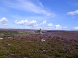
Neolithic and Bronze AgeSite Name: BallygrollCountry: Ireland (Northern) County: Co. Derry Type: Stone Row / Alignment
Map Ref: C533146
Discoverer Map Number: D7
Latitude: 54.976074N Longitude: 7.168378W
Condition:
| 5 | Perfect |
| 4 | Almost Perfect |
| 3 | Reasonable but with some damage |
| 2 | Ruined but still recognisable as an ancient site |
| 1 | Pretty much destroyed, possibly visible as crop marks |
| 0 | No data. |
| -1 | Completely destroyed |
| 5 | Superb |
| 4 | Good |
| 3 | Ordinary |
| 2 | Not Good |
| 1 | Awful |
| 0 | No data. |
| 5 | Can be driven to, probably with disabled access |
| 4 | Short walk on a footpath |
| 3 | Requiring a bit more of a walk |
| 2 | A long walk |
| 1 | In the middle of nowhere, a nightmare to find |
| 0 | No data. |
| 5 | co-ordinates taken by GPS or official recorded co-ordinates |
| 4 | co-ordinates scaled from a detailed map |
| 3 | co-ordinates scaled from a bad map |
| 2 | co-ordinates of the nearest village |
| 1 | co-ordinates of the nearest town |
| 0 | no data |
Internal Links:
External Links:
")
Have you visited this site? Please contribute a description or any thoughts by adding a comment.
You may be viewing yesterday's version of this page. To see the most up to date information please register for a free account.
")
")
")
")
")
")
")
Do not use the above information on other web sites or publications without permission of the contributor.
Nearby sites
Click here to view sites on an interactive map of the areaDownload sites to:
KML (Google Earth)
GPX (GPS waypoints)
CSV (Garmin/Navman)
CSV (Excel)
To unlock full downloads you need to sign up as a Contributory Member. Otherwise downloads are limited to 50 sites.
Nearby sites listing. In the following links * = Image available
899m S 181° Ballygroll* Stone Circle (C533137)
943m S 184° Ballygroll Prehistoric Complex* Stone Circle (NV693759)
2.3km WSW 252° High Cross (Mullaboy)* Early Christian Sculptured Stone (NV672763)
2.9km SSW 207° Ervey* Stone Circle (C520120)
4.8km SE 126° BallyhollyW Stone Row / Alignment (C572118)
5.2km ESE 123° Ballyholly* Stone Circle (C57681179)
5.2km ESE 123° Ballyholly E Stone Row / Alignment (C577118)
6.6km S 181° Cregg (Claudy)* Standing Stone (Menhir) (C5331107965)
9.3km SW 217° Lackagh* Stone Circle (C4778007050)
9.8km ESE 122° Ballymoney Standing Stone* Standing Stone (Menhir)
10.4km SSE 152° Clagan* Stone Row / Alignment (C5823805478)
12.1km SSE 157° Loughtilube Stone Standing Stone (Menhir) (C5822003480)
13.1km SSE 163° Lear Standing Stone* Standing Stone (Menhir) (NV724640)
13.2km NNW 334° Ardmore (Muff Stone)* Rock Art (C4726026415)
13.4km S 188° Cashelbane* Wedge Tomb (C5162001300)
13.6km S 187° Altaghoney* Stone Circle (C5173001070)
13.8km SSE 155° Tireighter* Wedge Tomb (C592021)
14.5km SE 131° Gallany* Standing Stone (Menhir) (NV797666)
14.6km SSW 200° Loughash Wedge Tomb* Wedge Tomb (C484008)
15.7km SW 233° Ballynabwee fort* Stone Fort or Dun (C40880495)
15.9km SE 126° Templemoyle Caugh Stone Circle (C66330541)
16.2km SSW 209° Lisnaragh Irish rath* Stone Fort or Dun (C45690023)
16.5km SE 129° Aughlish N* Multiple Stone Rows / Avenue (C6619004310)
16.5km SE 129° Aughlish* Stone Circle (C6619004310)
17.2km E 82° Carrick East* Burial Chamber or Dolmen (C703173)


 We would like to know more about this location. Please feel free to add a brief description and any relevant information in your own language.
 Wir möchten mehr über diese Stätte erfahren. Bitte zögern Sie nicht, eine kurze Beschreibung und relevante Informationen in Deutsch hinzuzufügen.
 Nous aimerions en savoir encore un peu sur les lieux. S'il vous plaît n'hesitez pas à ajouter une courte description et tous les renseignements pertinents dans votre propre langue.
 Quisieramos informarnos un poco más de las lugares. No dude en añadir una breve descripción y otros datos relevantes en su propio idioma.