

<< Text Pages >> Lismullin Henge - Henge in Ireland (Republic of) in Co. Meath
Submitted by Andy B on Thursday, 21 February 2008 Page Views: 13633
Neolithic and Bronze AgeSite Name: Lismullin Henge Alternative Name: Tara Valley Henge, National Monument of Lismullin, Lismullin National MonumentCountry: Ireland (Republic of) County: Co. Meath Type: Henge
Nearest Town: Navan Nearest Village: Lismullin
Map Ref: N93426156
Latitude: 53.595760N Longitude: 6.58977W
Condition:
| 5 | Perfect |
| 4 | Almost Perfect |
| 3 | Reasonable but with some damage |
| 2 | Ruined but still recognisable as an ancient site |
| 1 | Pretty much destroyed, possibly visible as crop marks |
| 0 | No data. |
| -1 | Completely destroyed |
| 5 | Superb |
| 4 | Good |
| 3 | Ordinary |
| 2 | Not Good |
| 1 | Awful |
| 0 | No data. |
| 5 | Can be driven to, probably with disabled access |
| 4 | Short walk on a footpath |
| 3 | Requiring a bit more of a walk |
| 2 | A long walk |
| 1 | In the middle of nowhere, a nightmare to find |
| 0 | No data. |
| 5 | co-ordinates taken by GPS or official recorded co-ordinates |
| 4 | co-ordinates scaled from a detailed map |
| 3 | co-ordinates scaled from a bad map |
| 2 | co-ordinates of the nearest village |
| 1 | co-ordinates of the nearest town |
| 0 | no data |
Be the first person to rate this site - see the 'Contribute!' box in the right hand menu.
Internal Links:
External Links:
Proposed Henge in Co. Meath. The enclosure is presently undated. However preliminary investigations indicate that it is most similar in morphology to late prehistoric ritual enclosures dating to the Late Bronze Age/Iron Age.
Its closest parallels are phases of the royal sites of Emain Macha, Co. Armagh and Dún Ailinne, Co. Kildare, although Lismullin is of a much smaller scale, is much less complex and appears to represent a single phase of use.
Archaeological excavation has revealed that the enclosure at Lismullin has been heavily truncated by past centuries of ploughing, with the result that the sample of surviving features investigated to date are very shallow.
The site is a large (c.80m diameter) circular enclosure formed of a double row or ring of stakeholes. The two rows are c.2m apart. The stakeholes are small in diameter (c.10-15cm) and evenly spaced (c.60cm apart) perhaps suggesting post and wattle construction. The enclosure appears to have an entrance in the east. A smaller enclosure c.16m in diameter formed of similarly closely spaced postholes (c.25cm diameter) is positioned centrally within the large enclosure. There are two radial rows of postholes forming a corridor between the entrance of the outer and inner enclosures. In addition there are what appear to be two slot trenches between the end of the corridor and the entrance of the inner enclosure
Source: M3 Clonee - Kells Motorway Project
Information on Archaeological Investigations at Lismullin, Co. Meath (PDF Document)
Note: Was dog skeleton found at Lismullin Henge, Tara Valley actually a primate skeleton? See latest comment
You may be viewing yesterday's version of this page. To see the most up to date information please register for a free account.
Do not use the above information on other web sites or publications without permission of the contributor.
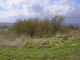
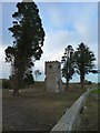
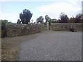
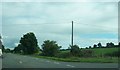
Nearby Images from Geograph Britain and Ireland:
©2011(licence)
©2010(licence)
©2013(licence)
©2013(licence)

©2018(licence)
The above images may not be of the site on this page, they are loaded from Geograph.
Please Submit an Image of this site or go out and take one for us!
Click here to see more info for this site
Nearby sites
Click here to view sites on an interactive map of the areaKey: Red: member's photo, Blue: 3rd party photo, Yellow: other image, Green: no photo - please go there and take one, Grey: site destroyed
Download sites to:
KML (Google Earth)
GPX (GPS waypoints)
CSV (Garmin/Navman)
CSV (Excel)
To unlock full downloads you need to sign up as a Contributory Member. Otherwise downloads are limited to 50 sites.
Turn off the page maps and other distractions
Nearby sites listing. In the following links * = Image available
544m ESE 120° Rath Lugh* Promontory Fort / Cliff Castle (N939613)
2.2km SW 219° Blocc and Bluigne* Standing Stones (N9206359823)
2.2km SW 215° King Cormacs Well* Holy Well or Sacred Spring (SA9500819076)
2.3km SW 218° Hill of Tara* Passage Grave (N9201659707)
2.4km SW 218° Lia Fail* Standing Stone (Menhir) (N9197659625)
2.8km SSW 211° Tuath Linde* Holy Well or Sacred Spring (N920591)
3.4km SSW 200° Rath Maeve* Henge
6.7km SSE 151° Moyer Carns Cairn
8.3km S 171° Moybologue Cemetery Artificial Mound
9.4km ESE 116° Kilbrew Henge
9.8km NW 312° Donaghmore Stone Circle (N860680)
12.6km NE 35° Recently Discovered Prehistoric Cropmark near Newgrange* Misc. Earthwork
13.2km NE 37° Newgrange Barrow ME019-049001* Chambered Tomb (SB0500930882)
13.3km NE 34° Newgrange Stone Circle* Stone Circle (O007727)
13.3km NE 34° Newgrange* Passage Grave (O00747272)
13.4km NNE 29° Knowth Timber Circle* Timber Circle (N997734)
13.4km NNE 29° Knowth* Passage Grave (N99697342)
13.6km NE 38° Newgrange Standing Stones* Standing Stones
13.8km NNE 12° Hill of Slane* Artificial Mound
15.1km NE 37° Dowth Passage Grave* Passage Grave (O02377377)
15.5km NE 41° Donore Mystery Mound Artificial Mound (O0334573550)
15.7km NE 39° Dowth Hall* Passage Grave
16.1km NE 39° Dowth Henge* Henge (O034742)
16.6km NNE 33° Townleyhall Passage Tomb* Passage Grave (O0222075723)
17.0km E 86° Micknanstown* Passage Grave
View more nearby sites and additional images


 We would like to know more about this location. Please feel free to add a brief description and any relevant information in your own language.
 Wir möchten mehr über diese Stätte erfahren. Bitte zögern Sie nicht, eine kurze Beschreibung und relevante Informationen in Deutsch hinzuzufügen.
 Nous aimerions en savoir encore un peu sur les lieux. S'il vous plaît n'hesitez pas à ajouter une courte description et tous les renseignements pertinents dans votre propre langue.
 Quisieramos informarnos un poco más de las lugares. No dude en añadir una breve descripción y otros datos relevantes en su propio idioma.