<< Our Photo Pages >> Catholme 01 - Timber Circle in England in Staffordshire
Submitted by TimPrevett on Sunday, 02 July 2017 Page Views: 11606
DigsSite Name: Catholme 01 Alternative Name: Catholme WoodhengeCountry: England County: Staffordshire Type: Timber Circle
Nearest Town: Alrewas
Map Ref: SK19621666
Latitude: 52.747208N Longitude: 1.710788W
Condition:
| 5 | Perfect |
| 4 | Almost Perfect |
| 3 | Reasonable but with some damage |
| 2 | Ruined but still recognisable as an ancient site |
| 1 | Pretty much destroyed, possibly visible as crop marks |
| 0 | No data. |
| -1 | Completely destroyed |
| 5 | Superb |
| 4 | Good |
| 3 | Ordinary |
| 2 | Not Good |
| 1 | Awful |
| 0 | No data. |
| 5 | Can be driven to, probably with disabled access |
| 4 | Short walk on a footpath |
| 3 | Requiring a bit more of a walk |
| 2 | A long walk |
| 1 | In the middle of nowhere, a nightmare to find |
| 0 | No data. |
| 5 | co-ordinates taken by GPS or official recorded co-ordinates |
| 4 | co-ordinates scaled from a detailed map |
| 3 | co-ordinates scaled from a bad map |
| 2 | co-ordinates of the nearest village |
| 1 | co-ordinates of the nearest town |
| 0 | no data |
Internal Links:
External Links:
I have visited· I would like to visit
greggmcfadyen saw from a distance on 1st Jan 2013 - their rating: Cond: -1 Amb: 1
greggmcfadyen saw from a distance on 1st Jan 2013 - their rating: Cond: -1 Amb: 1
Average ratings for this site from all visit loggers: Condition: -1 Ambience: 1
")
The two main monuments, and a cursus lie between 800m long pit alignments pointing to the river, located at the confluence of the Trent, Tame and Meuse. They form just part of a series of Neolithic sites along the river Trent.
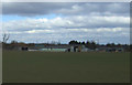
The Catholme Woodhenge not a henge, but is a timber monument of 5 rings, with 39 posts in each ring. The outer ring is 50-51m diameter, and the inner 23-24m. Post pits date from 2880-2410BC. Catholme was discovered as cropmarks by aerial photography after WW2, by RAF pilot Jim Pickering. Farming has now obliterated any traces.
More in Where Rivers Meet: Landscape, Ritual, Settlement and the Archaeology of River Gravels University of Birmingham, 2006 (updated 2012)
You may be viewing yesterday's version of this page. To see the most up to date information please register for a free account.
Do not use the above information on other web sites or publications without permission of the contributor.
Nearby Images from Geograph Britain and Ireland:
©2013(licence)
©2008(licence)
©2012(licence)
©2012(licence)
©2023(licence)
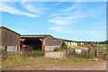
The above images may not be of the site on this page, they are loaded from Geograph.
Please Submit an Image of this site or go out and take one for us!
Click here to see more info for this site
Nearby sites
Key: Red: member's photo, Blue: 3rd party photo, Yellow: other image, Green: no photo - please go there and take one, Grey: site destroyed
Download sites to:
KML (Google Earth)
GPX (GPS waypoints)
CSV (Garmin/Navman)
CSV (Excel)
To unlock full downloads you need to sign up as a Contributory Member. Otherwise downloads are limited to 50 sites.
Turn off the page maps and other distractions
Nearby sites listing. In the following links * = Image available
194m WNW 282° Catholme 02 Henge (SK19431670)
445m NW 314° Barton Under Needwood Cursus Cursus (SK19301697)
588m N 350° Efflinch Cursus (SK19521724)
2.3km SSW 208° National Memorial Arboretum* Henge (SK18531459)
2.6km SW 228° Alrewas Cursus* Cursus (SK177149)
2.6km SW 228° Alrewas and Fradley Cursus Cursus (SK177149)
4.8km WSW 242° Alrewas Causewayed Enclosure* Causewayed Enclosure (SK15351436)
4.9km SSE 159° Stone in Croxall Churchyard* Marker Stone (SK2140512127)
5.8km N 10° Holy Well (Tatenhill)* Holy Well or Sacred Spring (SK20572236)
6.8km N 357° Wishing Well (nr Tatenhill) Holy Well or Sacred Spring (SK19272346)
8.1km W 263° King's Bromley Cursus Cursus (SK116157)
8.2km NE 43° St Andrew's Well (Burton on Trent)* Holy Well or Sacred Spring (SK25212266)
9.8km SW 230° St Chad's Well (Lichfield)* Holy Well or Sacred Spring (SK122103)
11.1km W 271° Mavesyn Ridware* Causewayed Enclosure (SK0853816800)
11.2km W 275° Hill Ridware* Cursus (SK08471759)
11.2km W 275° Mavesyn Ridware Cursus Cursus (SK08471759)
11.7km NNE 20° St Mary (Rolleston on Dove)* Ancient Cross (SK23542771)
12.3km E 89° Blackfordby Spring* Holy Well or Sacred Spring (SK3217)
12.9km S 175° St Ruffin's Well (Tamworth)* Holy Well or Sacred Spring (SK207038)
13.3km W 276° Cawarden Spring Holy Well or Sacred Spring (SK064181)
13.5km E 84° Blackfordby Spring* Holy Well or Sacred Spring (SK331182)
14.0km SW 225° Wall Roman sites (Letocetum)* Ancient Village or Settlement (SK0977506660)
14.2km NE 44° St Ann's Well (Repton)* Holy Well or Sacred Spring (SK29442699)
14.6km NE 44° St Thomas' Well (Repton) Holy Well or Sacred Spring (SK29822713)
15.0km NE 46° St Wystan's (Repton)* Early Christian Sculptured Stone (SK30292717)
View more nearby sites and additional images


 We would like to know more about this location. Please feel free to add a brief description and any relevant information in your own language.
 Wir möchten mehr über diese Stätte erfahren. Bitte zögern Sie nicht, eine kurze Beschreibung und relevante Informationen in Deutsch hinzuzufügen.
 Nous aimerions en savoir encore un peu sur les lieux. S'il vous plaît n'hesitez pas à ajouter une courte description et tous les renseignements pertinents dans votre propre langue.
 Quisieramos informarnos un poco más de las lugares. No dude en añadir una breve descripción y otros datos relevantes en su propio idioma.