

<< Our Photo Pages >> Zierzow Steingrab - Chambered Tomb in Germany in Mecklenburg-Western Pomerania
Submitted by Klingon on Monday, 27 June 2005 Page Views: 2540
Neolithic and Bronze AgeSite Name: Zierzow Steingrab Alternative Name: Sprockhoff 436, Schampermühle, Schamper Mühle, RöbelCountry: Germany Land: Mecklenburg-Western Pomerania Type: Chambered Tomb
Nearest Village: Zierzow
Latitude: 53.413797N Longitude: 12.569984E
Condition:
| 5 | Perfect |
| 4 | Almost Perfect |
| 3 | Reasonable but with some damage |
| 2 | Ruined but still recognisable as an ancient site |
| 1 | Pretty much destroyed, possibly visible as crop marks |
| 0 | No data. |
| -1 | Completely destroyed |
| 5 | Superb |
| 4 | Good |
| 3 | Ordinary |
| 2 | Not Good |
| 1 | Awful |
| 0 | No data. |
| 5 | Can be driven to, probably with disabled access |
| 4 | Short walk on a footpath |
| 3 | Requiring a bit more of a walk |
| 2 | A long walk |
| 1 | In the middle of nowhere, a nightmare to find |
| 0 | No data. |
| 5 | co-ordinates taken by GPS or official recorded co-ordinates |
| 4 | co-ordinates scaled from a detailed map |
| 3 | co-ordinates scaled from a bad map |
| 2 | co-ordinates of the nearest village |
| 1 | co-ordinates of the nearest town |
| 0 | no data |
Internal Links:
External Links:
I have visited· I would like to visit
DrewParsons would like to visit
")
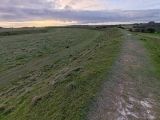
Remains of a chamber, NE-SW orientation.
Five orthostats and a mighty capstone.
Capstones size 3 x 1.7 x 1m.
The chamber must have been much bigger.
Fortunately you can crawl into this bush and admire the tomb.
But it should be visited in the leaf-free time.
You may be viewing yesterday's version of this page. To see the most up to date information please register for a free account.
")
")
")
")
")
")
")
")
Do not use the above information on other web sites or publications without permission of the contributor.
Click here to see more info for this site
Nearby sites
Click here to view sites on an interactive map of the areaKey: Red: member's photo, Blue: 3rd party photo, Yellow: other image, Green: no photo - please go there and take one, Grey: site destroyed
Download sites to:
KML (Google Earth)
GPX (GPS waypoints)
CSV (Garmin/Navman)
CSV (Excel)
To unlock full downloads you need to sign up as a Contributory Member. Otherwise downloads are limited to 50 sites.
Turn off the page maps and other distractions
Nearby sites listing. In the following links * = Image available
1.8km SW 216° Schälchenstein Gross Kelle Rock Art
3.6km WNW 300° Lexow Steingrab* Chambered Tomb
4.4km SW 220° Teufelsstein Minzow Rock Art
4.6km SSW 201° Dambeck Steingrab 1* Chambered Tomb
5.8km N 356° Wendhof Dolmen* Burial Chamber or Dolmen
7.0km SSE 163° Bollewick Opferstein Chambered Tomb
7.2km SW 223° Dambeck Schalenstein Rock Art
7.2km S 190° Bollewick Steingrab* Burial Chamber or Dolmen
7.3km SSW 191° Karchow Steingrab* Chambered Tomb
7.5km SSW 193° Erlenkamp Schalenstein Rock Art
7.7km SSW 194° Erlenkamp Steingrab* Chambered Tomb
7.7km SW 221° Dambeck Steingrab 3* Chambered Tomb
7.7km SW 221° Dambeck Steingrab 2* Chambered Tomb
8.2km SW 228° Leizen Huegelgrab Round Barrow(s)
9.1km SSE 163° Spitzkuhn Steingrab* Chambered Tomb
9.3km SSW 200° Erlenkamp Huegelgrab Round Barrow(s)
9.8km SSW 211° Buetow Huegelgrab Round Barrow(s)
12.1km WSW 245° Darze Steingrab 1* Chambered Tomb
12.4km WSW 244° Darze Steingrab 2 Chambered Tomb
12.5km WSW 244° Darze Steingrab 3 Chambered Tomb
14.3km W 277° Satow Steingrab 2* Chambered Tomb
14.4km S 173° Salwenburgen Kieve Ancient Village or Settlement
14.4km W 277° Satow Schaelchenstein Rock Art
14.4km WSW 251° Stuer Steingrab 6* Chambered Tomb
14.5km W 275° Satow Steingrab 1* Chambered Tomb
View more nearby sites and additional images


 We would like to know more about this location. Please feel free to add a brief description and any relevant information in your own language.
 Wir möchten mehr über diese Stätte erfahren. Bitte zögern Sie nicht, eine kurze Beschreibung und relevante Informationen in Deutsch hinzuzufügen.
 Nous aimerions en savoir encore un peu sur les lieux. S'il vous plaît n'hesitez pas à ajouter une courte description et tous les renseignements pertinents dans votre propre langue.
 Quisieramos informarnos un poco más de las lugares. No dude en añadir una breve descripción y otros datos relevantes en su propio idioma.