

<< Our Photo Pages >> Jungfrau von Dölau - Standing Stone (Menhir) in Germany in Saxony-Anhalt
Submitted by Klingon on Friday, 14 January 2005 Page Views: 4974
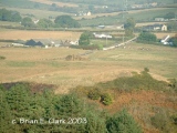
Neolithic and Bronze AgeSite Name: Jungfrau von Dölau Alternative Name: Steinerne Jungfrau, Heidenstein, der lange SteinCountry: Germany Land: Saxony-Anhalt Type: Standing Stone (Menhir)
Nearest Town: Halle Nearest Village: Dölau
Latitude: 51.519364N Longitude: 11.879539E
Condition:
| 5 | Perfect |
| 4 | Almost Perfect |
| 3 | Reasonable but with some damage |
| 2 | Ruined but still recognisable as an ancient site |
| 1 | Pretty much destroyed, possibly visible as crop marks |
| 0 | No data. |
| -1 | Completely destroyed |
| 5 | Superb |
| 4 | Good |
| 3 | Ordinary |
| 2 | Not Good |
| 1 | Awful |
| 0 | No data. |
| 5 | Can be driven to, probably with disabled access |
| 4 | Short walk on a footpath |
| 3 | Requiring a bit more of a walk |
| 2 | A long walk |
| 1 | In the middle of nowhere, a nightmare to find |
| 0 | No data. |
| 5 | co-ordinates taken by GPS or official recorded co-ordinates |
| 4 | co-ordinates scaled from a detailed map |
| 3 | co-ordinates scaled from a bad map |
| 2 | co-ordinates of the nearest village |
| 1 | co-ordinates of the nearest town |
| 0 | no data |
Internal Links:
External Links:
I have visited· I would like to visit
Boeddel visited on 3rd Oct 2021 - their rating: Amb: 3 Access: 4
Klingon visited on 27th Oct 2004 - their rating: Cond: 4 Amb: 4 Access: 4
Martin_L have visited here
Average ratings for this site from all visit loggers: Ambience: 3.5 Access: 4
")
Jungfrau von Dölau means Maid of Dölau
height: 5.5 m
Until 1890 the menhir was 8.5 m high.
You may be viewing yesterday's version of this page. To see the most up to date information please register for a free account.
")
")
")
")
")
")
")
")
")
")
")
")
")
")
")
")
")
")
")
")
")
Do not use the above information on other web sites or publications without permission of the contributor.
Click here to see more info for this site
Nearby sites
Click here to view sites on an interactive map of the areaKey: Red: member's photo, Blue: 3rd party photo, Yellow: other image, Green: no photo - please go there and take one, Grey: site destroyed
Download sites to:
KML (Google Earth)
GPX (GPS waypoints)
CSV (Garmin/Navman)
CSV (Excel)
To unlock full downloads you need to sign up as a Contributory Member. Otherwise downloads are limited to 50 sites.
Turn off the page maps and other distractions
Nearby sites listing. In the following links * = Image available
1.9km N 356° Brachwitz Grabhügel* Round Barrow(s)
2.2km SE 126° Langer Berg Hügelgrab (1)* Round Barrow(s)
2.2km SE 127° Langer Berg Hügelgrab (2)* Round Barrow(s)
2.3km SE 128° Langer Berg Steinkiste* Chambered Tomb
2.7km SE 139° Bischofswiese Ancient Village or Settlement
2.8km SE 141° Tonberg Steinkiste (3)* Cist
2.8km SSE 148° Tonberg Steinkiste (2)* Chambered Tomb
2.8km SSE 147° Tonberg Steinkiste (1)* Chambered Tomb
2.9km SE 133° Kolkturmberg Steinkiste* Cist
3.0km NE 37° Morl Menhir* Standing Stone (Menhir)
3.1km ENE 70° Morl Grabhügel* Round Barrow(s)
4.0km ESE 120° Waldkater Steinkiste* Chambered Tomb
4.5km ESE 114° Kröllwitz* Standing Stone (Menhir)
4.5km WNW 283° Bierhügel Salzmünde* Round Barrow(s)
5.0km W 265° Weiße Frau* Standing Stone (Menhir)
5.2km W 259° Zappendorf Bronzezeitliche Siedlung Ancient Village or Settlement
5.6km ENE 63° Teufelsstein Sennewitz* Standing Stone (Menhir)
5.8km WSW 241° Köllme Bronzezeitliche Gräber Barrow Cemetery
6.2km ESE 112° Menhir von Krosigk* Standing Stone (Menhir)
6.2km ESE 112° Landesmuseum für Vorgeschichte* Museum
7.0km E 84° Franzosenstein Seeben* Standing Stone (Menhir)
7.5km NE 48° Ibenberg Grabhügel* Round Barrow(s)
8.1km SE 144° Müllergrab Steine Early Christian Sculptured Stone
8.8km WSW 254° Menhir Höhnstedt* Standing Stone (Menhir)
9.1km W 269° Viererstein* Stone Circle
View more nearby sites and additional images


 We would like to know more about this location. Please feel free to add a brief description and any relevant information in your own language.
 Wir möchten mehr über diese Stätte erfahren. Bitte zögern Sie nicht, eine kurze Beschreibung und relevante Informationen in Deutsch hinzuzufügen.
 Nous aimerions en savoir encore un peu sur les lieux. S'il vous plaît n'hesitez pas à ajouter une courte description et tous les renseignements pertinents dans votre propre langue.
 Quisieramos informarnos un poco más de las lugares. No dude en añadir una breve descripción y otros datos relevantes en su propio idioma.