 with our Megalithic Portal iPhone app")


<< Our Photo Pages >> Maen Llwyd (Carmarthenshire) - Standing Stone (Menhir) in Wales in Carmarthenshire
Submitted by Kammer on Tuesday, 09 November 2004 Page Views: 11212
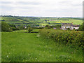
Neolithic and Bronze AgeSite Name: Maen Llwyd (Carmarthenshire)Country: Wales County: Carmarthenshire Type: Standing Stone (Menhir)
Nearest Town: Kidwelly Nearest Village: Ferryside
Map Ref: SN386123
Latitude: 51.786014N Longitude: 4.341383W
Condition:
| 5 | Perfect |
| 4 | Almost Perfect |
| 3 | Reasonable but with some damage |
| 2 | Ruined but still recognisable as an ancient site |
| 1 | Pretty much destroyed, possibly visible as crop marks |
| 0 | No data. |
| -1 | Completely destroyed |
| 5 | Superb |
| 4 | Good |
| 3 | Ordinary |
| 2 | Not Good |
| 1 | Awful |
| 0 | No data. |
| 5 | Can be driven to, probably with disabled access |
| 4 | Short walk on a footpath |
| 3 | Requiring a bit more of a walk |
| 2 | A long walk |
| 1 | In the middle of nowhere, a nightmare to find |
| 0 | No data. |
| 5 | co-ordinates taken by GPS or official recorded co-ordinates |
| 4 | co-ordinates scaled from a detailed map |
| 3 | co-ordinates scaled from a bad map |
| 2 | co-ordinates of the nearest village |
| 1 | co-ordinates of the nearest town |
| 0 | no data |
Internal Links:
External Links:
 (PID:10500)")
You may be viewing yesterday's version of this page. To see the most up to date information please register for a free account.
 (PID:112332)")
 (PID:112331)")
 (PID:112330)")
 (PID:112329)")
Do not use the above information on other web sites or publications without permission of the contributor.
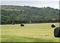
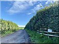
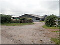
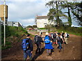
Nearby Images from Geograph Britain and Ireland:
©2023(licence)
©2023(licence)
©2023(licence)
©2014(licence)
©2008(licence)
The above images may not be of the site on this page, they are loaded from Geograph.
Please Submit an Image of this site or go out and take one for us!
Click here to see more info for this site
Nearby sites
Key: Red: member's photo, Blue: 3rd party photo, Yellow: other image, Green: no photo - please go there and take one, Grey: site destroyed
Download sites to:
KML (Google Earth)
GPX (GPS waypoints)
CSV (Garmin/Navman)
CSV (Excel)
To unlock full downloads you need to sign up as a Contributory Member. Otherwise downloads are limited to 50 sites.
Turn off the page maps and other distractions
Nearby sites listing. In the following links * = Image available
1.2km SSW 203° Is-Coed* Standing Stone (Menhir) (SN381112)
2.2km N 351° Maenau Llwydion, Llangain* Standing Stones (SN38311450)
2.6km N 0° Quoit Stone, Parc-y-maen llwyd* Standing Stone (Menhir) (SN38691485)
3.2km NNW 342° Meini Llwydion* Chambered Tomb (SN37721534)
3.2km WSW 243° Maen Llwyd, St Ishmail* Standing Stone (Menhir) (SN3569610910)
3.6km WSW 252° Waun y Felin Burial Chamber or Dolmen (SN351113)
3.7km NNW 348° Myrddin's Quoits* Chambered Tomb (SN37911598)
3.9km SSE 147° Allt Cunedda Barrow Cemetery (SN40640897)
3.9km W 275° Maen Melyn, Llanybri* Standing Stone (Menhir) (SN34711279)
4.0km WSW 236° Llansteffan Castle* Hillfort (SN352102)
4.2km NE 37° Ffynnon Berwyn* Holy Well or Sacred Spring (SN4127615577)
4.3km WSW 247° Fron Ucha* Chambered Tomb (SN3455510744)
4.6km WSW 237° St Anthony's Well (Llansteffan)* Holy Well or Sacred Spring (SN34600993)
4.7km SE 144° Cae Garreg Fawr Standing Stones (SN413084)
4.7km SE 145° Cae Garreg Fawr Standing Stone (Menhir) (SN41210833)
4.8km SE 144° Penlan Ucha Enclosure Ancient Village or Settlement (SN41250834)
5.1km ESE 114° Meinillwydion Stone Pair* Standing Stones (SN43191010)
5.2km SSE 157° Ffynnon Sul.* Holy Well or Sacred Spring (SN405075)
5.2km SSE 160° Ffynnon Stockwell* Holy Well or Sacred Spring (SN4024207325)
5.5km ENE 72° Maen Hir (Cloigyn)* Standing Stone (Menhir) (SN4393713807)
6.0km E 99° Gwempa* Standing Stone (Menhir) (SN44511112)
6.2km NW 307° Twlc y Filiast* Chambered Tomb (SN33811618)
6.6km E 90° Maen Llwyd, Llangendeirne* Standing Stone (Menhir) (SN452121)
6.6km NW 309° Bryn Cywyn* Ancient Village or Settlement (SN33551660)
6.8km SSE 150° Ffynnon Mihangel Holy Well or Sacred Spring (SN41770628)
View more nearby sites and additional images


 We would like to know more about this location. Please feel free to add a brief description and any relevant information in your own language.
 Wir möchten mehr über diese Stätte erfahren. Bitte zögern Sie nicht, eine kurze Beschreibung und relevante Informationen in Deutsch hinzuzufügen.
 Nous aimerions en savoir encore un peu sur les lieux. S'il vous plaît n'hesitez pas à ajouter une courte description et tous les renseignements pertinents dans votre propre langue.
 Quisieramos informarnos un poco más de las lugares. No dude en añadir una breve descripción y otros datos relevantes en su propio idioma.