

<< Our Photo Pages >> Ghajn Damma Stone Row - Stone Row / Alignment in Malta in Gozo
Submitted by enkidu41 on Wednesday, 20 October 2004 Page Views: 4844
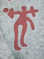
Neolithic and Bronze AgeSite Name: Ghajn Damma Stone RowCountry: Malta Island: Gozo Type: Stone Row / Alignment
Nearest Town: Victoria Nearest Village: Marsalforn
Latitude: 36.072907N Longitude: 14.267194E
Condition:
| 5 | Perfect |
| 4 | Almost Perfect |
| 3 | Reasonable but with some damage |
| 2 | Ruined but still recognisable as an ancient site |
| 1 | Pretty much destroyed, possibly visible as crop marks |
| 0 | No data. |
| -1 | Completely destroyed |
| 5 | Superb |
| 4 | Good |
| 3 | Ordinary |
| 2 | Not Good |
| 1 | Awful |
| 0 | No data. |
| 5 | Can be driven to, probably with disabled access |
| 4 | Short walk on a footpath |
| 3 | Requiring a bit more of a walk |
| 2 | A long walk |
| 1 | In the middle of nowhere, a nightmare to find |
| 0 | No data. |
| 5 | co-ordinates taken by GPS or official recorded co-ordinates |
| 4 | co-ordinates scaled from a detailed map |
| 3 | co-ordinates scaled from a bad map |
| 2 | co-ordinates of the nearest village |
| 1 | co-ordinates of the nearest town |
| 0 | no data |
Internal Links:
External Links:
")
The purpose of the stones is unknown but they may have formed part of a considerably larger megalithic structure, possibly defensive in nature. Prehistoric pottery may still be seen strewn around the stones.
Access to the site may only be had by a half a mile walk through the entrance to the il-Qortin ta' Ghajn Damma landfill.
You may be viewing yesterday's version of this page. To see the most up to date information please register for a free account.
")
Do not use the above information on other web sites or publications without permission of the contributor.
Nearby sites
Click here to view sites on an interactive map of the areaDownload sites to:
KML (Google Earth)
GPX (GPS waypoints)
CSV (Garmin/Navman)
CSV (Excel)
To unlock full downloads you need to sign up as a Contributory Member. Otherwise downloads are limited to 50 sites.
Nearby sites listing. In the following links * = Image available
733m WSW 252° Ghajn Damma Stones* Standing Stones
2.0km WSW 247° Ta' Kuljat* Ancient Village or Settlement
2.2km SSW 200° Il-Gebla ta' Sasuna* Burial Chamber or Dolmen
2.7km S 174° L’Ghar Tramuntana* Cave or Rock Shelter
2.8km S 182° L'Ghar ta' Gejzu* Cave or Rock Shelter
2.9km S 176° Ggantija* Ancient Temple
2.9km S 179° Ggantija Standing Stones* Standing Stones
2.9km S 184° Xaghra Circle* Stone Circle
3.0km SSW 193° Santa Verna* Ancient Temple
3.0km WSW 237° Is-Srug* Cave or Rock Shelter
3.5km S 171° In-Nuffara Settlement* Ancient Village or Settlement
3.9km SW 220° Gozo Museum of Archaeology* Museum
4.7km SW 222° Kercem Rock Cut Tombs* Rock Cut Tomb
4.7km SSW 207° Tac-Cawla Settlement* Ancient Village or Settlement
4.8km SW 224° Il-Hagra tad-Dawwara* Standing Stone (Menhir)
4.9km SSE 161° Borg il-Gharib* Ancient Temple
5.0km SSW 209° Ta' Marziena* Ancient Temple
5.0km SSW 192° Ta' Blankas Stone Row* Stone Row / Alignment
5.1km SSE 162° L-Imrejzbiet* Stone Circle
5.1km S 191° Ta' Blankas Cart Ruts* Ancient Trackway
5.1km SSW 191° Ta' Blankas Dolmen B* Burial Chamber or Dolmen
5.1km S 177° Ta' Lambert Stones* Stone Row / Alignment
5.1km SSW 192° Ta' Blankas Dolmen A* Burial Chamber or Dolmen
5.2km S 176° Ta' Lambert Cart Ruts* Ancient Trackway
5.4km SE 136° Il-Hagra L-Wieqfa* Standing Stone (Menhir)


 We would like to know more about this location. Please feel free to add a brief description and any relevant information in your own language.
 Wir möchten mehr über diese Stätte erfahren. Bitte zögern Sie nicht, eine kurze Beschreibung und relevante Informationen in Deutsch hinzuzufügen.
 Nous aimerions en savoir encore un peu sur les lieux. S'il vous plaît n'hesitez pas à ajouter une courte description et tous les renseignements pertinents dans votre propre langue.
 Quisieramos informarnos un poco más de las lugares. No dude en añadir una breve descripción y otros datos relevantes en su propio idioma.