

<< Text Pages >> Desford Stone - Standing Stone (Menhir) in England in Leicestershire and Rutland
Submitted by enkidu41 on Saturday, 14 August 2004 Page Views: 7055
Neolithic and Bronze AgeSite Name: Desford StoneCountry: England County: Leicestershire and Rutland Type: Standing Stone (Menhir)
Nearest Town: Leicester Nearest Village: Desford
Map Ref: SK478034
Latitude: 52.626263N Longitude: 1.295274W
Condition:
| 5 | Perfect |
| 4 | Almost Perfect |
| 3 | Reasonable but with some damage |
| 2 | Ruined but still recognisable as an ancient site |
| 1 | Pretty much destroyed, possibly visible as crop marks |
| 0 | No data. |
| -1 | Completely destroyed |
| 5 | Superb |
| 4 | Good |
| 3 | Ordinary |
| 2 | Not Good |
| 1 | Awful |
| 0 | No data. |
| 5 | Can be driven to, probably with disabled access |
| 4 | Short walk on a footpath |
| 3 | Requiring a bit more of a walk |
| 2 | A long walk |
| 1 | In the middle of nowhere, a nightmare to find |
| 0 | No data. |
| 5 | co-ordinates taken by GPS or official recorded co-ordinates |
| 4 | co-ordinates scaled from a detailed map |
| 3 | co-ordinates scaled from a bad map |
| 2 | co-ordinates of the nearest village |
| 1 | co-ordinates of the nearest town |
| 0 | no data |
Internal Links:
External Links:
Standing Stone in Leicestershire and Rutland.
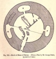
This recumbent boulder of gritty sandstone is just under 3' long and lies to the western edge of the churchyard of St. Martin's Church in Desford.
Based on the description by, and used by kind permission of, Bob Trubshaw, from his Interactive
Little-known Leicestershire and Rutland CD-ROM.
You may be viewing yesterday's version of this page. To see the most up to date information please register for a free account.
")
")
Do not use the above information on other web sites or publications without permission of the contributor.
Nearby sites
Download sites to:
KML (Google Earth)
GPX (GPS waypoints)
CSV (Garmin/Navman)
CSV (Excel)
To unlock full downloads you need to sign up as a Contributory Member. Otherwise downloads are limited to 50 sites.
Nearby sites listing. In the following links * = Image available
3.0km NE 41° Bury Camp (Leicestershire) Hillfort (SK498057)
5.1km ESE 120° Wishing Stone* Standing Stone (Menhir) (SK523009)
5.6km S 175° Earl Shilton Bypass Round Barrow(s) (SP483978)
7.6km SSW 208° Barwell Stone* Standing Stone (Menhir) (SP4429096665)
7.7km E 94° Braunstone Church* Standing Stone (Menhir) (SK555029)
7.7km SE 143° Huncote Stone* Standing Stone (Menhir) (SP5246497256)
7.7km E 84° Western Park (Leicester)* Misc. Earthwork (SK555043)
8.0km ESE 114° Enderby Henge (SK551002)
8.3km WSW 246° King Richard's Well* Holy Well or Sacred Spring (SK402000)
8.5km S 175° Stoney Stanton Stone Standing Stone (Menhir) (SP486949)
8.9km ENE 58° Anstey Stone* Standing Stone (Menhir) (SK55260820)
9.1km ESE 114° The Wethers* Standing Stones (SP56149972)
9.5km NNE 30° Bradgate Hunt's Hill Stone* Standing Stone (Menhir) (SK5247111651)
9.7km N 357° Kellam's Farm moated site* Ancient Village or Settlement (SK47211310)
10.4km E 85° Jewry Wall Museum Museum (SK582045)
10.5km ENE 58° Beaumont Leys* Standing Stones (SK566091)
10.7km E 81° St. Margaret's Church* Holy Well or Sacred Spring (SK584052)
10.8km NNE 11° Bawdon Monolith Standing Stone (Menhir) (SK49851400)
11.0km NE 52° Thurcaston C and D Standing Stones (SK56431020)
11.1km NE 52° Thurcaston B Standing Stone (Menhir) (SK56481030)
11.3km NE 51° Thurcaston A* Standing Stone (Menhir) (SK56501060)
11.7km NNE 17° Beacon Hill (Leicestershire)* Hillfort (SK512146)
11.9km N 355° Stone nr Oaks in Charnwood* Natural Stone / Erratic / Other Natural Feature (SK46721523)
12.0km N 359° Cat Hill Wood Stone* Modern Stone Circle etc (SK474154)
12.1km NE 41° Cross (near Swithland)* Ancient Cross (SK557126)


 We would like to know more about this location. Please feel free to add a brief description and any relevant information in your own language.
 Wir möchten mehr über diese Stätte erfahren. Bitte zögern Sie nicht, eine kurze Beschreibung und relevante Informationen in Deutsch hinzuzufügen.
 Nous aimerions en savoir encore un peu sur les lieux. S'il vous plaît n'hesitez pas à ajouter une courte description et tous les renseignements pertinents dans votre propre langue.
 Quisieramos informarnos un poco más de las lugares. No dude en añadir una breve descripción y otros datos relevantes en su propio idioma.