


<< Text Pages >> Gull Stones (Great Yarmouth) - Sculptured Stone in England in Norfolk
Submitted by Anne T on Thursday, 02 November 2017 Page Views: 7451
Multi-periodSite Name: Gull Stones (Great Yarmouth)Country: England County: Norfolk Type: Sculptured Stone
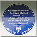
Nearest Town: Great Yarmouth Nearest Village: Gorleston-on-Sea
Map Ref: TG524035
Latitude: 52.570706N Longitude: 1.723277E
Condition:
| 5 | Perfect |
| 4 | Almost Perfect |
| 3 | Reasonable but with some damage |
| 2 | Ruined but still recognisable as an ancient site |
| 1 | Pretty much destroyed, possibly visible as crop marks |
| 0 | No data. |
| -1 | Completely destroyed |
| 5 | Superb |
| 4 | Good |
| 3 | Ordinary |
| 2 | Not Good |
| 1 | Awful |
| 0 | No data. |
| 5 | Can be driven to, probably with disabled access |
| 4 | Short walk on a footpath |
| 3 | Requiring a bit more of a walk |
| 2 | A long walk |
| 1 | In the middle of nowhere, a nightmare to find |
| 0 | No data. |
| 5 | co-ordinates taken by GPS or official recorded co-ordinates |
| 4 | co-ordinates scaled from a detailed map |
| 3 | co-ordinates scaled from a bad map |
| 2 | co-ordinates of the nearest village |
| 1 | co-ordinates of the nearest town |
| 0 | no data |
Internal Links:
External Links:
Sculptured Stone in Norfolk
The Northern Antiquarian (TNA) have found several local history records which make reference to there being a circle of ten standing stones in a field called 'Stone-field' or 'Stone-piece', the area now covered by a housing estate at Gorleston-on-Sea, just south of Great Yarmouth - see their entry for Gull Stones, Great Yarmouth, Norfolk.
Intriguingly, TNA quote from an 1875 document by C.J. Parker, which reads: "there is a tradition that the Druids had a temple at Gorleston, some remains of which existed down to a comparatively recent period. It is supposed to have stood on a field next to the road to Lowestoft, upon what is called Great Stone Close; and it has been asserted that some huge stones remained standing until 1768, when they were destroyed by digging round their base and dragging them down by ropes. There are also two fields called Further Stone Close and Middle Stone Close, so that it is possible the Druidical circle, if it ever existed, may have had a wide extent."
TNA add: "A painting of the site was reported to have been viewed by members of the Norfolk & Norwich Archaeological Society in 1888, but I’ve been unable to find out where this has gone. Anyone out there got a copy? Or know where it hangs? An image of this lost stone circle would be hugely welcome!" (both to TNA and to the Portal!)
Note: Do you have any historical information, drawings or pictures of this stone circle?
You may be viewing yesterday's version of this page. To see the most up to date information please register for a free account.
Do not use the above information on other web sites or publications without permission of the contributor.
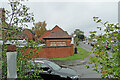
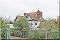
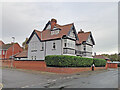
Nearby Images from Geograph Britain and Ireland:
©2022(licence)
©2022(licence)
©2022(licence)
©2022(licence)
©2018(licence)
The above images may not be of the site on this page, they are loaded from Geograph.
Please Submit an Image of this site or go out and take one for us!
Click here to see more info for this site
Nearby sites
Key: Red: member's photo, Blue: 3rd party photo, Yellow: other image, Green: no photo - please go there and take one, Grey: site destroyed
Download sites to:
KML (Google Earth)
GPX (GPS waypoints)
CSV (Garmin/Navman)
CSV (Excel)
To unlock full downloads you need to sign up as a Contributory Member. Otherwise downloads are limited to 50 sites.
Turn off the page maps and other distractions
Nearby sites listing. In the following links * = Image available
5.0km WSW 243° Bell Hill Round Barrow(s) (TG480010)
5.0km WSW 243° Mill Hill Round Barrow(s) (TG480010)
5.1km WNW 283° Burgh Castle Shore Fort Stone Fort or Dun (TG474044)
9.5km SSE 167° The Witches' Stones, Lowestoft Modern Stone Circle etc (TM5505294359)
16.4km WSW 240° Stockton Stone* Standing Stone (Menhir) (TM386946)
20.2km W 266° The White Heath Mounds Round Barrow(s) (TG3225000920)
21.7km WSW 239° Broome Heath Long Barrow Long Barrow (TM344913)
21.9km WSW 239° Broome Heath Enclosure Ancient Village or Settlement (TM34289115)
23.2km WSW 237° Druid's Stone (Bungay)* Natural Stone / Erratic / Other Natural Feature (TM3366689739)
23.3km SSW 212° Brampton Stone* Standing Stone (Menhir) (TM4105783093)
27.9km SW 235° Flixton Park Quarry Timber Circle (TM303863)
27.9km NW 324° Devil's Ditch Ancient Trackway (TG347252)
28.2km SSW 198° Ladywell (Blythborough)* Holy Well or Sacred Spring (TM450762)
28.4km W 278° Arminghall Henge* Henge (TG240060)
29.0km SSW 211° Halesworth And District Museum Museum (TM3884177788)
29.1km SSW 193° Walberswick Burial Mounds* Round Barrow(s) (TM4718274820)
29.3km W 273° Venta Icenorum* Ancient Village or Settlement (TG230034)
29.6km SSW 204° The Devil's Stone (Suffolk) Natural Stone / Erratic / Other Natural Feature (TM4160075900)
29.6km WNW 283° Norwich Castle Museum and Art Gallery* Museum (TG231085)
31.1km W 278° Eaton Heath* Barrow Cemetery (TG2128006050)
31.5km NNW 336° Happisburgh Ancient Village or Settlement (TG379315)
33.0km W 260° Tasburgh Fort* Hillfort (TM201960)
34.3km WNW 302° Fiddler's Hill (Stratton) Long Barrow (TG2225520048)
36.1km WNW 284° Roundwell* Holy Well or Sacred Spring (TG168104)
36.6km WNW 296° Horsford Woods Barrow Cemetary* Barrow Cemetery (TG18571780)
View more nearby sites and additional images


 We would like to know more about this location. Please feel free to add a brief description and any relevant information in your own language.
 Wir möchten mehr über diese Stätte erfahren. Bitte zögern Sie nicht, eine kurze Beschreibung und relevante Informationen in Deutsch hinzuzufügen.
 Nous aimerions en savoir encore un peu sur les lieux. S'il vous plaît n'hesitez pas à ajouter une courte description et tous les renseignements pertinents dans votre propre langue.
 Quisieramos informarnos un poco más de las lugares. No dude en añadir una breve descripción y otros datos relevantes en su propio idioma.