


<< Text Pages >> Ladywell (Padstow) - Holy Well or Sacred Spring in England in Cornwall
Submitted by Thorgrim on Monday, 29 March 2004 Page Views: 5828
Springs and Holy WellsSite Name: Ladywell (Padstow) Alternative Name: Lady Well (Lanadwell Street)Country: England County: Cornwall Type: Holy Well or Sacred Spring
Nearest Town: Padstow
Map Ref: SW91787535 Landranger Map Number: 200
Latitude: 50.540760N Longitude: 4.93999W
Condition:
| 5 | Perfect |
| 4 | Almost Perfect |
| 3 | Reasonable but with some damage |
| 2 | Ruined but still recognisable as an ancient site |
| 1 | Pretty much destroyed, possibly visible as crop marks |
| 0 | No data. |
| -1 | Completely destroyed |
| 5 | Superb |
| 4 | Good |
| 3 | Ordinary |
| 2 | Not Good |
| 1 | Awful |
| 0 | No data. |
| 5 | Can be driven to, probably with disabled access |
| 4 | Short walk on a footpath |
| 3 | Requiring a bit more of a walk |
| 2 | A long walk |
| 1 | In the middle of nowhere, a nightmare to find |
| 0 | No data. |
| 5 | co-ordinates taken by GPS or official recorded co-ordinates |
| 4 | co-ordinates scaled from a detailed map |
| 3 | co-ordinates scaled from a bad map |
| 2 | co-ordinates of the nearest village |
| 1 | co-ordinates of the nearest town |
| 0 | no data |
Internal Links:
External Links:
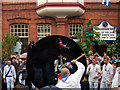
Holy Well / Spring somewhere behind the lovely Golden Lion pub in Padstow, the home of the original Obby Oss. It is possibly of note that the streetname here is Lanadwell Street.
Note: Ladywell (aka Lady Well) is described by Pastscape in their record for Monument No. 430935 (at SW 9180 7538) as a possible holy well. The well was in Lanadwell Street, Padstow, described originally as a 'copious spring'. It "is noted as having entirely disappeared".
Note: Does anyone have any information, photographs or illustrations about this well, please?
You may be viewing yesterday's version of this page. To see the most up to date information please register for a free account.
Do not use the above information on other web sites or publications without permission of the contributor.
Nearby Images from Geograph Britain and Ireland:

©2009(licence)
©2009(licence)

©2009(licence)

©2008(licence)

©2023(licence)
The above images may not be of the site on this page, they are loaded from Geograph.
Please Submit an Image of this site or go out and take one for us!
Click here to see more info for this site
Nearby sites
Key: Red: member's photo, Blue: 3rd party photo, Yellow: other image, Green: no photo - please go there and take one, Grey: site destroyed
Download sites to:
KML (Google Earth)
GPX (GPS waypoints)
CSV (Garmin/Navman)
CSV (Excel)
To unlock full downloads you need to sign up as a Contributory Member. Otherwise downloads are limited to 50 sites.
Turn off the page maps and other distractions
Nearby sites listing. In the following links * = Image available
182m W 277° Cross Shaft and Base at St Petroc's, Padstow.* Ancient Cross (SW91607538)
213m W 279° Padstow Cross* Ancient Cross (SW91577539)
363m WNW 299° Fenton Luna* Holy Well or Sacred Spring (SW91477554)
467m WNW 288° Prideaux Place Cross* Ancient Cross (SW91347551)
1.1km N 3° St George's Well (Padstow)* Holy Well or Sacred Spring (SW91887645)
1.9km E 89° St Michael's Porthilly Churchyard Cross* Ancient Cross (SW937753)
2.1km NNE 28° Brea Hill* Round Barrow(s) (SW92847714)
2.2km ENE 59° Jesus Well* Holy Well or Sacred Spring (SW937764)
2.3km NE 34° St Enodoc Church Cross* Ancient Cross (SW93157722)
2.9km SW 226° The Stones, Tresallyn Cross* Modern Stone Circle etc (SW89587340)
3.1km N 351° St John's Well (Stepper Point)* Holy Well or Sacred Spring (SW914784)
3.3km W 260° St Cadoc's Well Holy Well or Sacred Spring (SW885749)
4.1km W 268° Harlyn Bay* Barrow Cemetery (SW877754)
4.4km S 171° Trenance Rounds* Ancient Village or Settlement (SW923710)
4.6km NNE 17° Pentireglaze Haven barrow* Round Barrow(s) (SW933797)
4.7km W 277° Cataclews Point Tumuli* Barrow Cemetery (SW87167610)
5.0km ENE 67° St Minver cross* Ancient Cross (SW965771)
5.3km W 263° St Constantine's Well* Holy Well or Sacred Spring (SW86517496)
5.3km N 11° Pentire Cairn* Cairn (SW92978056)
5.8km ESE 123° Whitecross (Wadebridge)* Ancient Cross (SW965720)
5.9km NNE 14° The Rumps* Hillfort (SW93408100)
6.0km NE 39° Lundy Hole* Natural Stone / Erratic / Other Natural Feature (SW95777985)
6.0km W 266° Constantine Island* Barrow Cemetery (SW85727513)
6.2km S 185° Bogee Round Ancient Village or Settlement (SW90996924)
6.5km WSW 254° Winecove Point N* Promontory Fort / Cliff Castle (SW85427382)
View more nearby sites and additional images


 We would like to know more about this location. Please feel free to add a brief description and any relevant information in your own language.
 Wir möchten mehr über diese Stätte erfahren. Bitte zögern Sie nicht, eine kurze Beschreibung und relevante Informationen in Deutsch hinzuzufügen.
 Nous aimerions en savoir encore un peu sur les lieux. S'il vous plaît n'hesitez pas à ajouter une courte description et tous les renseignements pertinents dans votre propre langue.
 Quisieramos informarnos un poco más de las lugares. No dude en añadir una breve descripción y otros datos relevantes en su propio idioma.