
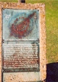

<< Our Photo Pages >> Capel Newydd - Carving in Wales in Monmouthshire (Sir Fynwy)
Submitted by Annwfn_deCym23 on Tuesday, 14 November 2023 Page Views: 575
Multi-periodSite Name: Capel Newydd Alternative Name: Dan y CapelCountry: Wales
NOTE: This site is 0.8 km away from the location you searched for.
County: Monmouthshire (Sir Fynwy) Type: Carving
Nearest Town: Blaenavon Nearest Village: Blaenavon
Map Ref: SO27020763
Latitude: 51.762577N Longitude: 3.058865W
Condition:
| 5 | Perfect |
| 4 | Almost Perfect |
| 3 | Reasonable but with some damage |
| 2 | Ruined but still recognisable as an ancient site |
| 1 | Pretty much destroyed, possibly visible as crop marks |
| 0 | No data. |
| -1 | Completely destroyed |
| 5 | Superb |
| 4 | Good |
| 3 | Ordinary |
| 2 | Not Good |
| 1 | Awful |
| 0 | No data. |
| 5 | Can be driven to, probably with disabled access |
| 4 | Short walk on a footpath |
| 3 | Requiring a bit more of a walk |
| 2 | A long walk |
| 1 | In the middle of nowhere, a nightmare to find |
| 0 | No data. |
| 5 | co-ordinates taken by GPS or official recorded co-ordinates |
| 4 | co-ordinates scaled from a detailed map |
| 3 | co-ordinates scaled from a bad map |
| 2 | co-ordinates of the nearest village |
| 1 | co-ordinates of the nearest town |
| 0 | no data |
Internal Links:
External Links:
")
Boulders will a sequence of fairly equal boreholes in what may be a glacial erratic.
Exact age or purpose unknown.
There is a quarry to the south east and downhill but, some of these boreholes appear far more eroded than would be expected given their sheltered location and obscure location in a woodland.
You may be viewing yesterday's version of this page. To see the most up to date information please register for a free account.
")
Do not use the above information on other web sites or publications without permission of the contributor.
Nearby Images from Geograph Britain and Ireland:

©2006(licence)

©2006(licence)

©2024(licence)

©2024(licence)

©2024(licence)
The above images may not be of the site on this page, they are loaded from Geograph.
Please Submit an Image of this site or go out and take one for us!
Click here to see more info for this site
Nearby sites
Key: Red: member's photo, Blue: 3rd party photo, Yellow: other image, Green: no photo - please go there and take one, Grey: site destroyed
Download sites to:
KML (Google Earth)
GPX (GPS waypoints)
CSV (Garmin/Navman)
CSV (Excel)
To unlock full downloads you need to sign up as a Contributory Member. Otherwise downloads are limited to 50 sites.
Turn off the page maps and other distractions
Nearby sites listing. In the following links * = Image available
936m SE 125° Carn-y-Garnclochdy Ring Cairn (SO27780708)
1.4km NNE 31° Carn-y-Big Fach Cist (SO27790885)
1.7km NNW 344° Mynydd Garn Fawr* Ancient Trackway (SO2655609300)
2.3km N 360° Carn y Defaid (S)* Cairn (SO27040997)
2.4km N 1° Carn y Defaid (N)* Cairn (SO27081004)
2.9km S 183° Garnteg Menhir* Standing Stone (Menhir) (SO268047)
2.9km S 185° Garnteg Barrows* Barrow Cemetery (SO267047)
3.7km NW 322° Careg Croes-Ifor Round Cairn (SO248106)
3.8km SE 132° Ffynnon Angaeron* Holy Well or Sacred Spring (SO298051)
3.8km NNW 344° Blorenge West Flank - Y Blorens* Not Known (by us) (SO260113)
4.2km N 359° Blorenge Cairn* Round Cairn (SO26991186)
4.4km ENE 75° Ffynnon Gofer (Llanover)* Holy Well or Sacred Spring (SO313087)
4.9km NW 319° Carreg Maen-Taro* Standing Stone (Menhir) (SO23831134)
5.6km NW 326° Gilwern Hill* Standing Stone (Menhir) (SO2395512301)
5.6km NNW 329° Carreg Gywir* Stone Row / Alignment (SO242125)
6.0km W 273° Cwmcelyn Valley Neolithic Cairns Cairn (SO2108)
6.3km NNW 336° Bedd y Gwr Hir* Standing Stone (Menhir) (SO246134)
6.4km NNE 15° Llanfoist Standing Stone* Standing Stone (Menhir) (SO28781379)
6.4km WNW 294° Carreg Gywir Marker Stone (SO21191033)
6.4km NW 318° Twyn-y-Dinas Hillfort (SO228125)
6.7km SSE 164° Pontypool Gorsedd Circle Modern Stone Circle etc (SO2875001181)
7.0km NNE 24° Abergavenny Museum* Museum (SO2995913943)
7.0km NNE 26° Priory Well (Abergavenny)* Holy Well or Sacred Spring (SO30231387)
7.2km NNE 24° Abergavenny Priory Cross* Ancient Cross (SO3009514184)
7.4km NW 319° Craig y Gaer* Hillfort (SO223133)
View more nearby sites and additional images


 We would like to know more about this location. Please feel free to add a brief description and any relevant information in your own language.
 Wir möchten mehr über diese Stätte erfahren. Bitte zögern Sie nicht, eine kurze Beschreibung und relevante Informationen in Deutsch hinzuzufügen.
 Nous aimerions en savoir encore un peu sur les lieux. S'il vous plaît n'hesitez pas à ajouter une courte description et tous les renseignements pertinents dans votre propre langue.
 Quisieramos informarnos un poco más de las lugares. No dude en añadir una breve descripción y otros datos relevantes en su propio idioma.