


<< Our Photo Pages >> Gallow Hill A - Rock Art in Scotland in Angus
Submitted by tiompan on Sunday, 09 January 2005 Page Views: 8363
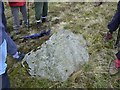
Rock ArtSite Name: Gallow Hill ACountry: Scotland
NOTE: This site is 0.7 km away from the location you searched for.
County: Angus Type: Rock Art
Nearest Village: Tealing
Map Ref: NO39054033
Latitude: 56.550981N Longitude: 2.993014W
Condition:
| 5 | Perfect |
| 4 | Almost Perfect |
| 3 | Reasonable but with some damage |
| 2 | Ruined but still recognisable as an ancient site |
| 1 | Pretty much destroyed, possibly visible as crop marks |
| 0 | No data. |
| -1 | Completely destroyed |
| 5 | Superb |
| 4 | Good |
| 3 | Ordinary |
| 2 | Not Good |
| 1 | Awful |
| 0 | No data. |
| 5 | Can be driven to, probably with disabled access |
| 4 | Short walk on a footpath |
| 3 | Requiring a bit more of a walk |
| 2 | A long walk |
| 1 | In the middle of nowhere, a nightmare to find |
| 0 | No data. |
| 5 | co-ordinates taken by GPS or official recorded co-ordinates |
| 4 | co-ordinates scaled from a detailed map |
| 3 | co-ordinates scaled from a bad map |
| 2 | co-ordinates of the nearest village |
| 1 | co-ordinates of the nearest town |
| 0 | no data |
Internal Links:
External Links:
")
You may be viewing yesterday's version of this page. To see the most up to date information please register for a free account.
")
")
Do not use the above information on other web sites or publications without permission of the contributor.
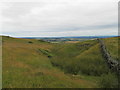
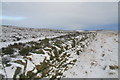
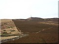
Nearby Images from Geograph Britain and Ireland:
©2013(licence)
©2008(licence)
©2009(licence)
©2008(licence)
©2009(licence)
The above images may not be of the site on this page, they are loaded from Geograph.
Please Submit an Image of this site or go out and take one for us!
Click here to see more info for this site
Nearby sites
Key: Red: member's photo, Blue: 3rd party photo, Yellow: other image, Green: no photo - please go there and take one, Grey: site destroyed
Download sites to:
KML (Google Earth)
GPX (GPS waypoints)
CSV (Garmin/Navman)
CSV (Excel)
To unlock full downloads you need to sign up as a Contributory Member. Otherwise downloads are limited to 50 sites.
Turn off the page maps and other distractions
Nearby sites listing. In the following links * = Image available
623m ENE 57° Gallow Hill B* Rock Art (NO39584066)
730m S 182° Prieston* Rock Art (NO39023960)
2.1km SSW 203° Balkemback* Stone Circle (NO382384)
2.3km ESE 104° Huntingfaulds* Rock Art (NO41303974)
2.6km E 101° Tealing Stones* Standing Stones (NO4165139785)
3.1km SE 135° Tealing* Souterrain (Fogou, Earth House) (NO412381)
3.2km SSW 209° Balluderon* Class II Pictish Symbol Stone (NO37483758)
3.4km SW 232° Balkello Standing Stone* Standing Stone (Menhir) (NO36333830)
4.6km WSW 256° Witches Stone (Auchterhouse) Stone Circle (NO34603928)
4.7km WSW 255° Auchterhouse Standing Stones (NO345392)
5.3km SSW 193° Strathmartine 3 Class II Pictish Symbol Stone (NO378352)
5.6km SW 218° Templelands (Auchterhouse) Stone Circle (NO355360)
6.2km N 2° Glamis 1* Class I / Class II Hybrid Pictish Symbol Stone (NO39374654)
6.4km E 92° Carrot Hill* Rock Art (NO45454000)
6.5km N 355° Glamis 2* Class I / Class II Hybrid Pictish Symbol Stone (NO38584686)
6.6km N 356° Glamis 3 Class III Pictish Cross Slab (NO387469)
6.6km N 355° St Fergus's Well* Holy Well or Sacred Spring (NO386469)
7.2km NE 41° Mill Of Invereighty Ancient Village or Settlement (NO439457)
8.1km NNW 331° Eassie Stone* Class II Pictish Symbol Stone (NO35264745)
8.1km NNW 332° Eassie* Class II Pictish Symbol Stone (NO353475)
8.2km SSW 205° Camperdown Standing Stone* Standing Stone (Menhir) (NO3549632905)
8.5km SW 220° Liff and Benvie Cursus Cursus (NO33403391)
8.6km SW 221° Liff and Benvie Cursus Cursus (NO33263396)
9.5km SSW 202° Balgarthno* Stone Circle (NO35333161)
9.5km SW 217° Hurly Hawkins* Broch or Nuraghe (NO332328)
View more nearby sites and additional images

")
 We would like to know more about this location. Please feel free to add a brief description and any relevant information in your own language.
 Wir möchten mehr über diese Stätte erfahren. Bitte zögern Sie nicht, eine kurze Beschreibung und relevante Informationen in Deutsch hinzuzufügen.
 Nous aimerions en savoir encore un peu sur les lieux. S'il vous plaît n'hesitez pas à ajouter une courte description et tous les renseignements pertinents dans votre propre langue.
 Quisieramos informarnos un poco más de las lugares. No dude en añadir una breve descripción y otros datos relevantes en su propio idioma.