


<< Our Photo Pages >> Long Man's Grave (Abernyte) - Marker Stone in Scotland in Perth and Kinross
Submitted by Anne T on Friday, 01 December 2017 Page Views: 1787
Date UncertainSite Name: Long Man's Grave (Abernyte) Alternative Name: Hoolmyre; Lang Man's Grave; MacBeth's GraveCountry: Scotland County: Perth and Kinross Type: Marker Stone
Nearest Town: Perth Nearest Village: Abernyte
Map Ref: NO22183153
Latitude: 56.469447N Longitude: 3.264717W
Condition:
| 5 | Perfect |
| 4 | Almost Perfect |
| 3 | Reasonable but with some damage |
| 2 | Ruined but still recognisable as an ancient site |
| 1 | Pretty much destroyed, possibly visible as crop marks |
| 0 | No data. |
| -1 | Completely destroyed |
| 5 | Superb |
| 4 | Good |
| 3 | Ordinary |
| 2 | Not Good |
| 1 | Awful |
| 0 | No data. |
| 5 | Can be driven to, probably with disabled access |
| 4 | Short walk on a footpath |
| 3 | Requiring a bit more of a walk |
| 2 | A long walk |
| 1 | In the middle of nowhere, a nightmare to find |
| 0 | No data. |
| 5 | co-ordinates taken by GPS or official recorded co-ordinates |
| 4 | co-ordinates scaled from a detailed map |
| 3 | co-ordinates scaled from a bad map |
| 2 | co-ordinates of the nearest village |
| 1 | co-ordinates of the nearest town |
| 0 | no data |
Internal Links:
External Links:
 (PID:224683)")
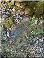
It is listed as Canmore ID 30663, which records in 1883, "Traditionally the grave of a suicide, or perhaps the victim of a murder; according to Hunter, that of Macbeth. The tumulus when examined, however, proved to be a 'druidical stone' that had toppled over. Nothing was found to support these traditions."
In 1969, a further report in the Canmore record says: "This grave is marked by a stone slab, 0.5m wide and 1.8m long, lying flush with the ground on the grass-verge of the road and with the modern stone dyke over-riding one end. This stone is probably a 'grave slab' and not a "standing stone" which has toppled over. There is no evidence of a cairn or tumulus." By 1989, the stone could no longer be located.
The Northern Antiquarian (TNA) also features a page for this tomb - see their entry for Long Man’s Grave, Abernyte, Perthshire. TNA's page includes an image of the 1867 showing the grave's location, a brief archaeology & history and a photograph of the site. TNA add local folklore, which says: “the tradition of the district is that MacBeth, finding it impossible to escape from MacDuff, threw himself from the top of the (Dunsinane) Hill, was killed upon the rocks, and buried at the ‘Lang Man’s Grave’.”
You may be viewing yesterday's version of this page. To see the most up to date information please register for a free account.
 (PID:258015)")
 (PID:224684)")
 (PID:224682)")
Do not use the above information on other web sites or publications without permission of the contributor.
Nearby Images from Geograph Britain and Ireland:
©2023(licence)
©2023(licence)
©2012(licence)
©2006(licence)
©2010(licence)
The above images may not be of the site on this page, they are loaded from Geograph.
Please Submit an Image of this site or go out and take one for us!
Click here to see more info for this site
Nearby sites
Key: Red: member's photo, Blue: 3rd party photo, Yellow: other image, Green: no photo - please go there and take one, Grey: site destroyed
Download sites to:
KML (Google Earth)
GPX (GPS waypoints)
CSV (Garmin/Navman)
CSV (Excel)
To unlock full downloads you need to sign up as a Contributory Member. Otherwise downloads are limited to 50 sites.
Turn off the page maps and other distractions
Nearby sites listing. In the following links * = Image available
1.4km WSW 246° Bandirran* Stone Circle (NO20913099)
2.2km NW 317° Collace Pictish Stone* Class I Pictish Symbol Stone (NO20693319)
2.4km ENE 57° Stockmuir* Stone Circle (NO242328)
4.4km S 169° Fingask Castle* Standing Stone (Menhir) (NO22932716)
4.5km SSW 199° Beal Hill Stone Circle (NO206273)
4.8km S 172° Rait Farm Cup Marked Stone* Sculptured Stone (NO2275326773)
5.6km S 190° Kilspindie* Stone Circle (NO2112826053)
5.6km SE 134° Inchmartine House* Standing Stone (Menhir) (NO26152759)
6.1km NW 305° East Whitefield Stone Circle (NO17293514)
6.1km W 263° Brownies Knowe Stone Circle (NO16063092)
6.2km W 266° St. Martins* Stone Circle (NO160312)
6.2km W 270° Witches' Stone, St Martins* Standing Stone (Menhir) (NO15923160)
6.3km SSW 200° Evelick Hill Fort* Hillfort (NO199257)
6.5km ESE 107° Moncur Castle* Standing Stone (Menhir) (NO2836929520)
6.8km SW 224° Shien Hill* Round Cairn (NO1735926678)
7.0km NW 309° Gallowhill Wood* Stone Row / Alignment (NO16813604)
7.0km NW 309° Gallow Hill Wood* Rock Art (NO16803605)
7.0km E 95° Rossie Loupin-on Stane* Standing Stone (Menhir) (NO2917630741)
7.0km E 95° Rossie Priory Class II Pictish Symbol Stone (NO292308)
7.1km E 95° Rossie Mercat Cross 1746 Ancient Cross (NO2920830732)
7.1km WNW 298° Gallowhill Stone Circle (NO1635)
7.3km E 94° Falcon Stone* Standing Stone (Menhir) (NO295309)
7.3km NW 304° Moonshade Standing Stones (NO16153576)
7.5km W 279° Craigmakerran* Standing Stones (NO1477832850)
7.6km W 279° Wolfhill* Stone Circle (NO147328)
View more nearby sites and additional images


 We would like to know more about this location. Please feel free to add a brief description and any relevant information in your own language.
 Wir möchten mehr über diese Stätte erfahren. Bitte zögern Sie nicht, eine kurze Beschreibung und relevante Informationen in Deutsch hinzuzufügen.
 Nous aimerions en savoir encore un peu sur les lieux. S'il vous plaît n'hesitez pas à ajouter une courte description et tous les renseignements pertinents dans votre propre langue.
 Quisieramos informarnos un poco más de las lugares. No dude en añadir una breve descripción y otros datos relevantes en su propio idioma.