


<< Our Photo Pages >> St Madoes Stones - Stone Row / Alignment in Scotland in Perth and Kinross
Submitted by Nick on Tuesday, 05 November 2002 Page Views: 13856
Neolithic and Bronze AgeSite Name: St Madoes StonesCountry: Scotland County: Perth and Kinross Type: Stone Row / Alignment
Map Ref: NO197210 Landranger Map Number: 53
Latitude: 56.374453N Longitude: 3.301723W
Condition:
| 5 | Perfect |
| 4 | Almost Perfect |
| 3 | Reasonable but with some damage |
| 2 | Ruined but still recognisable as an ancient site |
| 1 | Pretty much destroyed, possibly visible as crop marks |
| 0 | No data. |
| -1 | Completely destroyed |
| 5 | Superb |
| 4 | Good |
| 3 | Ordinary |
| 2 | Not Good |
| 1 | Awful |
| 0 | No data. |
| 5 | Can be driven to, probably with disabled access |
| 4 | Short walk on a footpath |
| 3 | Requiring a bit more of a walk |
| 2 | A long walk |
| 1 | In the middle of nowhere, a nightmare to find |
| 0 | No data. |
| 5 | co-ordinates taken by GPS or official recorded co-ordinates |
| 4 | co-ordinates scaled from a detailed map |
| 3 | co-ordinates scaled from a bad map |
| 2 | co-ordinates of the nearest village |
| 1 | co-ordinates of the nearest town |
| 0 | no data |
Internal Links:
External Links:
")
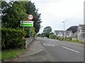
St. Madoes is reached from the A90 Perth - Dundee road, at the Glencarse turning. Head down the little main street and turn right at the sign for the school. These stones are now incorporated into a garden feature in the grounds of St. Madoes Primary School, in front of the main entrance.
Note: Permission MUST be obtained from the school for viewing - for obvious reasons.
You may be viewing yesterday's version of this page. To see the most up to date information please register for a free account.
")
Do not use the above information on other web sites or publications without permission of the contributor.
coldrum has found this location on Google Street View:
Nearby Images from Geograph Britain and Ireland:
©2016(licence)
©2010(licence)

©2014(licence)
©2010(licence)
©2005(licence)
The above images may not be of the site on this page, they are loaded from Geograph.
Please Submit an Image of this site or go out and take one for us!
Click here to see more info for this site
Nearby sites
Key: Red: member's photo, Blue: 3rd party photo, Yellow: other image, Green: no photo - please go there and take one, Grey: site destroyed
Download sites to:
KML (Google Earth)
GPX (GPS waypoints)
CSV (Garmin/Navman)
CSV (Excel)
To unlock full downloads you need to sign up as a Contributory Member. Otherwise downloads are limited to 50 sites.
![]()
Turn off the page maps and other distractions
Nearby sites listing. In the following links * = Image available
2.5km E 82° Grey Stone (St Madoes)* Standing Stone (Menhir) (NO22172131)
4.0km SE 134° Mugdrum Class III Pictish Cross Slab (NO22531819)
4.2km NNW 331° Commonbank SE Stone Circle (NO177247)
4.3km S 190° Abernethy Circle Stone Circle (NO189168)
4.4km NNW 329° Commonbank* Stone Row / Alignment (NO17502484)
4.4km NNW 329° Commonbank* Stone Circle (NO1748824837)
4.6km SE 128° Laing's Museum, Newburgh* Museum (NO233181)
4.7km S 188° Abernethy Symbol Stone* Class I Pictish Symbol Stone (NO18991638)
4.7km N 1° Evelick Hill Fort* Hillfort (NO199257)
5.0km S 189° Abernethy Den* Stone Circle (NO188161)
5.2km SE 144° Macduff's Cross* Early Christian Sculptured Stone (NO227167)
5.2km NNE 15° Kilspindie* Stone Circle (NO2112826053)
5.6km NNW 330° Arnbathie Fort* Hillfort (NO1703125894)
6.1km NNW 337° Shien Hill* Round Cairn (NO1735926678)
6.1km W 259° Moredun Top Hillfort (NO13621999)
6.2km WSW 253° Gask House Class II Pictish Symbol Stone (NO13661933)
6.2km WSW 253° Boar Stone* Class III Pictish Cross Slab (NO13661933)
6.3km WSW 254° Moncrieffe* Stone Circle (NO13601933)
6.4km N 7° Beal Hill Stone Circle (NO206273)
6.5km NNE 27° Rait Farm Cup Marked Stone* Sculptured Stone (NO2275326773)
6.6km W 259° Moncreiffe Hill* Hillfort (NO13131988)
6.7km WSW 254° Moncrieffe Timber Circle (NO132193)
6.9km NW 318° Murrayshall* Standing Stone (Menhir) (NO1519926265)
6.9km NNE 27° Fingask Castle* Standing Stone (Menhir) (NO22932716)
7.5km NW 326° Shianbank SE* Stone Circle (NO15562729)
View more nearby sites and additional images


 We would like to know more about this location. Please feel free to add a brief description and any relevant information in your own language.
 Wir möchten mehr über diese Stätte erfahren. Bitte zögern Sie nicht, eine kurze Beschreibung und relevante Informationen in Deutsch hinzuzufügen.
 Nous aimerions en savoir encore un peu sur les lieux. S'il vous plaît n'hesitez pas à ajouter une courte description et tous les renseignements pertinents dans votre propre langue.
 Quisieramos informarnos un poco más de las lugares. No dude en añadir una breve descripción y otros datos relevantes en su propio idioma.