Featured: Ark of Secrets - Neolithic spirit alive in the Middle Ages

Ark of Secrets - Neolithic spirit alive in the Middle Ages

Random Image


Emsen Ganggrab

The Illustrated Encyclopedia of Native American Indian Mounds

The Illustrated Encyclopedia of Native American Indian Mounds

Who's Online

There are currently, 292 guests and 2 members online.

You are a guest. To join in, please register for free by clicking here

Sponsors

<< Our Photo Pages >> East Cult - Stone Row / Alignment in Scotland in Perth and Kinross

Submitted by bigsweetie on Sunday, 22 June 2003  Page Views: 10085

Neolithic and Bronze AgeSite Name: East Cult Alternative Name: Standing Stone (Caputh)
Country: Scotland County: Perth and Kinross Type: Stone Row / Alignment
Nearest Town: Dunkeld  Nearest Village: Caputh
Map Ref: NO0722642159  Landranger Map Number: 52
Latitude: 56.562195N  Longitude: 3.511146W
Condition:
5Perfect
4Almost Perfect
3Reasonable but with some damage
2Ruined but still recognisable as an ancient site
1Pretty much destroyed, possibly visible as crop marks
0No data.
-1Completely destroyed
3 Ambience:
5Superb
4Good
3Ordinary
2Not Good
1Awful
0No data.
no data Access:
5Can be driven to, probably with disabled access
4Short walk on a footpath
3Requiring a bit more of a walk
2A long walk
1In the middle of nowhere, a nightmare to find
0No data.
no data Accuracy:
5co-ordinates taken by GPS or official recorded co-ordinates
4co-ordinates scaled from a detailed map
3co-ordinates scaled from a bad map
2co-ordinates of the nearest village
1co-ordinates of the nearest town
0no data
5

Internal Links:
External Links:

I have visited· I would like to visit

SolarMegalith would like to visit

SandyG visited on 18th Nov 2016 - their rating: Cond: 4 Amb: 4 Access: 4 Car parking near to the row may be available at East Cult Farm. Permission must however be sought at the farmhouse.
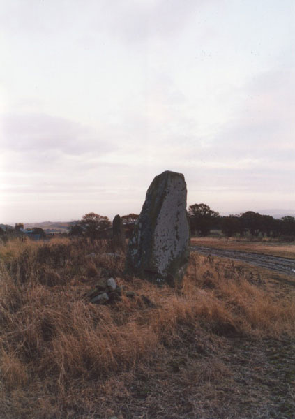
East Cult
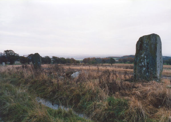
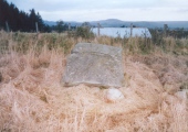
East Cult submitted by bigsweetie : East Cult standing stones NO 0725 4216 Perthshire (Vote or comment on this photo)
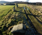
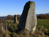
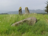
Stone row in Perthshire. Two stones stand in an alignment at this site, while one is prostrate.

Oher reports are of a circle diameter 75 feet having once existed here?

For more information see Canmore ID 27135 (stone circle, now destroyed or a denuded cairn, now removed) and Canmore ID 27127(Standing stones and cup marked stone).

Update October 2019: This alignment is featured on the Stone Rows of Great Britain website - see their entry for East Cult, which includes a description, a plan of the row with its cup marked stone, drawings of the row and the cup marked stone from Romilly Allen (1881), photographs of the alignment and the individual stones, access information and links to other online resources for more information.

The SRoGB also includes a section for 'A Landscape Reveal' which discusses and illustrates the distant Grampian Mountains which come into view when approaching the row from the south when approaching the row.
You may be viewing yesterday's version of this page. To see the most up to date information please register for a free account.
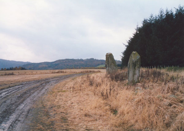

East Cult
East Cult submitted by bigsweetie : East Cult standing stones NO 0725 4216 Perthshire (Vote or comment on this photo)

East Cult
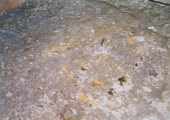
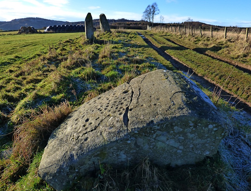
East Cult submitted by SandyG : The cup-marked stone. View from above and south (Scale 1m). 18 November 2016. (Vote or comment on this photo)

East Cult
East Cult submitted by SandyG : Looking west along the row. 18 November 2016. (Vote or comment on this photo)

East Cult
East Cult submitted by bigsweetie : East Cult standing stones NO 0725 4216 Perthshire (Vote or comment on this photo)

East Cult
East Cult submitted by bigsweetie (Vote or comment on this photo)

East Cult
East Cult submitted by bigsweetie

East Cult
East Cult submitted by bigsweetie

East Cult
East Cult submitted by bigsweetie

East Cult
East Cult submitted by bigsweetie

East Cult
East Cult submitted by bigsweetie

East Cult
East Cult submitted by bigsweetie

East Cult
East Cult submitted by SandyG : View from above and east (Scale 1m). 18 November 2016.

East Cult
East Cult submitted by SandyG : Looking east along the row (Scale 1m). 18 November 2016.

East Cult
East Cult submitted by cosmic : East Cult row from East

East Cult
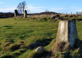
East Cult submitted by SandyG : A triangulation pillar was erected next to the stone row. 18 November 2016.

East Cult
East Cult submitted by SandyG : View from above and east (Scale 1m). 18 November 2016.

East Cult
East Cult submitted by cosmic : West stone from South.

East Cult
East Cult submitted by cosmic : West stone from NE

East Cult
East Cult submitted by cosmic : East Cult Row on horizon

East Cult
East Cult submitted by cosmic : The middle stone

East Cult
East Cult submitted by cosmic : Cults row from West

East Cult
East Cult submitted by cosmic : Cup marks on the right hand side.

East Cult
East Cult submitted by bigsweetie : East Cult standing stones NO 0725 4216 Perthshire

East Cult
East Cult submitted by bigsweetie

These are just the first 25 photos of East Cult. If you log in with a free user account you will be able to see our entire collection.

Do not use the above information on other web sites or publications without permission of the contributor.
Click here to see more info for this site

Nearby sites

Click here to view sites on an interactive OS map

Key: Red: member's photo, Blue: 3rd party photo, Yellow: other image, Green: no photo - please go there and take one, Grey: site destroyed

Download sites to:
KML (Google Earth)
GPX (GPS waypoints)
CSV (Garmin/Navman)
CSV (Excel)

To unlock full downloads you need to sign up as a Contributory Member. Otherwise downloads are limited to 50 sites.

Stone Rows of Great Britain by Sandy Gerrard


Turn off the page maps and other distractions

Nearby sites listing. In the following links * = Image available
 1.5km NNE 12° Ninewells* Cairn (NO07574360)
 2.6km S 183° Murthly Castle Standing Stone (Menhir) (NO07053956)
 2.8km ESE 106° Glendelvine House Standing Stone (Menhir) (NO09954130)
 2.9km WSW 247° Newtyle* Standing Stones (NO0449241062)
 4.5km SSW 210° Staredam Standing Stones* Standing Stones (NO049383)
 4.7km SE 139° Murthly* Stone Circle (NO10273852)
 4.8km SSW 206° Muirheadston Stone Circle (NO05053790)
 4.8km W 274° Dunkeld Cathedral Sculptured Stone* Early Christian Sculptured Stone (NO024426)
 5.5km SSW 212° Witch's Stone* Standing Stone (Menhir) (NO042375)
 5.8km W 277° Dunkeld Park* Standing Stone (Menhir) (NO0142642993)
 6.3km W 277° King's Seat Hillfort (NO00934303)
 6.3km SW 230° Craig Obney Vitrified Fort (NO02243822)
 6.8km E 93° Tower of Lethendy Class III Pictish Cross Slab (NO140417)
 6.9km NNW 339° Sancta Crux Well* Holy Well or Sacred Spring (NO049487)
 7.0km NE 39° Muir of Gormach Stone Circle (NO11734751)
 7.1km E 82° Aikenhead Farm (Blairgowrie) Rock Art (NO143430)
 7.3km ENE 67° Kinloch Cairn* Cairn (NO14074485)
 7.6km NNE 14° Sheriffmuir Cairn (NO09244949)
 7.9km S 191° Pitsundry* Stone Circle (NO0558834454)
 8.4km SW 224° Tullybeagles* Stone Circle (NO013362)
 8.5km E 97° Caputh Cursus Cursus (NO15664088)
 8.9km ENE 78° Ardblair* Stone Circle (NO1598943883)
 8.9km ESE 106° The Tron* Modern Stone Circle etc (NO1575439489)
 9.1km S 177° Loak Stone Standing Stone (Menhir) (NO07573305)
 9.2km S 176° Loak Court Hill Round Barrow(s) (NO07733301)
View more nearby sites and additional images

<< Rhos y Clegyrn

Bant's Carn >>

Please add your thoughts on this site

Stone Circles CD-ROM now £10+p&p

Stone Circles CD-ROM now £10+p&p

Web Links for East Cult

Stone Rows of Great Britain by Sandy Gerrard

Sponsors

Auto-Translation (Google)

Translate from English into:

"East Cult" | Login/Create an Account | 5 News and Comments
  
Go back to top of page    Comments are owned by the poster. We aren't responsible for their content.
East Cult Cupmarked Standing Stones, Perthshire by Andy B on Thursday, 20 April 2017
(User Info | Send a Message)
A write up from Douglas Scott, author of Watchers of the Dawn (PDF)

https://watchersofthedawn.files.wordpress.com/2017/03/east-cult-cupmarked-standing-stones-perthshire.pdf

More at https://watchersofthedawn.wordpress.com/
[ Reply to This ]

East Cult - cupmarks by cosmic on Friday, 30 June 2006
(User Info | Send a Message)
See Coles in Proceedings Society of Antiquaries 1908 P151
[ Reply to This ]

East Cult - directions by BigSweetie on Saturday, 21 June 2003
(User Info | Send a Message)
Take the A9 N from Perth (sign-posted Inverness), turning off at Luncarty onto the B9099. Follow this road through Luncarty, Stanley, then Murthly, crossing the Tay before entering Caputh. Continue on through Caputh until you reach the T-junction with the A984. Turn right onto this road, and after about 1.5km turn left opposite Glendelvine Primary School for Clunie.

Approximately 2km up this road is a farm track to the left (no sign), opposite the drive for Craigend farm on the right side of the road, and approximately 200m before the drive for Snaigow House. Turn onto the track, which is quite rough and can be muddy, but should be suitable for most cars, following the line of trees on your right.

After a short-distance you will find another farm track joining with a T-junction. Turn left, and follow the track for approximately 1.5km, where there is the first road up to the right. This is the road up to East Cult farm, which is surfaced in places, but please park sensibly at the bottom and walk up to the farm to ask permission. Approaching the farm, you will see the stones to your left. There is a track which passes the farmhouse and runs along the edge of a field to the stones.
[ Reply to This ]

Re: East Cult by BigSweetie on Saturday, 21 June 2003
(User Info | Send a Message)
The East Cult stones stand proud on a high ridge above the River Tay that extends E from Dunkeld. Aligned E-W, the two huge standing stones are approximately 9.0m apart, while a similar distance to the E is a third prostrate stone, profusely decorated with cup-marks. In 1986 the RCAHMS counted some 130 cup-marks and a dumb-bell on the upper face, and a further 3 cup-marks on the E face. However, weathering has taken its toll since, and it's difficult to make out so many today. Field clearance or possibly cairn material is scattered around the stones.

The prostrate stone may originally have stood upright, and if it did, Coles suggests that the stones may have been part of a circle with a diameter of 78' (24m). But considering their E-W alignment, I believe the stones are unlikely to have ever formed part of a circle. However, in the Old Statistical Account, and repeated in the New, the site is described like this:

"About a mile and a half north-west from the church, in a very elevated situation, there is a small Druidical circle. Beside it are two large stones, deeply sunk in the ground; the top of the lowest is artificially formed into an inclined plane, facing the south, and contains a number of small cavities; which may have been used by the Druids in the performance of religious rites."

This makes me think that perhaps the cairn mentioned by the RCAHMS as being 185m S of the standing stones, and which was removed before 1865 for building material, could in fact have been the site of the "small Druidical circle." If the Statistical Accounts are accurate, then one of the three stones now at East Cult may have been moved from its original position as part of the circle, and the remaining two been outliers for the circle to the S.
[ Reply to This ]
    Re: East Cult by Anonymous on Monday, 20 June 2005
    The scattered field stones you refer to in your description of the site have now been removed - under the supervision of Historic Scotland. We are aiming to keep the ground immediately to the south of the stones uncultivated so the stones can be viewed more easily.

    Anji Styles & Mike Chalmers - current owners of East Cult Farm.

    A very interesting website!
    [ Reply to This ]

Your Name: Anonymous [ Register Now ]
Subject:


Add your comment or contribution to this page. Spam or offensive posts are deleted immediately, don't even bother

<<< What is five plus one as a number? (Please type the answer to this question in the little box on the left)
You can also embed videos and other things. For Youtube please copy and paste the 'embed code'.
For Google Street View please include Street View in the text.
Create a web link like this: <a href="https://www.megalithic.co.uk">This is a link</a>  

Allowed HTML is:
<p> <b> <i> <a> <img> <em> <br> <strong> <blockquote> <tt> <li> <ol> <ul> <object> <param> <embed> <iframe>

We would like to know more about this location. Please feel free to add a brief description and any relevant information in your own language.
Wir möchten mehr über diese Stätte erfahren. Bitte zögern Sie nicht, eine kurze Beschreibung und relevante Informationen in Deutsch hinzuzufügen.
Nous aimerions en savoir encore un peu sur les lieux. S'il vous plaît n'hesitez pas à ajouter une courte description et tous les renseignements pertinents dans votre propre langue.
Quisieramos informarnos un poco más de las lugares. No dude en añadir una breve descripción y otros datos relevantes en su propio idioma.