


<< Our Photo Pages >> Collace Pictish Stone - Class I Pictish Symbol Stone in Scotland in South Ayrshire
Submitted by cosmic on Sunday, 28 August 2005 Page Views: 10693
Early Medieval (Dark Age)Site Name: Collace Pictish Stone Alternative Name: FairygreenCountry: Scotland County: South Ayrshire Type: Class I Pictish Symbol Stone
Nearest Town: Coupar Angus
Map Ref: NO20693319
Latitude: 56.484108N Longitude: 3.2894W
Condition:
| 5 | Perfect |
| 4 | Almost Perfect |
| 3 | Reasonable but with some damage |
| 2 | Ruined but still recognisable as an ancient site |
| 1 | Pretty much destroyed, possibly visible as crop marks |
| 0 | No data. |
| -1 | Completely destroyed |
| 5 | Superb |
| 4 | Good |
| 3 | Ordinary |
| 2 | Not Good |
| 1 | Awful |
| 0 | No data. |
| 5 | Can be driven to, probably with disabled access |
| 4 | Short walk on a footpath |
| 3 | Requiring a bit more of a walk |
| 2 | A long walk |
| 1 | In the middle of nowhere, a nightmare to find |
| 0 | No data. |
| 5 | co-ordinates taken by GPS or official recorded co-ordinates |
| 4 | co-ordinates scaled from a detailed map |
| 3 | co-ordinates scaled from a bad map |
| 2 | co-ordinates of the nearest village |
| 1 | co-ordinates of the nearest town |
| 0 | no data |
Be the first person to rate this site - see the 'Contribute!' box in the right hand menu.
Internal Links:
External Links:
")
This Pictish Stone was found in 1948 on Fairygreen Farm but presented to the Marischal Museum in Aberdeen in 1962.
It shows a tuning-fork and elephant with mirror-and-comb below.
You may be viewing yesterday's version of this page. To see the most up to date information please register for a free account.
Do not use the above information on other web sites or publications without permission of the contributor.
Nearby Images from Geograph Britain and Ireland:
©2013(licence)
©2011(licence)
©2017(licence)
©2011(licence)
©2006(licence)
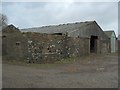
The above images may not be of the site on this page, they are loaded from Geograph.
Please Submit an Image of this site or go out and take one for us!
Click here to see more info for this site
Nearby sites
Key: Red: member's photo, Blue: 3rd party photo, Yellow: other image, Green: no photo - please go there and take one, Grey: site destroyed
Download sites to:
KML (Google Earth)
GPX (GPS waypoints)
CSV (Garmin/Navman)
CSV (Excel)
To unlock full downloads you need to sign up as a Contributory Member. Otherwise downloads are limited to 50 sites.
Turn off the page maps and other distractions
Nearby sites listing. In the following links * = Image available
2.2km S 173° Bandirran* Stone Circle (NO20913099)
2.2km SE 137° Long Man's Grave (Abernyte)* Marker Stone (NO22183153)
3.5km E 95° Stockmuir* Stone Circle (NO242328)
3.9km WNW 299° East Whitefield Stone Circle (NO17293514)
4.8km NW 305° Gallowhill Wood* Stone Row / Alignment (NO16813604)
4.8km NW 305° Gallow Hill Wood* Rock Art (NO16803605)
5.0km WNW 290° Gallowhill Stone Circle (NO1635)
5.0km WSW 250° Witches' Stone, St Martins* Standing Stone (Menhir) (NO15923160)
5.1km WSW 246° St. Martins* Stone Circle (NO160312)
5.1km WSW 243° Brownies Knowe Stone Circle (NO16063092)
5.2km WNW 298° Moonshade Standing Stones (NO16153576)
5.5km WNW 295° Hangie's Stone Standing Stone (Menhir) (NO15753557)
5.9km S 180° Beal Hill Stone Circle (NO206273)
5.9km W 266° Craigmakerran* Standing Stones (NO1477832850)
6.0km W 265° Wolfhill* Stone Circle (NO147328)
6.4km SSE 159° Fingask Castle* Standing Stone (Menhir) (NO22932716)
6.6km WSW 250° Tammieteeth* Cairn (NO14403109)
6.6km NNE 27° Kettins Burn* Class II Pictish Symbol Stone (NO23783906)
6.6km WNW 296° Cargill Symbol Stone Class I Pictish Symbol Stone (NO14773623)
6.7km WSW 256° Blackfaulds* Stone Circle (NO14133167)
6.7km SSE 161° Rait Farm Cup Marked Stone* Sculptured Stone (NO2275326773)
7.1km NW 317° Meikleour Natural Stone / Erratic / Other Natural Feature (NO15993849)
7.1km S 175° Kilspindie* Stone Circle (NO2112826053)
7.2km WSW 251° Williamston Stone Circle (NO138310)
7.3km SSW 206° Shien Hill* Round Cairn (NO1735926678)
View more nearby sites and additional images


 We would like to know more about this location. Please feel free to add a brief description and any relevant information in your own language.
 Wir möchten mehr über diese Stätte erfahren. Bitte zögern Sie nicht, eine kurze Beschreibung und relevante Informationen in Deutsch hinzuzufügen.
 Nous aimerions en savoir encore un peu sur les lieux. S'il vous plaît n'hesitez pas à ajouter une courte description et tous les renseignements pertinents dans votre propre langue.
 Quisieramos informarnos un poco más de las lugares. No dude en añadir una breve descripción y otros datos relevantes en su propio idioma.