


<< Our Photo Pages >> Appin of Dull - Rock Art in Scotland in Perth and Kinross
Submitted by Andy B on Tuesday, 14 June 2011 Page Views: 6990
Rock ArtSite Name: Appin of DullCountry: Scotland
NOTE: This site is 0.9 km away from the location you searched for.
County: Perth and Kinross Type: Rock Art
Map Ref: NN803491
Latitude: 56.618420N Longitude: 3.95222W
Condition:
| 5 | Perfect |
| 4 | Almost Perfect |
| 3 | Reasonable but with some damage |
| 2 | Ruined but still recognisable as an ancient site |
| 1 | Pretty much destroyed, possibly visible as crop marks |
| 0 | No data. |
| -1 | Completely destroyed |
| 5 | Superb |
| 4 | Good |
| 3 | Ordinary |
| 2 | Not Good |
| 1 | Awful |
| 0 | No data. |
| 5 | Can be driven to, probably with disabled access |
| 4 | Short walk on a footpath |
| 3 | Requiring a bit more of a walk |
| 2 | A long walk |
| 1 | In the middle of nowhere, a nightmare to find |
| 0 | No data. |
| 5 | co-ordinates taken by GPS or official recorded co-ordinates |
| 4 | co-ordinates scaled from a detailed map |
| 3 | co-ordinates scaled from a bad map |
| 2 | co-ordinates of the nearest village |
| 1 | co-ordinates of the nearest town |
| 0 | no data |
Internal Links:
External Links:
")
In the field adjacent to Dull chapel, the OS notes the existence of cup marked rocks. There are a few, and some of the positions are interesting, as they appear to point towards the circles at Carse Farm 1 & 2. A bit of fun for those who like to draw connections!
Big Sweetie, Scotty and I visited, and had a good hunt about. Scotty found the stone with two cup marks (pictured top). Standing on a large natural outcrop in the NE corner of the field, this stone lined up nicely with Carse Farm 1. The second cup marked stone (lower picture) forms a line which, when extended runs from the site of the chapel down to Carse Farm 2 four poster. There are supposed to be cup marked rocks in the western corner of the field, but we couldn't find them - many of these rocks are covered in moss and turf.
More at Perthshire Stones
You may be viewing yesterday's version of this page. To see the most up to date information please register for a free account.
")
Do not use the above information on other web sites or publications without permission of the contributor.
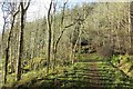
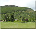
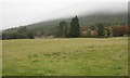
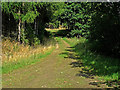
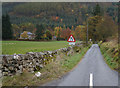
Nearby Images from Geograph Britain and Ireland:
©2014(licence)
©2011(licence)
©2018(licence)
©2009(licence)
©2014(licence)
The above images may not be of the site on this page, they are loaded from Geograph.
Please Submit an Image of this site or go out and take one for us!
Click here to see more info for this site
Nearby sites
Key: Red: member's photo, Blue: 3rd party photo, Yellow: other image, Green: no photo - please go there and take one, Grey: site destroyed
Download sites to:
KML (Google Earth)
GPX (GPS waypoints)
CSV (Garmin/Navman)
CSV (Excel)
To unlock full downloads you need to sign up as a Contributory Member. Otherwise downloads are limited to 50 sites.
Turn off the page maps and other distractions
Nearby sites listing. In the following links * = Image available
378m S 191° Carse Farm I* Stone Circle (NN80224873)
406m E 83° Dull Cross (Aberfeldy) Ancient Cross (NN8070649135)
508m E 100° Dull Cairn* Cairn (NN808490)
640m S 180° Carse Farm 2* Stone Circle (NN80284846)
859m SW 214° Tirinie Farm Barrow Round Barrow(s) (NN798484)
920m SW 219° Tirinie Farm Circle Stone Circle (NN797484)
989m E 85° Nether Tullicro* Standing Stone (Menhir) (NN81294916)
1.4km S 186° Taymouth (2) Standing Stones (NN801477)
1.9km SSW 194° Croft Moraig* Stone Circle (NN79774727)
1.9km SSW 195° Croft Moraig Carving 1 Rock Art (NN7974647251)
2.0km SSE 167° St Adamnan's Well* Holy Well or Sacred Spring (NN807471)
2.0km NE 48° Lurgan* Rock Art (NN8185550425)
2.1km E 84° Balhomais* Stone Circle (NN82384926)
2.5km SW 220° An Tobar* Holy Well or Sacred Spring (NN786472)
2.6km SSW 201° Taymouth (1)* Standing Stones (NN793467)
2.7km E 82° Weem Cursus Cursus (NN83044939)
2.8km SSW 213° Comrie Bridge Stone Circle (NN787468)
3.9km ENE 76° Weem Woods (Dull)* Rock Art (NN841499)
4.1km ENE 76° St David's Well (Perth and Kinross)* Holy Well or Sacred Spring (NN84274999)
4.2km SSE 164° Craig Hill* Rock Art (NN81334506)
4.2km SSW 195° Tombuie Cottage* Rock Art (NN791451)
4.7km ESE 111° An Torr* Rock Art (NN84694729)
4.9km ESE 119° Coilleachur Stone Circle (NN845466)
5.0km SW 215° Spar Island* Crannog (NN773451)
5.1km ENE 59° Glassie Standing Stone* Standing Stone (Menhir) (NN84715160)
View more nearby sites and additional images

 We would like to know more about this location. Please feel free to add a brief description and any relevant information in your own language.
 Wir möchten mehr über diese Stätte erfahren. Bitte zögern Sie nicht, eine kurze Beschreibung und relevante Informationen in Deutsch hinzuzufügen.
 Nous aimerions en savoir encore un peu sur les lieux. S'il vous plaît n'hesitez pas à ajouter une courte description et tous les renseignements pertinents dans votre propre langue.
 Quisieramos informarnos un poco más de las lugares. No dude en añadir una breve descripción y otros datos relevantes en su propio idioma.