


Dunruchan C (Muthill)
Submitted by Anne T on Wednesday, 06 September 2017 Page Views: 2163
Neolithic and Bronze AgeSite Name: Dunruchan C (Muthill) Alternative Name: Aodann Mhor; Cornoch; Shillinghill; CraigneichCountry: Scotland County: Perth and Kinross Type: Standing Stone (Menhir)
Nearest Village: Muthill
Map Ref: NN7910817137
Latitude: 56.331128N Longitude: 3.956804W
Condition:
| 5 | Perfect |
| 4 | Almost Perfect |
| 3 | Reasonable but with some damage |
| 2 | Ruined but still recognisable as an ancient site |
| 1 | Pretty much destroyed, possibly visible as crop marks |
| 0 | No data. |
| -1 | Completely destroyed |
| 5 | Superb |
| 4 | Good |
| 3 | Ordinary |
| 2 | Not Good |
| 1 | Awful |
| 0 | No data. |
| 5 | Can be driven to, probably with disabled access |
| 4 | Short walk on a footpath |
| 3 | Requiring a bit more of a walk |
| 2 | A long walk |
| 1 | In the middle of nowhere, a nightmare to find |
| 0 | No data. |
| 5 | co-ordinates taken by GPS or official recorded co-ordinates |
| 4 | co-ordinates scaled from a detailed map |
| 3 | co-ordinates scaled from a bad map |
| 2 | co-ordinates of the nearest village |
| 1 | co-ordinates of the nearest town |
| 0 | no data |
Be the first person to rate this site - see the 'Contribute!' box in the right hand menu.
Internal Links:


External Links:


I have visited· I would like to visit
Uralsdaughter visited on 22nd Aug 2018
SandyG visited on 5th May 2016 Car parking is available at NN 78036 15154.
Log in or create a free account to see how our visitors rate this site for condition, ambience and access, and to record your own visits.

The Northern Antiquarian (TNA) also features a page for this stone, see their entry for Dunruchan ‘C’ Standing Stone, Muthill, Perthshire, which gives directions for finding the site together with photographs, a brief archaeology & history and a 1911 drawing of the stone.
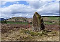
TNA include the following description of this stone by Cole: "This huge block…rugged and irregular…makes, from the extraordinary angle at which it leans over southwards, a surprisingly picturesque object amid the heather and the various small boulders that lie scattered about in its vicinity. Of oblong basal section, the Stone tapers sharply up to a small narrow edge, which is at present 9 feet 4 inches in vertical height above the grassy ledge surrounding the base. In girth it measures over 17 feet, and the slope of its upper surface is over 12 feet in length. Intervening undulations in the moorland prevent one seeing the two Stones which stand farther down south-wards. The main axis of its base is N. 18° W. by S. 18° E."
Note: Have you visited this site? Do you have any photographs or comments to add?
You may be viewing yesterday's version of this page. To see the most up to date information please register for a free account.
Do not use the above information on other web sites or publications without permission of the contributor.
Nearby Images from Geograph Britain and Ireland:
©2018(licence)
©2014(licence)
©2014(licence)

©2019(licence)

©2014(licence)
The above images may not be of the site on this page, they are loaded from Geograph.
Please Submit an Image of this site or go out and take one for us!
Click here to see more info for this site
Log in or create a free account to see nearby ancient sites our visitors rate highly
All Nearby sites
 Click here to view sites on an interactive OS map
Download sites to:
KML (Google Earth)
GPX (GPS waypoints)
CSV (Garmin/Navman)
CSV (Excel)
To unlock full downloads you need to sign up as a Society Member. Otherwise downloads are limited to 50 sites.
Turn off the page maps and other distractions
Nearby sites listing. In the following links * = Image available
264m SSW 192° Dunruchan D (Muthill)* Standing Stone (Menhir) (NN7904416881)
336m SSW 198° Dunruchan E (Muthill)* Standing Stone (Menhir) (NN7899716819)
413m SSW 201° Craigneich Stones* Standing Stones (NN7894816756)
743m N 7° Craigneich Farm* Standing Stone (Menhir) (NN7922617871)
790m NW 306° Giant's Knowe (Culloch) Cairn (NN78481762)
2.5km N 350° Auchingarrich Farm Standing Stone (Menhir) (NN78731958)
3.3km ESE 106° Dalchirla North (Muthill) Standing Stone (Menhir) (NN8227416125)
3.6km ESE 109° Dalchirla East (Muthill) Standing Stones (NN8244615893)
3.7km NNW 332° Comrie Cursus Cursus (NN77422047)
3.8km NNW 329° Comrie Cursus Cursus (NN77252048)
3.9km NNW 333° West Cowden* Stone Row / Alignment (NN7744520645)
4.3km NNW 344° Dalginross* Stone Circle (NN7802521264)
4.5km NW 320° Craggish Stone Row / Alignment (NN763207)
4.6km NE 36° Strowan (Crieff)* Cairn (NN819208)
4.8km NW 324° Comrie Cursus Cursus (NN76422112)
5.1km NW 325° Craggish (Comrie) Standing Stones (NN763214)
5.3km NNW 335° Tom na Chessaig Stone Circle (NN770220)
5.5km NNW 342° Coney Hill (Comrie)* Misc. Earthwork (NN77552238)
5.6km N 9° Lawers* Standing Stone (Menhir) (NN80102267)
5.9km SE 137° Cairn Wochel Long Barrow (NN83011276)
5.9km NNE 33° Samson's Stone Standing Stone (Menhir) (NN82512202)
6.1km NE 54° Rottenreoch Chambered Cairn (NN842206)
6.4km NNE 18° Clathick House Standing Stone (Menhir) (NN81212315)
6.4km NW 324° Tullybannocher* Stone Circle (NN75482247)
6.8km ENE 68° Concraig* Standing Stone (Menhir) (NN8548419503)
View more nearby sites and additional images

 We would like to know more about this location. Please feel free to add a brief description and any relevant information in your own language.
 Wir möchten mehr über diese Stätte erfahren. Bitte zögern Sie nicht, eine kurze Beschreibung und relevante Informationen in Deutsch hinzuzufügen.
 Nous aimerions en savoir encore un peu sur les lieux. S'il vous plaît n'hesitez pas à ajouter une courte description et tous les renseignements pertinents dans votre propre langue.
 Quisieramos informarnos un poco más de las lugares. No dude en añadir una breve descripción y otros datos relevantes en su propio idioma.