


<< Text Pages >> River Balgy (Shieldaig) - Standing Stone (Menhir) in Scotland in Highlands
Submitted by Anne T on Thursday, 04 January 2018 Page Views: 2816
Neolithic and Bronze AgeSite Name: River Balgy (Shieldaig)Country: Scotland
NOTE: This site is 5.0 km away from the location you searched for.
County: Highlands Type: Standing Stone (Menhir)
Nearest Village: Balgy
Map Ref: NG849533
Latitude: 57.518604N Longitude: 5.593508W
Condition:
| 5 | Perfect |
| 4 | Almost Perfect |
| 3 | Reasonable but with some damage |
| 2 | Ruined but still recognisable as an ancient site |
| 1 | Pretty much destroyed, possibly visible as crop marks |
| 0 | No data. |
| -1 | Completely destroyed |
| 5 | Superb |
| 4 | Good |
| 3 | Ordinary |
| 2 | Not Good |
| 1 | Awful |
| 0 | No data. |
| 5 | Can be driven to, probably with disabled access |
| 4 | Short walk on a footpath |
| 3 | Requiring a bit more of a walk |
| 2 | A long walk |
| 1 | In the middle of nowhere, a nightmare to find |
| 0 | No data. |
| 5 | co-ordinates taken by GPS or official recorded co-ordinates |
| 4 | co-ordinates scaled from a detailed map |
| 3 | co-ordinates scaled from a bad map |
| 2 | co-ordinates of the nearest village |
| 1 | co-ordinates of the nearest town |
| 0 | no data |
Be the first person to rate this site - see the 'Contribute!' box in the right hand menu.
Internal Links:
External Links:
I have visited· I would like to visit
SumDoood would like to visit
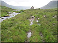
Sited between Loch Damh and Upper Loch Torridon, the Northern Antiquarian (TNA) features a page for this standing stone - see their entry for River Balgy, Shieldaig, Ross & Cromarty.
TNA gives directions for finding this stone, found in the 1980s, together with a photograph. TNA tells us: "This is a small but chunky standing stone was rediscovered by Dr J. Havelock Fidler in the 1980s. Less than four-feet tall, it stands alone at the edge of the boggy landscape, with superb views all around ... There are other human remains scattered amidst the rocky landscape close by, including the remains of old buildings not far away, but this prehistoric monolith seems to be an isolated example. However, the landscape here is so vast that it’s highly likely that other standing stones remain hidden in these ancient mythic hills…"
Note: Have you visited this site? Do you have any photographs or information to add?
You may be viewing yesterday's version of this page. To see the most up to date information please register for a free account.
Do not use the above information on other web sites or publications without permission of the contributor.
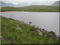
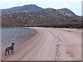
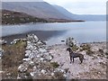
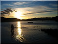
Nearby Images from Geograph Britain and Ireland:
©2015(licence)
©2015(licence)
©2015(licence)
©2008(licence)
©2015(licence)
The above images may not be of the site on this page, they are loaded from Geograph.
Please Submit an Image of this site or go out and take one for us!
Click here to see more info for this site
Nearby sites
Key: Red: member's photo, Blue: 3rd party photo, Yellow: other image, Green: no photo - please go there and take one, Grey: site destroyed
Download sites to:
KML (Google Earth)
GPX (GPS waypoints)
CSV (Garmin/Navman)
CSV (Excel)
To unlock full downloads you need to sign up as a Contributory Member. Otherwise downloads are limited to 50 sites.
Turn off the page maps and other distractions
Nearby sites listing. In the following links * = Image available
3.6km WNW 287° Rhu na Bidh* Standing Stone (Menhir) (NG81505455)
12.9km S 183° Lag An Duin Broch or Nuraghe (NG83624044)
16.7km SW 233° Applecross* Stone Circle (NG7144)
17.4km SW 231° Torr Mor (Applecross) Ancient Village or Settlement (NG70764313)
20.1km SW 220° Toscaig (Applecross) Standing Stones (NG712385)
20.6km ENE 60° Tobar Mhoire* Holy Well or Sacred Spring (NH033628)
20.7km NNE 20° Isle Maree* Holy Well or Sacred Spring (NG93107236)
22.0km S 185° Carn na Sean-chreige* Hillfort (NG81893146)
22.6km NNW 345° An Dun (Gairloch)* Stone Fort or Dun (NG802754)
22.6km S 186° Loch Achaidh na h-Inich* Crannog (NG81173095)
23.8km S 177° Gleann Udalain Cairn Cairn (NG85092942)
24.1km NNW 346° Gairloch Class I Pictish Symbol Stone (NG80357699)
25.5km S 177° Dun Gleann Udalain Stone Fort or Dun (NG85062773)
25.7km S 182° Dun Kirkton Stone Fort or Dun (NG82722768)
25.8km SSE 166° Bard's Castle* Hillfort (NG89822790)
25.9km S 181° Angels' Hill, Kirkton* Hillfort (NG83142745)
25.9km S 181° Lochalsh* Stone Circle (NG831274)
26.0km SSE 155° Camas Luinie* Rock Art (NG94492909)
26.8km SSE 154° Faddoch* Rock Art (NG95452863)
27.6km N 359° Inverewe* Class I Pictish Symbol Stone (NG860809)
27.6km E 85° Fuaran A'Ghille* Modern Stone Circle etc (NH1261454317)
28.0km S 172° Totaig Cup Markings* Rock Art (NG87432536)
28.0km S 173° Dun Totaig (Loch Duich) Broch or Nuraghe (NG868253)
28.2km SSW 201° Sligeanach Kildonan Stone Row / Alignment (NG735275)
28.2km S 173° Caisteal Grugaig* Broch or Nuraghe (NG86692508)
View more nearby sites and additional images


 We would like to know more about this location. Please feel free to add a brief description and any relevant information in your own language.
 Wir möchten mehr über diese Stätte erfahren. Bitte zögern Sie nicht, eine kurze Beschreibung und relevante Informationen in Deutsch hinzuzufügen.
 Nous aimerions en savoir encore un peu sur les lieux. S'il vous plaît n'hesitez pas à ajouter une courte description et tous les renseignements pertinents dans votre propre langue.
 Quisieramos informarnos un poco más de las lugares. No dude en añadir una breve descripción y otros datos relevantes en su propio idioma.