<< Our Photo Pages >> Steinbergholz ~ Norgaardholz - Barrow Cemetery in Germany in Schleswig-Holstein, Hamburg
Submitted by Nype on Saturday, 04 March 2017 Page Views: 792
Neolithic and Bronze AgeSite Name: Steinbergholz ~ NorgaardholzCountry: Germany
NOTE: This site is 6.388 km away from the location you searched for.
Land: Schleswig-Holstein, Hamburg Type: Barrow Cemetery
Nearest Town: Flensburg Nearest Village: Steinbergkirche
Latitude: 54.773609N Longitude: 9.802298E
Condition:
| 5 | Perfect |
| 4 | Almost Perfect |
| 3 | Reasonable but with some damage |
| 2 | Ruined but still recognisable as an ancient site |
| 1 | Pretty much destroyed, possibly visible as crop marks |
| 0 | No data. |
| -1 | Completely destroyed |
| 5 | Superb |
| 4 | Good |
| 3 | Ordinary |
| 2 | Not Good |
| 1 | Awful |
| 0 | No data. |
| 5 | Can be driven to, probably with disabled access |
| 4 | Short walk on a footpath |
| 3 | Requiring a bit more of a walk |
| 2 | A long walk |
| 1 | In the middle of nowhere, a nightmare to find |
| 0 | No data. |
| 5 | co-ordinates taken by GPS or official recorded co-ordinates |
| 4 | co-ordinates scaled from a detailed map |
| 3 | co-ordinates scaled from a bad map |
| 2 | co-ordinates of the nearest village |
| 1 | co-ordinates of the nearest town |
| 0 | no data |
Internal Links:
External Links:
")
A tiny forest that holds a small group of barrows.
Near the Baltic Sea.
Houses around and directly at road. No further informations.
You may be viewing yesterday's version of this page. To see the most up to date information please register for a free account.
")
")
Do not use the above information on other web sites or publications without permission of the contributor.
Nearby Images from Flickr
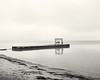
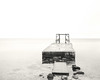
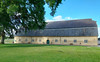
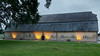
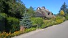
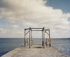
The above images may not be of the site on this page, but were taken nearby. They are loaded from Flickr so please click on them for image credits.
Click here to see more info for this site
Nearby sites
Click here to view sites on an interactive map of the areaKey: Red: member's photo, Blue: 3rd party photo, Yellow: other image, Green: no photo - please go there and take one, Grey: site destroyed
Download sites to:
KML (Google Earth)
GPX (GPS waypoints)
CSV (Garmin/Navman)
CSV (Excel)
To unlock full downloads you need to sign up as a Contributory Member. Otherwise downloads are limited to 50 sites.
Turn off the page maps and other distractions
Nearby sites listing. In the following links * = Image available
3.4km WNW 298° Philipsthal Langbett* Long Barrow
5.4km SE 126° Ohrfeld Riesenbett Long Barrow
7.1km SE 128° Lehbek Langbett* Long Barrow
9.0km E 92° Nieby Langbett* Long Barrow
9.1km NNW 341° Skelde Kobbelskov Megalitgrav* Burial Chamber or Dolmen
9.1km NNW 341° Skelde Kobbelskov Runddysse 1* Burial Chamber or Dolmen
9.1km NNW 341° Skelde Kobbelskov Langdysse 1* Long Barrow
9.1km NNW 341° Skelde Kobbelskov Langdysse 2* Long Barrow
9.6km NNW 343° Skelde Kobbelskov Langdysse 3* Long Barrow
9.7km NNW 341° Skelde Kobbelskov Runddysse 2* Burial Chamber or Dolmen
10.2km NNW 331° Skelde Overballe Langdysse* Long Barrow
10.2km S 180° Brarupholz* Barrow Cemetery
10.3km SSE 165° Gulde Thing Platz [Guly Thing]* Museum
11.0km SSE 147° Drülter Holz* Barrow Cemetery
11.1km ESE 114° Kronsgaard Dolmen* Burial Chamber or Dolmen
12.7km WNW 283° Ringsberg Steingrab* Burial Chamber or Dolmen
12.8km WNW 296° Siegum Langbett* Long Barrow
13.2km NNE 21° Kegnæs Grønmarkstenen* Natural Stone / Erratic / Other Natural Feature
13.3km N 11° Sønderborg Sønderskov 56 Rundhøj - Vonshøj* Round Barrow(s)
13.7km N 4° Sønderborg Sønderskov 472 Rundhøj - Hyggebjerg* Round Barrow(s)
13.8km N 6° Sønderborg Sønderskov 90 Rundhøj* Round Barrow(s)
13.8km N 11° Sønderborg Sønderskov 57-63 Rundhøjsklynge Helshøje* Barrow Cemetery
13.9km N 8° Sønderborg Sønderskov 85-87 and 89 Rundhøjsklynge Gubberhøje* Barrow Cemetery
13.9km SE 132° Buckhagen Findling* Natural Stone / Erratic / Other Natural Feature
13.9km N 11° Skålsten ved Helshøje i Sønderborg Sønderskov* Rock Art
View more nearby sites and additional images


 We would like to know more about this location. Please feel free to add a brief description and any relevant information in your own language.
 Wir möchten mehr über diese Stätte erfahren. Bitte zögern Sie nicht, eine kurze Beschreibung und relevante Informationen in Deutsch hinzuzufügen.
 Nous aimerions en savoir encore un peu sur les lieux. S'il vous plaît n'hesitez pas à ajouter une courte description et tous les renseignements pertinents dans votre propre langue.
 Quisieramos informarnos un poco más de las lugares. No dude en añadir una breve descripción y otros datos relevantes en su propio idioma.