<< Our Photo Pages >> Milis Pozzo Sacro - Holy Well or Sacred Spring in Italy in Sardinia (Sardegna)
Submitted by AlexHunger on Saturday, 25 March 2006 Page Views: 4515
Springs and Holy WellsSite Name: Milis Pozzo Sacro Alternative Name: Pozzo sacro MilisCountry: Italy
NOTE: This site is 1.649 km away from the location you searched for.
Region: Sardinia (Sardegna) Type: Holy Well or Sacred Spring
Nearest Town: Olbia Nearest Village: Golfo Aranci
Latitude: 40.995230N Longitude: 9.630890E
Condition:
| 5 | Perfect |
| 4 | Almost Perfect |
| 3 | Reasonable but with some damage |
| 2 | Ruined but still recognisable as an ancient site |
| 1 | Pretty much destroyed, possibly visible as crop marks |
| 0 | No data. |
| -1 | Completely destroyed |
| 5 | Superb |
| 4 | Good |
| 3 | Ordinary |
| 2 | Not Good |
| 1 | Awful |
| 0 | No data. |
| 5 | Can be driven to, probably with disabled access |
| 4 | Short walk on a footpath |
| 3 | Requiring a bit more of a walk |
| 2 | A long walk |
| 1 | In the middle of nowhere, a nightmare to find |
| 0 | No data. |
| 5 | co-ordinates taken by GPS or official recorded co-ordinates |
| 4 | co-ordinates scaled from a detailed map |
| 3 | co-ordinates scaled from a bad map |
| 2 | co-ordinates of the nearest village |
| 1 | co-ordinates of the nearest town |
| 0 | no data |
Internal Links:
External Links:
I have visited· I would like to visit
SolarMegalith visited on 11th Oct 2015 - their rating: Cond: 5 Amb: 2 Access: 5
")
Nuragic sacred well with an underground chamber.
Positional co-ordinates scaled from a map source.
You may be viewing yesterday's version of this page. To see the most up to date information please register for a free account.
")
")
")
")
Do not use the above information on other web sites or publications without permission of the contributor.
Nearby Images from Flickr
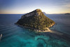
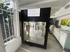
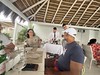

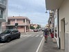
The above images may not be of the site on this page, but were taken nearby. They are loaded from Flickr so please click on them for image credits.
Click here to see more info for this site
Nearby sites
Click here to view sites on an interactive map of the areaKey: Red: member's photo, Blue: 3rd party photo, Yellow: other image, Green: no photo - please go there and take one, Grey: site destroyed
Download sites to:
KML (Google Earth)
GPX (GPS waypoints)
CSV (Garmin/Navman)
CSV (Excel)
To unlock full downloads you need to sign up as a Contributory Member. Otherwise downloads are limited to 50 sites.
Turn off the page maps and other distractions
Nearby sites listing. In the following links * = Image available
9.8km SW 227° Sa Testa Pozzo sacro* Holy Well or Sacred Spring
10.5km WSW 257° Campu Majore Dolmen Burial Chamber or Dolmen
10.6km WSW 254° Monte Conia Nuraghe Broch or Nuraghe
11.0km W 281° Cugnana Pozzo Sacro* Holy Well or Sacred Spring
11.1km WSW 245° Cabu Abbas Complesso Nuragico* Broch or Nuraghe
12.0km WSW 253° Nuragadena Nuraghe Broch or Nuraghe
12.6km WSW 256° Culatolzu Nuraghe Broch or Nuraghe
12.8km WSW 258° Lattumbrosu Nuraghe Broch or Nuraghe
13.6km NW 306° Lu Naracacciu Nuraghe Broch or Nuraghe
14.7km NW 304° Monti Canaglia Nuraghe Broch or Nuraghe
17.2km SW 219° Lu Montigghju Longu Nuraghe Broch or Nuraghe
17.8km NW 306° Baignoni Nuraghe Broch or Nuraghe
17.8km WSW 245° Paulelada Nuraghe Broch or Nuraghe
18.1km SW 223° Su Monte 'e S'Abe Tomba di Giganti* Chambered Tomb
18.8km WNW 292° Monti Aguisi Nuraghe Broch or Nuraghe
19.8km WSW 246° Caprolu Nuraghe Broch or Nuraghe
19.8km WSW 248° Labia Tomba di Giganti Chambered Tomb
20.1km WNW 294° Moru Tomba di Giganti* Chambered Tomb
20.2km WNW 294° Albucciu Nuraghe* Broch or Nuraghe
20.7km WNW 297° Malchittu Tempietto A* Ancient Temple
20.7km WNW 297° Malchittu Tempietto B* Ancient Village or Settlement
21.2km WSW 253° Monti Pinu Muraglia Megalitica* Stone Fort or Dun
21.4km SW 218° Zappali Mannu Nuraghe Broch or Nuraghe
22.2km WSW 243° Lu Naracu Nuraghe* Broch or Nuraghe
23.2km SW 230° Sa Prexone de Siana Nuraghe Broch or Nuraghe
View more nearby sites and additional images


 We would like to know more about this location. Please feel free to add a brief description and any relevant information in your own language.
 Wir möchten mehr über diese Stätte erfahren. Bitte zögern Sie nicht, eine kurze Beschreibung und relevante Informationen in Deutsch hinzuzufügen.
 Nous aimerions en savoir encore un peu sur les lieux. S'il vous plaît n'hesitez pas à ajouter une courte description et tous les renseignements pertinents dans votre propre langue.
 Quisieramos informarnos un poco más de las lugares. No dude en añadir una breve descripción y otros datos relevantes en su propio idioma.