<< Text Pages >> Palazzo Pignano - Ancient Village or Settlement in Italy in Lombardia
Submitted by Giovanni on Sunday, 26 July 2015 Page Views: 3809
Multi-periodSite Name: Palazzo PignanoCountry: Italy
NOTE: This site is 31.35 km away from the location you searched for.
Region: Lombardia Type: Ancient Village or Settlement
Nearest Town: Crema Nearest Village: Palazzo Pignano
Latitude: 45.392500N Longitude: 9.572900E
Condition:
| 5 | Perfect |
| 4 | Almost Perfect |
| 3 | Reasonable but with some damage |
| 2 | Ruined but still recognisable as an ancient site |
| 1 | Pretty much destroyed, possibly visible as crop marks |
| 0 | No data. |
| -1 | Completely destroyed |
| 5 | Superb |
| 4 | Good |
| 3 | Ordinary |
| 2 | Not Good |
| 1 | Awful |
| 0 | No data. |
| 5 | Can be driven to, probably with disabled access |
| 4 | Short walk on a footpath |
| 3 | Requiring a bit more of a walk |
| 2 | A long walk |
| 1 | In the middle of nowhere, a nightmare to find |
| 0 | No data. |
| 5 | co-ordinates taken by GPS or official recorded co-ordinates |
| 4 | co-ordinates scaled from a detailed map |
| 3 | co-ordinates scaled from a bad map |
| 2 | co-ordinates of the nearest village |
| 1 | co-ordinates of the nearest town |
| 0 | no data |
Internal Links:
External Links:
Ancient Village or Settlement in Lombardia
Official page
You may be viewing yesterday's version of this page. To see the most up to date information please register for a free account.
Do not use the above information on other web sites or publications without permission of the contributor.
Nearby Images from Flickr
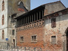
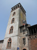
The above images may not be of the site on this page, but were taken nearby. They are loaded from Flickr so please click on them for image credits.
Click here to see more info for this site
Nearby sites
Click here to view sites on an interactive map of the areaKey: Red: member's photo, Blue: 3rd party photo, Yellow: other image, Green: no photo - please go there and take one, Grey: site destroyed
Download sites to:
KML (Google Earth)
GPX (GPS waypoints)
CSV (Garmin/Navman)
CSV (Excel)
To unlock full downloads you need to sign up as a Contributory Member. Otherwise downloads are limited to 50 sites.
Turn off the page maps and other distractions
Nearby sites listing. In the following links * = Image available
31.8km WNW 285° Civico Museo Archeologico di Milano Museum
57.8km NE 46° Pyramids of Zone* Natural Stone / Erratic / Other Natural Feature
60.4km NW 319° Roccione di Prestino Rock Art
60.5km NW 317° Cerchio di Como Stone Circle
71.7km NW 317° Stabio Lepontische Stelen Sculptured Stone
72.2km NE 40° Luine* Rock Art
72.3km NW 304° Bòsc di Sàss Rock Art
72.6km NW 312° Velmaio* Rock Art
73.8km NE 41° Boario Terme Archeopark Museum
76.6km WNW 297° Garzonera cromlech* Stone Circle
77.3km NW 319° The Ceresio Valley Natural Stone / Erratic / Other Natural Feature
78.5km ENE 77° Manerba del Garda Chambered Tombs Chambered Tomb
78.6km NE 38° Borno Stone* Standing Stone (Menhir)
79.2km WNW 297° Golasecca's Necropolis* Long Barrow
79.5km NE 39° Borno 4 Sculptured Stone
79.9km NW 325° Pugerna Schalenstein* Rock Art
80.1km ENE 77° La Rocca di Manerba* Ancient Temple
81.6km NNW 327° Sasso della Predescia Rock Art
82.2km NE 39° Asino-Anvoia* Standing Stones
82.2km NE 40° Ossimo Stones Sculptured Stone
82.3km NE 40° Anvoia Stones* Standing Stones
82.7km SW 217° Sant'Alosio cup marks Rock Art
82.9km WNW 298° Preja Buja Natural Stone / Erratic / Other Natural Feature
84.3km NNW 327° Pregassona Lepontische Stele Sculptured Stone
86.4km NW 323° Bioggio Lepontische Stelen* Sculptured Stone
View more nearby sites and additional images


 We would like to know more about this location. Please feel free to add a brief description and any relevant information in your own language.
 Wir möchten mehr über diese Stätte erfahren. Bitte zögern Sie nicht, eine kurze Beschreibung und relevante Informationen in Deutsch hinzuzufügen.
 Nous aimerions en savoir encore un peu sur les lieux. S'il vous plaît n'hesitez pas à ajouter une courte description et tous les renseignements pertinents dans votre propre langue.
 Quisieramos informarnos un poco más de las lugares. No dude en añadir una breve descripción y otros datos relevantes en su propio idioma.