<< Text Pages >> Mayma VI - Barrow Cemetery in Russia
Submitted by davidmorgan on Wednesday, 13 October 2010 Page Views: 4957
Neolithic and Bronze AgeSite Name: Mayma VICountry: Russia Type: Barrow Cemetery
Nearest Town: Mayma
Latitude: 52.019702N Longitude: 85.920639E
Condition:
| 5 | Perfect |
| 4 | Almost Perfect |
| 3 | Reasonable but with some damage |
| 2 | Ruined but still recognisable as an ancient site |
| 1 | Pretty much destroyed, possibly visible as crop marks |
| 0 | No data. |
| -1 | Completely destroyed |
| 5 | Superb |
| 4 | Good |
| 3 | Ordinary |
| 2 | Not Good |
| 1 | Awful |
| 0 | No data. |
| 5 | Can be driven to, probably with disabled access |
| 4 | Short walk on a footpath |
| 3 | Requiring a bit more of a walk |
| 2 | A long walk |
| 1 | In the middle of nowhere, a nightmare to find |
| 0 | No data. |
| 5 | co-ordinates taken by GPS or official recorded co-ordinates |
| 4 | co-ordinates scaled from a detailed map |
| 3 | co-ordinates scaled from a bad map |
| 2 | co-ordinates of the nearest village |
| 1 | co-ordinates of the nearest town |
| 0 | no data |
Be the first person to rate this site - see the 'Contribute!' box in the right hand menu.
Internal Links:
External Links:
Barrow Cemetery in Altai, Russia.
A late Scythian burial ground dating from the 3rd century BCE.
Note: Ancient Monuments of Scythian Epoch Found in Altai
You may be viewing yesterday's version of this page. To see the most up to date information please register for a free account.
Do not use the above information on other web sites or publications without permission of the contributor.
Nearby Images from Flickr
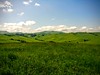
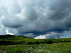


The above images may not be of the site on this page, but were taken nearby. They are loaded from Flickr so please click on them for image credits.
Click here to see more info for this site
Nearby sites
Click here to view sites on an interactive map of the areaKey: Red: member's photo, Blue: 3rd party photo, Yellow: other image, Green: no photo - please go there and take one, Grey: site destroyed
Download sites to:
KML (Google Earth)
GPX (GPS waypoints)
CSV (Garmin/Navman)
CSV (Excel)
To unlock full downloads you need to sign up as a Contributory Member. Otherwise downloads are limited to 50 sites.
Turn off the page maps and other distractions
Nearby sites listing. In the following links * = Image available
7.2km SSE 166° Anokhin Museum* Museum
15.3km SSE 159° Oldest settlement Ulalinka* Ancient Village or Settlement
85.9km SSW 196° Tavdinsky Caves Cave or Rock Shelter
110.2km SW 232° Denisova* Cave or Rock Shelter
111.7km WSW 237° Karama - Paleolithic settlement* Ancient Village or Settlement
131.3km S 181° Tuekta kurgan* Artificial Mound
183.0km SSE 164° Inya Deer Stones* Standing Stone (Menhir)
190.5km SSE 160° Kalbak-Tash* Rock Art
191.1km SSE 159° Chuya Deer Stone* Standing Stone (Menhir)
299.2km S 174° Berel Burial Mounds* Barrow Cemetery
305.9km SE 143° Tarhatinsky megalithic site* Standing Stones
353.6km NE 40° Paleolithic settlement Small Syya* Ancient Village or Settlement
360.4km WSW 236° Seleutas Mountain Sphinx* Natural Stone / Erratic / Other Natural Feature
363.4km SSE 152° Shiveet Mountain Petroglyphs* Rock Art
366.8km SSE 151° Mt. Shiveet altar stone with petroglyphs* Rock Art
376.5km NE 44° Tuim Cromlech* Stone Circle
386.1km NE 55° Great Salbyk Kurgan* Pyramid / Mastaba
391.4km NE 39° Complex Sunduki* Natural Stone / Erratic / Other Natural Feature
411.7km SSE 155° Lake Hoton Petroglyphs* Rock Art
415.2km SSE 154° Lake Hoton Round Barrow Round Barrow(s)
415.6km ENE 61° Museum Kyzlasov L.R.* Museum
428.4km SSE 154° Lake Hoton Standing Grave Stones* Standing Stones
449.4km E 93° Ancient sanctuary Chaa-Holl* Rock Cut Tomb
532.5km E 86° Arzhan Scythian royal necropolis* Barrow Cemetery
548.2km S 191° Shilikty Burial Mounds Barrow Cemetery
View more nearby sites and additional images


 We would like to know more about this location. Please feel free to add a brief description and any relevant information in your own language.
 Wir möchten mehr über diese Stätte erfahren. Bitte zögern Sie nicht, eine kurze Beschreibung und relevante Informationen in Deutsch hinzuzufügen.
 Nous aimerions en savoir encore un peu sur les lieux. S'il vous plaît n'hesitez pas à ajouter une courte description et tous les renseignements pertinents dans votre propre langue.
 Quisieramos informarnos un poco más de las lugares. No dude en añadir una breve descripción y otros datos relevantes en su propio idioma.