<< Other Photo Pages >> Fuorcla da Strem Sut - Ancient Mine, Quarry or other Industry in Switzerland in Uri
Submitted by Megalithic89 on Tuesday, 03 May 2022 Page Views: 492
Multi-periodSite Name: Fuorcla da Strem Sut Alternative Name: Untere StremlückeCountry: Switzerland
NOTE: This site is 1.657 km away from the location you searched for.
Canton: Uri Type: Ancient Mine, Quarry or other Industry
Nearest Town: Altdorf UR Nearest Village: Amsteg
Latitude: 46.731100N Longitude: 8.780300E
Condition:
| 5 | Perfect |
| 4 | Almost Perfect |
| 3 | Reasonable but with some damage |
| 2 | Ruined but still recognisable as an ancient site |
| 1 | Pretty much destroyed, possibly visible as crop marks |
| 0 | No data. |
| -1 | Completely destroyed |
| 5 | Superb |
| 4 | Good |
| 3 | Ordinary |
| 2 | Not Good |
| 1 | Awful |
| 0 | No data. |
| 5 | Can be driven to, probably with disabled access |
| 4 | Short walk on a footpath |
| 3 | Requiring a bit more of a walk |
| 2 | A long walk |
| 1 | In the middle of nowhere, a nightmare to find |
| 0 | No data. |
| 5 | co-ordinates taken by GPS or official recorded co-ordinates |
| 4 | co-ordinates scaled from a detailed map |
| 3 | co-ordinates scaled from a bad map |
| 2 | co-ordinates of the nearest village |
| 1 | co-ordinates of the nearest town |
| 0 | no data |
Internal Links:
External Links:
I have visited· I would like to visit
WhiskyRiver would like to visit
")
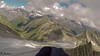
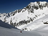
The retreating Brunnifirn glacier in the Alps of central Switzerland exposed a rock crystal extraction site exploited during the Early and Late Mesolithic. It has yielded organic objects preserved in the ice as well as rock crystal and quartz extraction waste, knapping debris, and tools.
The extraction site was probably covered with ice from around 5900 BC to 2013, when the local quartz crystal hunter Heinz Infanger discovered it. The site is situated at 2917 m a.s.l.
Very interesting pictures in the second reference.
References:
[1] „Fundstelle ist nun auch Thema in norwegischer Fachzeitschrift“, Neue Luzerner Zeitung, Lucerne, 23rd April 2022
[2] Marcel Cornelissen, Christian Auf der Maur & Thomas Reitmaier (2022): A Glacially Preserved Mesolithic Rock Crystal Extraction Site in the Swiss Alps, Norwegian Archaeological Review.
Link to this article
You may be viewing yesterday's version of this page. To see the most up to date information please register for a free account.
Do not use the above information on other web sites or publications without permission of the contributor.
Nearby Images from Flickr
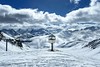
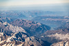
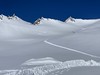
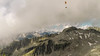
The above images may not be of the site on this page, but were taken nearby. They are loaded from Flickr so please click on them for image credits.
Click here to see more info for this site
Nearby sites
Click here to view sites on an interactive map of the areaKey: Red: member's photo, Blue: 3rd party photo, Yellow: other image, Green: no photo - please go there and take one, Grey: site destroyed
Download sites to:
KML (Google Earth)
GPX (GPS waypoints)
CSV (Garmin/Navman)
CSV (Excel)
To unlock full downloads you need to sign up as a Contributory Member. Otherwise downloads are limited to 50 sites.
Turn off the page maps and other distractions
Nearby sites listing. In the following links * = Image available
20.3km NW 308° Attinghausen-Geissrüggen Siedlungsplatz* Ancient Village or Settlement
30.7km NNW 338° Tümmlen Steinreihe Stone Row / Alignment
30.7km NNW 339° Hänibüel Menhir Standing Stone (Menhir)
31.0km NNW 337° Grossegg Druidenstein* Natural Stone / Erratic / Other Natural Feature
31.5km E 79° Crap de Tiranns Rock Art
31.8km E 79° Ruschein Schalenstein Rock Art
31.8km E 79° Crest la Cuppa Rock Art
34.4km NNW 346° Tschütschiwald Chindlistein Natural Stone / Erratic / Other Natural Feature
34.6km E 79° Crap de Pops Natural Stone / Erratic / Other Natural Feature
35.5km ENE 78° Falera Vorgeschichtliche Siedlung* Ancient Village or Settlement
35.5km ENE 77° Falera Menhirfeld* Stone Row / Alignment
36.4km NNW 348° Steinkreuz Haggenegg* Ancient Cross
42.4km WNW 301° Hexenstein St. Jakob Natural Stone / Erratic / Other Natural Feature
43.6km NW 314° Kehrsiten Ancient Village or Settlement
47.4km NW 312° Dormen Schalensteine* Rock Art
48.9km E 89° Cazis Petrushügel* Ancient Village or Settlement
49.2km SSW 196° Boschetto Schalenstein2* Rock Art
50.7km NNW 331° Chilchberg Steinreihe* Stone Row / Alignment
51.0km NW 316° Gletschergarten Schalensteine Rock Art
51.0km SE 137° Mesocco-Andergia Lepontische Stele Sculptured Stone
51.7km ESE 107° Anselmo Gadola Collection* Museum
51.7km NNW 337° Museum für Urgeschichte(n)* Museum
52.0km E 94° Carschenna* Rock Art
52.7km NE 42° Seebenalp Hinkelstein * Standing Stone (Menhir)
52.8km NNE 12° Wygarten Steinreihe Stone Row / Alignment
View more nearby sites and additional images


 We would like to know more about this location. Please feel free to add a brief description and any relevant information in your own language.
 Wir möchten mehr über diese Stätte erfahren. Bitte zögern Sie nicht, eine kurze Beschreibung und relevante Informationen in Deutsch hinzuzufügen.
 Nous aimerions en savoir encore un peu sur les lieux. S'il vous plaît n'hesitez pas à ajouter une courte description et tous les renseignements pertinents dans votre propre langue.
 Quisieramos informarnos un poco más de las lugares. No dude en añadir una breve descripción y otros datos relevantes en su propio idioma.