<< Our Photo Pages >> Garzonera cromlech - Stone Circle in Italy in Lombardia
Submitted by ilsignorstano on Wednesday, 09 March 2022 Page Views: 545
Neolithic and Bronze AgeSite Name: Garzonera cromlechCountry: Italy
NOTE: This site is 8.214 km away from the location you searched for.
Region: Lombardia Type: Stone Circle
Nearest Town: Somma Lombardo Nearest Village: Vergiate
Latitude: 45.707180N Longitude: 8.697350E
Condition:
| 5 | Perfect |
| 4 | Almost Perfect |
| 3 | Reasonable but with some damage |
| 2 | Ruined but still recognisable as an ancient site |
| 1 | Pretty much destroyed, possibly visible as crop marks |
| 0 | No data. |
| -1 | Completely destroyed |
| 5 | Superb |
| 4 | Good |
| 3 | Ordinary |
| 2 | Not Good |
| 1 | Awful |
| 0 | No data. |
| 5 | Can be driven to, probably with disabled access |
| 4 | Short walk on a footpath |
| 3 | Requiring a bit more of a walk |
| 2 | A long walk |
| 1 | In the middle of nowhere, a nightmare to find |
| 0 | No data. |
| 5 | co-ordinates taken by GPS or official recorded co-ordinates |
| 4 | co-ordinates scaled from a detailed map |
| 3 | co-ordinates scaled from a bad map |
| 2 | co-ordinates of the nearest village |
| 1 | co-ordinates of the nearest town |
| 0 | no data |
Internal Links:
External Links:
")
Golasecca culture cromlech, area cleaned and opened to public in 2004.
You may be viewing yesterday's version of this page. To see the most up to date information please register for a free account.
")
")
")
Do not use the above information on other web sites or publications without permission of the contributor.
Nearby Images from Flickr
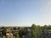
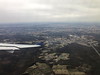
The above images may not be of the site on this page, but were taken nearby. They are loaded from Flickr so please click on them for image credits.
Click here to see more info for this site
Nearby sites
Click here to view sites on an interactive map of the areaKey: Red: member's photo, Blue: 3rd party photo, Yellow: other image, Green: no photo - please go there and take one, Grey: site destroyed
Download sites to:
KML (Google Earth)
GPX (GPS waypoints)
CSV (Garmin/Navman)
CSV (Excel)
To unlock full downloads you need to sign up as a Contributory Member. Otherwise downloads are limited to 50 sites.
Turn off the page maps and other distractions
Nearby sites listing. In the following links * = Image available
2.7km W 278° Golasecca's Necropolis* Long Barrow
6.3km WNW 301° Preja Buja Natural Stone / Erratic / Other Natural Feature
9.5km ENE 57° Bòsc di Sàss Rock Art
11.9km NW 308° Museo Archeologico di Angera Museum
12.3km WNW 284° Necropoli Golasecchiana di Motto Lagone Long Barrow
19.3km NW 322° Masso Coppellato Brovello Rock Art
19.3km NNW 327° Masso coppellato San Paolo Rock Art
19.7km NE 46° Velmaio* Rock Art
23.6km WNW 283° Preja Batizà* Rock Art
25.0km NE 48° Stabio Lepontische Stelen Sculptured Stone
25.7km WNW 290° Masso coppellato Pella Rock Art
28.2km NE 36° The Ceresio Valley Natural Stone / Erratic / Other Natural Feature
28.6km ENE 71° Cerchio di Como Stone Circle
29.5km NW 306° Masso coppellato Bagnella Rock Art
30.2km ENE 69° Roccione di Prestino Rock Art
30.7km N 11° Pineta Alta carved stone* Carving
35.1km NNE 18° Bedigliora Capèla dala Barèla* Rock Art
35.6km NNE 19° Novaggio Lepontische Inschrift* Sculptured Stone
35.6km NNE 19° Bedigliora (Banco) Lepontische Stele Sculptured Stone
37.1km NNE 21° Aranno Lepontische Stelen* Sculptured Stone
37.3km NNW 334° Masso coppellato Val Grande Rock Art
37.4km NE 36° Pugerna Schalenstein* Rock Art
37.7km NNE 25° Bioggio Lepontische Stelen* Sculptured Stone
40.1km NE 35° Sasso della Predescia Rock Art
41.6km NNE 31° Pregassona Lepontische Stele Sculptured Stone
View more nearby sites and additional images


 We would like to know more about this location. Please feel free to add a brief description and any relevant information in your own language.
 Wir möchten mehr über diese Stätte erfahren. Bitte zögern Sie nicht, eine kurze Beschreibung und relevante Informationen in Deutsch hinzuzufügen.
 Nous aimerions en savoir encore un peu sur les lieux. S'il vous plaît n'hesitez pas à ajouter une courte description et tous les renseignements pertinents dans votre propre langue.
 Quisieramos informarnos un poco más de las lugares. No dude en añadir una breve descripción y otros datos relevantes en su propio idioma.