<< Our Photo Pages >> Alte Burg (Wittgenstein) - Hillfort in Germany in North Rhine-Westphalia
Submitted by Harald_Platta on Wednesday, 02 December 2015 Page Views: 724
Iron Age and Later PrehistorySite Name: Alte Burg (Wittgenstein)Country: Germany
NOTE: This site is 1.73 km away from the location you searched for.
Land: North Rhine-Westphalia Type: Hillfort
Nearest Town: Bad Laasphe
Latitude: 50.935392N Longitude: 8.393347E
Condition:
| 5 | Perfect |
| 4 | Almost Perfect |
| 3 | Reasonable but with some damage |
| 2 | Ruined but still recognisable as an ancient site |
| 1 | Pretty much destroyed, possibly visible as crop marks |
| 0 | No data. |
| -1 | Completely destroyed |
| 5 | Superb |
| 4 | Good |
| 3 | Ordinary |
| 2 | Not Good |
| 1 | Awful |
| 0 | No data. |
| 5 | Can be driven to, probably with disabled access |
| 4 | Short walk on a footpath |
| 3 | Requiring a bit more of a walk |
| 2 | A long walk |
| 1 | In the middle of nowhere, a nightmare to find |
| 0 | No data. |
| 5 | co-ordinates taken by GPS or official recorded co-ordinates |
| 4 | co-ordinates scaled from a detailed map |
| 3 | co-ordinates scaled from a bad map |
| 2 | co-ordinates of the nearest village |
| 1 | co-ordinates of the nearest town |
| 0 | no data |
Internal Links:
External Links:
I have visited· I would like to visit
Janek visited on 15th Jun 2019 - their rating: Cond: 3 Amb: 4 Access: 4
 (PID:214979)")
The central enclosure measures 180 m x 130 m. Today, some remains of the ramparts and ditches are still visible. It is situated 600 m above the medieval Wittgenstein Castle.
Literature:
[01] Hömberg, P. H., Schubert, A.H.: Der Kreis Siegen-Wittgenstein. Führer zu archäologischen Denkmälern in Deutschland 25 (1993).
[02] Losse, M. (Hrsg.): Die schönsten Schlösser und Burgen im Lahntal (2001).
You may be viewing yesterday's version of this page. To see the most up to date information please register for a free account.
 (PID:214978)")
Do not use the above information on other web sites or publications without permission of the contributor.
Nearby Images from Flickr
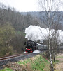
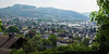

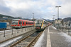
The above images may not be of the site on this page, but were taken nearby. They are loaded from Flickr so please click on them for image credits.
Click here to see more info for this site
Nearby sites
Click here to view sites on an interactive map of the areaKey: Red: member's photo, Blue: 3rd party photo, Yellow: other image, Green: no photo - please go there and take one, Grey: site destroyed
Download sites to:
KML (Google Earth)
GPX (GPS waypoints)
CSV (Garmin/Navman)
CSV (Excel)
To unlock full downloads you need to sign up as a Contributory Member. Otherwise downloads are limited to 50 sites.
Turn off the page maps and other distractions
Nearby sites listing. In the following links * = Image available
6.8km SW 215° Burg von Hesselbach* Hillfort
9.3km SW 234° Heilige Ilsequelle* Holy Well or Sacred Spring
10.5km W 259° Siegquelle* Holy Well or Sacred Spring
12.4km SW 221° Burg Rittershausen* Hillfort
13.3km NNW 334° Wallburg Aue* Hillfort
16.7km W 270° Alte Burg Obernau* Hillfort
17.0km S 170° Wilhelmsteine Natural Stone / Erratic / Other Natural Feature
17.1km NNE 14° Wallburg Wemlinghausen* Hillfort
20.1km SW 234° Höllenrain Iron Age Forge Ancient Mine, Quarry or other Industry
20.2km SSW 199° Ringwall Dillenburg* Hillfort
20.9km N 356° Altarstein Latrop* Natural Stone / Erratic / Other Natural Feature
23.8km NW 324° Heiligenborn Saalhausen Holy Well or Sacred Spring
24.7km E 84° Lützelburg* Hillfort
24.7km N 350° Wallburg Wilzenberg* Hillfort
25.0km E 85° Christenberg* Hillfort
26.2km SSW 203° Summstein Donsbach Modern Stone Circle etc
26.3km WSW 255° Siegerlandmuseum* Museum
26.8km SE 143° Steinkistengrab Lohra* Chambered Tomb
29.6km SSW 211° Wildweiberhaus-Klippe Rock Outcrop
30.3km NW 313° Wallburg Kahle* Hillfort
30.7km SSW 204° Steinkammer Hoehle Cave or Rock Shelter
30.9km WSW 237° Zeppenfeld Iron Age Forge Ancient Mine, Quarry or other Industry
31.0km WSW 255° Siegen La Tène Ironworks Ancient Mine, Quarry or other Industry
31.7km SW 226° Burg von Burbach* Hillfort
32.9km ESE 117° Grabhügelfeld Lahnberge* Barrow Cemetery
View more nearby sites and additional images


 We would like to know more about this location. Please feel free to add a brief description and any relevant information in your own language.
 Wir möchten mehr über diese Stätte erfahren. Bitte zögern Sie nicht, eine kurze Beschreibung und relevante Informationen in Deutsch hinzuzufügen.
 Nous aimerions en savoir encore un peu sur les lieux. S'il vous plaît n'hesitez pas à ajouter une courte description et tous les renseignements pertinents dans votre propre langue.
 Quisieramos informarnos un poco más de las lugares. No dude en añadir una breve descripción y otros datos relevantes en su propio idioma.