

<< Our Photo Pages >> Alte Burg Obernau - Hillfort in Germany in North Rhine-Westphalia
Submitted by Harald_Platta on Wednesday, 02 December 2015 Page Views: 897
Iron Age and Later PrehistorySite Name: Alte Burg Obernau Alternative Name: AldenburgkCountry: Germany
NOTE: This site is 7.724 km away from the location you searched for.
Land: North Rhine-Westphalia Type: Hillfort
Nearest Town: Netphen
Latitude: 50.935000N Longitude: 8.154750E
Condition:
| 5 | Perfect |
| 4 | Almost Perfect |
| 3 | Reasonable but with some damage |
| 2 | Ruined but still recognisable as an ancient site |
| 1 | Pretty much destroyed, possibly visible as crop marks |
| 0 | No data. |
| -1 | Completely destroyed |
| 5 | Superb |
| 4 | Good |
| 3 | Ordinary |
| 2 | Not Good |
| 1 | Awful |
| 0 | No data. |
| 5 | Can be driven to, probably with disabled access |
| 4 | Short walk on a footpath |
| 3 | Requiring a bit more of a walk |
| 2 | A long walk |
| 1 | In the middle of nowhere, a nightmare to find |
| 0 | No data. |
| 5 | co-ordinates taken by GPS or official recorded co-ordinates |
| 4 | co-ordinates scaled from a detailed map |
| 3 | co-ordinates scaled from a bad map |
| 2 | co-ordinates of the nearest village |
| 1 | co-ordinates of the nearest town |
| 0 | no data |
Internal Links:
External Links:
")
The hillfort is situated on Alte Burg hill and consists of two concentric annular ramparts. The inner rampart is about 600 m long and includes an area of approximately 3.5 ha, while the outer rampart is about 1100 m long and covers an area of about 9.5 ha.
The site was most likely not just a refuge castle, but could have been inhabited permanently, as it is located close to major trade routes.
Today, the remains of the ramparts and ditches are still visible.
Literature:
[01] Petri, F., Droege, G., Fink, K.: Nordrhein-Westfalen. Handbuch der historischen Stätten Deutschlands 3 (1970).
You may be viewing yesterday's version of this page. To see the most up to date information please register for a free account.
")
Do not use the above information on other web sites or publications without permission of the contributor.
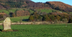
Nearby Images from Flickr


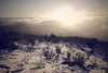
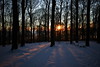
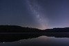

The above images may not be of the site on this page, but were taken nearby. They are loaded from Flickr so please click on them for image credits.
Click here to see more info for this site
Nearby sites
Click here to view sites on an interactive map of the areaKey: Red: member's photo, Blue: 3rd party photo, Yellow: other image, Green: no photo - please go there and take one, Grey: site destroyed
Download sites to:
KML (Google Earth)
GPX (GPS waypoints)
CSV (Garmin/Navman)
CSV (Excel)
To unlock full downloads you need to sign up as a Contributory Member. Otherwise downloads are limited to 50 sites.
Turn off the page maps and other distractions
Nearby sites listing. In the following links * = Image available
6.7km ESE 106° Siegquelle* Holy Well or Sacred Spring
10.7km ESE 120° Heilige Ilsequelle* Holy Well or Sacred Spring
11.0km SW 233° Siegerlandmuseum* Museum
11.7km S 178° Höllenrain Iron Age Forge Ancient Mine, Quarry or other Industry
12.8km SE 137° Burg Rittershausen* Hillfort
14.0km ESE 113° Burg von Hesselbach* Hillfort
15.4km WSW 239° Siegen La Tène Ironworks Ancient Mine, Quarry or other Industry
16.2km NE 42° Wallburg Aue* Hillfort
16.7km E 90° Alte Burg (Wittgenstein)* Hillfort
19.2km SSW 208° Zeppenfeld Iron Age Forge Ancient Mine, Quarry or other Industry
19.4km N 7° Heiligenborn Saalhausen Holy Well or Sacred Spring
20.8km NW 323° Wallburg Hofkühl* Hillfort
21.5km NNW 345° Wallburg Kahle* Hillfort
21.6km SSE 152° Ringwall Dillenburg* Hillfort
22.1km NW 322° Wallburg Jäckelchen* Hillfort
22.7km SSW 211° Wallburg Hohenseelenbachskopf Hillfort
22.8km SSW 196° Burg von Burbach* Hillfort
23.2km SW 228° Druidenstein Kirchen* Natural Stone / Erratic / Other Natural Feature
24.4km NNW 342° Wallburg Weilenscheid* Hillfort
24.9km SSE 165° Summstein Donsbach Modern Stone Circle etc
25.4km S 176° Wildweiberhaus-Klippe Rock Outcrop
25.5km SW 228° Abschnittsbefestigung Alsdorf* Promontory Fort / Cliff Castle
25.7km NE 36° Altarstein Latrop* Natural Stone / Erratic / Other Natural Feature
25.7km SE 130° Wilhelmsteine Natural Stone / Erratic / Other Natural Feature
25.8km W 271° Dreiherrenstein am Kamp* Marker Stone
View more nearby sites and additional images


 We would like to know more about this location. Please feel free to add a brief description and any relevant information in your own language.
 Wir möchten mehr über diese Stätte erfahren. Bitte zögern Sie nicht, eine kurze Beschreibung und relevante Informationen in Deutsch hinzuzufügen.
 Nous aimerions en savoir encore un peu sur les lieux. S'il vous plaît n'hesitez pas à ajouter une courte description et tous les renseignements pertinents dans votre propre langue.
 Quisieramos informarnos un poco más de las lugares. No dude en añadir una breve descripción y otros datos relevantes en su propio idioma.