<< Our Photo Pages >> Karakol Regional Museum - Museum in Kyrgyzstan
Submitted by h_fenton on Saturday, 04 September 2010 Page Views: 4118
MuseumsSite Name: Karakol Regional MuseumCountry: Kyrgyzstan
NOTE: This site is 122.754 km away from the location you searched for.
Type: Museum
Nearest Town: Karakol
Latitude: 42.489365N Longitude: 78.391644E
Condition:
| 5 | Perfect |
| 4 | Almost Perfect |
| 3 | Reasonable but with some damage |
| 2 | Ruined but still recognisable as an ancient site |
| 1 | Pretty much destroyed, possibly visible as crop marks |
| 0 | No data. |
| -1 | Completely destroyed |
| 5 | Superb |
| 4 | Good |
| 3 | Ordinary |
| 2 | Not Good |
| 1 | Awful |
| 0 | No data. |
| 5 | Can be driven to, probably with disabled access |
| 4 | Short walk on a footpath |
| 3 | Requiring a bit more of a walk |
| 2 | A long walk |
| 1 | In the middle of nowhere, a nightmare to find |
| 0 | No data. |
| 5 | co-ordinates taken by GPS or official recorded co-ordinates |
| 4 | co-ordinates scaled from a detailed map |
| 3 | co-ordinates scaled from a bad map |
| 2 | co-ordinates of the nearest village |
| 1 | co-ordinates of the nearest town |
| 0 | no data |
Internal Links:
External Links:
I have visited· I would like to visit
h_fenton has visited here
")
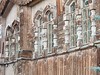
The museum has a good collections of taxidermy, regional costumes, horse tack, 19th-20th century history and scientific exploration going upto to the end of the Soviet Union.
There is some limited and brief labelling in English (2008) and more comprehensive labelling in Russian.
Karakol Regioanl History Museum
164 Gamansarieva Street / Jamansarieva St.
Karakol
Kyrgyz Republic
the museum is next door to the Neofit Travel Company
You may be viewing yesterday's version of this page. To see the most up to date information please register for a free account.
")
Do not use the above information on other web sites or publications without permission of the contributor.
Nearby Images from Flickr
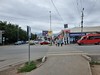
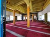
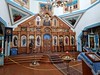
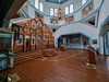
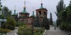
The above images may not be of the site on this page, but were taken nearby. They are loaded from Flickr so please click on them for image credits.
Click here to see more info for this site
Nearby sites
Click here to view sites on an interactive map of the areaKey: Red: member's photo, Blue: 3rd party photo, Yellow: other image, Green: no photo - please go there and take one, Grey: site destroyed
Download sites to:
KML (Google Earth)
GPX (GPS waypoints)
CSV (Garmin/Navman)
CSV (Excel)
To unlock full downloads you need to sign up as a Contributory Member. Otherwise downloads are limited to 50 sites.
Turn off the page maps and other distractions
Nearby sites listing. In the following links * = Image available
695m ENE 68° Karakol Park* Sculptured Stone
143.8km NW 306° The Central State Museum of the Republic of Kazakhstan* Museum
160.1km N 355° Complex Besshatyr* Artificial Mound
235.8km WNW 294° Targan Barrow Cemetery Barrow Cemetery
258.7km W 277° Balasagun stone Balbas Sculptured Stone
258.7km WSW 254° East Song Köl Balbal* Sculptured Stone
274.0km WNW 303° Tamgaly Petroglyphs* Rock Art
312.6km W 279° State Historical Museum of Kyrgyz Republic, Bishkek* Museum
348.0km ESE 102° Kizil Caves of 1000 Buddhas* Cave or Rock Shelter
366.1km SSW 210° Mor Stupas* Ancient Temple
406.2km WSW 251° Saimaly-Tash Rock Art
529.1km SE 145° Karadong* Ancient Village or Settlement
536.5km WSW 248° The Heavenly Horses Rock Art
582.8km SSW 209° Jirzankal cemetery* Barrow Cemetery
589.4km SSW 208° Tashkurgan* Ancient Village or Settlement
613.8km NNE 27° Eleke Sazy Burial Mounds* Barrow Cemetery
615.1km SSE 166° Dandan Oilik* Ancient Village or Settlement
626.8km SSE 159° Rawak* Ancient Village or Settlement
696.6km SE 137° Endere (China)* Ancient Village or Settlement
701.8km E 100° Tarim River Tombs Barrow Cemetery
710.0km NE 41° Shilikty Burial Mounds Barrow Cemetery
710.6km SE 146° Niya (China)* Ancient Village or Settlement
757.7km SSW 206° Hunza Valley Petroglyphs* Rock Art
759.8km ENE 76° Zinjiang Autonomous Region Museum* Museum
760.7km ENE 76° Sahensai Cemetery* Barrow Cemetery
View more nearby sites and additional images


 We would like to know more about this location. Please feel free to add a brief description and any relevant information in your own language.
 Wir möchten mehr über diese Stätte erfahren. Bitte zögern Sie nicht, eine kurze Beschreibung und relevante Informationen in Deutsch hinzuzufügen.
 Nous aimerions en savoir encore un peu sur les lieux. S'il vous plaît n'hesitez pas à ajouter une courte description et tous les renseignements pertinents dans votre propre langue.
 Quisieramos informarnos un poco más de las lugares. No dude en añadir una breve descripción y otros datos relevantes en su propio idioma.